On Rainier Avenue South north of South Holden Street, on the right when traveling north.
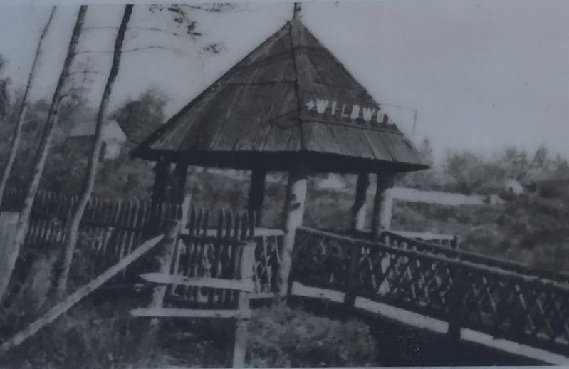
A Trolley Stop along the Seattle and Rainier Valley Railway
Wildwood Station dates back to Washington State's early yeans when the first privately owned electric trolley rail service carried passenger streetcars and freight trains along . . . — — Map (db m181541) HM
On July 4, 1776, the Declaration of Independence proclaimed to the world that thirteen British colonies had joined together to create a new nation: the United States of America. Here in Brooklyn, only two months later, the survival of that new . . . — — Map (db m31009) HM
On 18th Avenue at 84th Street, on the right when traveling north on 18th Avenue.
On July 4, 1776, the Declaration of Independence proclaimed to the world that thirteen British colonies had joined together to create a new nation: the United States of America. Here in Brooklyn, only two months later, the survival of that new . . . — — Map (db m30175) HM
Near Sheridan Loop at Sterling Drive, on the right when traveling east.
On July 4, 1776, the Declaration of Independence proclaimed to the world that thirteen British colonies had joined together to create a new nation: the United States of America. Here in Brooklyn, only two months later, the survival of that new . . . — — Map (db m21613) HM
On Gravesend Neck Road, on the left when traveling west.
On July 4, 1776, the Declaration of Independence proclaimed to the world that thirteen British colonies had joined together to create a new nation: the United States of America. Here in Brooklyn, only two months later, the survival of that new . . . — — Map (db m30174) HM
On Battle Avenue, on the left when traveling north.
On July 4, 1776, the Declaration of Independence proclaimed to the world that thirteen British colonies had joined together to create a new nation: the United States of America. Here in Brooklyn, only two months later, the survival of that new . . . — — Map (db m13255) HM
On 5th Avenue at 3rd Street, on the right when traveling south on 5th Avenue. Reported permanently removed.
On July 4, 1776, the Declaration of Independence proclaimed to the world that thirteen British colonies had joined together to create a new nation: the United States of America. Here in Brooklyn, only two months later, the survival of that new . . . — — Map (db m30997) HM
On Main Street at Plymouth Street, on the left when traveling north on Main Street.
On July 4, 1776, the Declaration of Independence proclaimed to the world that thirteen British colonies had joined together to create a new nation: the United States of America. Here in Brooklyn, only two months later, the survival of that new . . . — — Map (db m309930) HM
Near East Burdick Expressway (Business U.S. 2) at 13th Street Southeast, on the right when traveling west.
Streeter, North Dakota 1915-1983 Company E, 338th Infantry, 85th Infantry Division, U.S. Army A small patrol led by First Lieutenant Bloch near Firenzuola, Italy, on September 22, 1944, located a group of machine gun nests holding up the advance in . . . — — Map (db m240690) HM
On Columbia Heights at Clark Street, on the left when traveling north on Columbia Heights.
In March 1776, American Revolutionary forces built Fort Stirling on this site to protect both civilian and military ships passing through the East River. Originally named "Fort Half-Moon" due to its crescent shape, control of the fort didn't stay . . . — — Map (db m309935) HM
On E. 22nd Street at Avenue P, on the right when traveling north on E. 22nd Street.
This Dutch-American farmhouse is a quiet reminder that the Battle of Brooklyn, one of the biggest conflicts of the Revolutionary War, took place when Kings County was still mostly farm country. The country boasted fewer than 4,000 inhabitants, one . . . — — Map (db m30082) HM
On Richmond Heritage Trail north of Country Acres Road, on the right when traveling west.
In 1644, Roger Williams secured the Charter of Rhode Island and Providence Plantations from the English Parliament. The charter, or agreement with the early settlers was voided in 1660, but a new charter that provided religious freedom was . . . — — Map (db m312821) HM
On Interurban Avenue South at 56h Avenue South, on the right when traveling north on Interurban Avenue South.
Flat-bottomed boats carried passengers and goods on the Duwamish River to and from the Green and Black rivers from 1854 to 1886. Names of the boats were the Minehaha, the Black Diamond, the Decatur, the Comet, and the Gem. A landing for the . . . — — Map (db m181561) HM
Prior to 1916, Lake Washington’s shoreline reached today’s Juanita Drive. When Lake Washington was lowered, a vast, sandy expanse was revealed on the north side of Juanita Bay. Leslie and Alicia Forbes erected a small bathhouse and established a . . . — — Map (db m266197) HM
On South Main Street east of 4th Avenue South, on the right when traveling west.
Injustice Challenged
Over and above any man-made creed or law is the natural law of life — the right of human individuals to live and to creatively express themselves. No man was born with the right to limit that law. . . . — — Map (db m296050) HM
Acquired by the People of King County, State of Washington, for the purpose of promoting aeronautics, and named in honor of William Edward Boeing, whose intelligent, active, and long continued interest in all that concerns and advances the . . . — — Map (db m139396) HM
On North Main Street at Jackson Street, on the right when traveling north on North Main Street.
John Brooks Henderson was born in Virginia and moved with his family to Lincoln County, Missouri when he was six years old. By age 10, he was an orphan.
Henderson overcame what could have been a life of obscurity to be a Pike County teacher, . . . — — Map (db m141281) HM
On Holmes Street, on the left when traveling south.
Belton
The Tennis Capital of South Carolina
Tennis Anyone?
Long know as the Tennis Capital of South Carolina, Belton's tennis history can be traced back over 110 years. An 1892 edition of the Anderson Intelligencer . . . — — Map (db m35564) HM