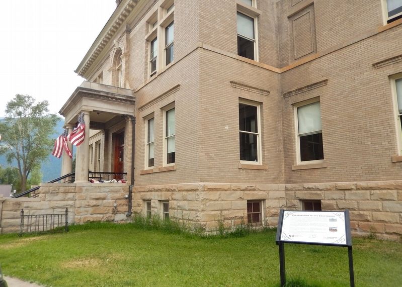
On Greene Street (County Road 2) just south of East 16th Street, on the right when traveling south.
In June 1906, San Juan County commissioned the design and construction of its courthouse, selecting architect James Murdoch to develop the plans. The foundation was completed by David Ramsay of Durango, Colorado, in August 1906, and in February . . . — — Map (db m282876) HM
On Greene Street (County Road 2) just south of East 16th Street, on the right when traveling south.
Immigrants played a vital role in the development of mining in the San Juan Mountains. Until 1941, the San Juan County Courthouse housed the Naturalization Office, where immigrants began the legal process of becoming U.S. citizens. Immigration . . . — — Map (db m282892) HM
On Snowden Street just north of 13th Street, on the left when traveling north.
The Architecture and the Architect The Miner's Union Hospital Building was completed in 1908 at a cost of approximately $35,000. The building is of great importance to Silverton's architectural heritage, designated as a contributing structure . . . — — Map (db m283000) HM
On Front Street 0.1 miles north of Geyser Drive, on the left when traveling north.
The people who came before us, the Nuche who traversed the San Juans without hindrance and occupied these mountains for as long as stories have been told. They and their families utilized the resources as needed. They did not take for granted the . . . — — Map (db m293399) HM
Near Silver Street at 2nd Street (County Road 20), on the right when traveling north.
Colorado Stone Quarries, a subsidiary of the international Italian stone quarry corporation R.E.D. Graniti, extracted and donated this 2,300-lb. marble slab from the company's Colorado Yule Marble Quarry in Gunnison County. The slab is displayed at . . . — — Map (db m292298) HM
On County Highway 2 at County Highway 4, on the right when traveling east on County Highway 2.
Howardsville was the first attempted settlement on the Western Slope of Colorado Territory, although the community was never platted or incorporated. The town was founded in 1874, received the first post office designation in the San Juan . . . — — Map (db m177655) HM
On Santa Rita Drive just west of South Camino Del Rio (U.S. 160/550), on the right when traveling west.
To the west across the Animas River stood Durango’s Smelter, 1881-1930. It was a uranium mill from World War II into 1963. The last buildings were demolished in 1987: the bricks and stones used for this monument’s base are all that remain. The . . . — — Map (db m291641) HM
On Black Locust Avenue at 5th E Street on Black Locust Avenue.
George Hobbs was one of several single young adults called to participate in the San Juan Mission. He was the only person assigned to all three of the mission's major scouting expeditions.
The first scouting expedition, which established sites . . . — — Map (db m270870) HM
On U.S. 550 0.1 miles west of County Highway 31, on the left when traveling east.
"Instant Cities"
In the last quarter of the nineteenth century, towns came and went in the San Juan Mountains as abruptly as gusts of wind. A promising mineral strike might spawn a complete settlement - houses, a general store, saloons, . . . — — Map (db m177508) HM
On Navajo Twins Drive west of U.S. 191, on the right when traveling west.
Bluff was the first settlement of the white man in San Juan County and its first county seat. It was founded April 6, 1880 by the San Juan Mission "called" by the L.D.S. Church to establish friendly relations with the Indians. A small band of . . . — — Map (db m95043) HM
On County Highway 9 0.5 miles north of Highway 2, on the left when traveling north.
The first prospectors wintered in "Three Forks of the Animas" in 1873, looking for silver and gold. In 1875 the name was changed to Animas Forks to accommodate the Post Office Department, and funds were committed by the San Juan County . . . — — Map (db m177689) HM
On Main Avenue at East 5th Street, on the left when traveling south on Main Avenue.
Trails & Passes
• The Colorado Rocky Mountains, appearing as a formidable barrier, have trails over almost all 260 passes.
• A trail is a corridor between two places: usually a network of paths that meet at certain key points, such as river . . . — — Map (db m153407) HM
On Greene Street (County Highway 110) at East 16th Street, on the left when traveling north on Greene Street.
History
Freight trains commonly had a caboose at the end. In 1871, its first year of operation, the Denver and Rio Grande (D&RG) railroad had four cabooses made by Billmeyer & Small. D&RG built 84 more, similar to their design, between . . . — — Map (db m177561) HM
On Greene Street (County Highway 110) at West 12th Street, on the left when traveling north on Greene Street.
Trails & Passes
▪︎ The Colorado Rocky Mountains, appearing as a formidable barrier, have trails over almost all 260 passes.
▪︎ A trail is a corridor between two places: usually a network of paths that meet at . . . — — Map (db m178408) HM
Near U.S. 191 at milepost 110.4, on the right when traveling north.
Kane Springs, San Juan County, was a major water stop along the historic Spanish Trail, in use from 1829 to 1848. Large trade caravans halted here and drank from the abundant spring waters. In autumn months, pack trains carried woolen textiles and . . . — — Map (db m95080) HM
On Greene Street (County Highway 110) at East 16th Street, on the left when traveling north on Greene Street.
Law and Order on the Frontier
Imagine arriving in Silverton in 1903. You're a burly miner, traveling from the metropolis of Denver to the remote high country of the San Juan. You step off the train onto "Notorious" Blair Street, ready to . . . — — Map (db m177564) HM
On Greene Street (County Highway 110) at Mineral Street, on the right when traveling north on Greene Street.
In 1860, Charles Baker and several prospectors entered the San Juan Mountains in search of wealth. They soon found deposits of gold and silver along the Animas River in an area that was later called "Baker's Park." The prospectors stayed through . . . — — Map (db m177513) HM
Near Utah Route 95 at milepost 101.5, on the right when traveling west.
Mule Canyon Ruin is an open Anasazi habitation site consisting of both above- and below-ground structures. This site was first occupied briefly in the Pueblo I time period (about A.D. 750) but the main occupation was during the Pueblo II and Pueblo . . . — — Map (db m95153) HM