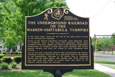
On Mahoning Avenue 0.1 miles north of High Street NW, on the right when traveling south.
Leicester King
Born in Connecticut in 1789, Judge Leicester King and his wife Julia Ann Huntington King, moved to Warren in 1817 from Westfield, Massachusetts. He was one of the principle promoters of the Pennsylvania and Ohio Canal, which . . . — — Map (db m65445) HM
On Elm Road NE at Panther Avenue SE, on the right when traveling east on Elm Road NE.
Camp Hutchins-Warren's Civil War Training Camp.
After the outbreak of the Civil War in the spring of 1861, the U.S. War Department commissioned Ohio Senator B.F. Wade of Jefferson and local Congressman John Hutchins of Warren to supervise . . . — — Map (db m288735) HM
On Brown Street at Brown and E 3rd Street, on the left on Brown Street.
The Ward-Thomas House.
Niles industrialist James Ward, Sr. built the house that shares his family’s name in 1862. The house has a low-pitched roof, wide, bracketed eaves, and rounded window and door openings, all characteristics of the . . . — — Map (db m268919) HM
On West Washington Street at Mentor Avenue, on the right when traveling east on West Washington Street.
From Ravenna to Warren To D.C.: 1853-1880s
Harriet Taylor was born December 17, 1853 in Ravenna, Ohio, the daughter of Ezra Taylor, an Ohio judge. The Taylors moved to Warren in 1861 and purchased the home known as the Harriet Taylor Upton . . . — — Map (db m300105) HM
On Mahoning Avenue 0.1 miles north of High Street NW, on the right when traveling north.
This congregation was founded in Warren November 19, 1803, by the Rev. Joseph Badger, who was serving as a missionary in the Western Reserve for the Connecticut Missionary Society of the Congregational Church. Rev. Badger was assisted at the first . . . — — Map (db m65442) HM
On Prairie Street east of North Street (Ohio Route 61), on the right when traveling east.
Historic New Haven, Ohio. New Haven, Ohio. was the mercantile center of southwest Huron County during the first half of the 19th century. Residents described immense wagons, or "land schooners," lined up for miles on the New Haven-Worthington . . . — — Map (db m309232) HM
On Portage Lakes Drive (County Route 75) at South Turkeyfoot Road (County Route 123), on the right when traveling east on Portage Lakes Drive.
Coventry Township. The land on which Coventry Township is situated was ceded in 1785 to
the United States by the Delaware, Chippewa, Ottawa, and Wyandot tribes under the Treaty of Fort McIntosh. The area was a choice location for Native . . . — — Map (db m277653) HM
On Warren-Meadville Road (County Route 330) at Wilson-Sharpsville Road (County Route 305), on the right when traveling west on Warren-Meadville Road.
Mosquito Lake Dog Park Friends
The Mosquito Lake Dog Park officially opened in July 2009.
Also known as the Cooperation Station because several entities came together to make the Dog Park a reality; Ohio Department of Natural Resources, . . . — — Map (db m278894) HM
On River Street just west of North Milton Boulevard, on the right when traveling east.
The Newtown Falls Covered Bridge was originally built about 1831 on this site, which is now known as Arlington Street, over the East Branch of the Mahoning River. This bridge structure is the second oldest covered bridge in the State of Ohio and . . . — — Map (db m165706) HM
On Mahoning Avenue 0.2 miles north of High Street NW, on the right when traveling south.
The Kinsman House once served as classrooms for the Dana School of Music, Hiram College Branch. The house is listed on the National Register of Historic Places. — — Map (db m121476) HM
On State Road Northwest 0.1 miles north of Washington Street NW, on the right when traveling south.
Trumbull Red Cross Chapter House
Administration Building built in 1931. Chapter House built in 1962. Commemorating American Red Cross Centennial, 1881-1981.
Pioneer Cemetery
Early Western Reserve burial grounds, 1804-1848. Grave sites . . . — — Map (db m65453) HM
On High Street Northwest, on the right when traveling east.
In recognition of the Patriotism of the People of Trumbull County who so generously purchased War Savings Stamps in 1918 this tablet is gratefully erected by the Ohio War Savings Committee — — Map (db m204355) HM
On Hallock Young Road at Hallock Sook Road, on the right when traveling east on Hallock Young Road.
Side A
Alexander Sutherland (1767-1845) and his wife Sarah (1768-1836) were the first settlers in Newton Township, Trumbull County, Ohio. Coming from Westmoreland County, Pennsylvania, the Sutherlands acquired 205 acres of land along Duck . . . — — Map (db m121502) HM
On State Road Street (County Road 25) 0.3 miles north of Plymouth Ridge Road, on the right when traveling west.
Ashtabula County is rich in history from Conneaut Township Park Beach to the Ashtabula Lighthouse and the Harbor's Bascule Lift Bridge. From Geneva-on the-Lake to the County seat of Jefferson, from Pymatuning Lake to the Grand Valley area. . . . — — Map (db m213952) HM
On Apple Street at Everett Hull Road (County Route 193), on the right when traveling north on Apple Street.
The idea for the saloon came from Jeffrey Ford of the Trumbull County Historical Village Committee. Ford wanted to add additional buildings to the village and thought a good addition would be a structure showcasing historic taverns of Trumbull . . . — — Map (db m278873) HM
On Arlington Road, on the right when traveling west.
The Newton Falls covered bridge was built over the east branch of the Mahoning River around 1831. A crosswalk was added in 1921 for children crossing the bridge on their way to the school on Center Street. The Newton Falls bridge is considered . . . — — Map (db m73215) HM
On Hine Circle near Main Street (Ohio Route 170), on the left when traveling north.
Born at Wallingford, Connecticut. Served during the Revolutionary War. Proprietor, Agent, and Surveyor of the Connecticut Land Company. Appointed Judge of Trumbull County by Territorial Governor Arthur St. Clair, 1800. State Senator, Trumbull . . . — — Map (db m43802) HM
On Warren-Meadville Road (County Route 330) at Wilson-Sharpsville Road (County Route 305), on the right when traveling west on Warren-Meadville Road.
What's In a Name?
Mosquito Lake was named for the insects that inhabited the marshy area. Local lore states that the name is based on a tale of two brothers from Cleveland who stayed in the area on their way to boiling mineral water for salt. . . . — — Map (db m278891) HM
On Phelps Creek Road (Ohio Route 534) 0.4 miles south of Kinsman Road NW ( Route 87), on the right when traveling south.
Mesopotamia Township, Trumbull County was a part of the Western Reserve, 3.3 million acres in Northeast Ohio claimed by Connecticut. After the Treaty of Greenville extinguished American Indian title in 1795, the state sold most of the land to the . . . — — Map (db m225410) HM
On Adams Street east of North Michigan Street (State Route 25), on the left when traveling east.
(panel 1)
William McKinley
Born at Niles – Trumbull County, Ohio
January Twenty-Ninth – Eighteen Hundred and Forty-Three
Volunteer Soldier of the Rebellion
Representative in Congress
Twice Governor of Ohio
Twice . . . — — Map (db m121996) HM
On Old 82 (Ohio Route 7) at Warren-Sharon Road, on the left when traveling south on Old 82. Reported missing.
Activity of the Underground Railroad is believed to have begun in Brookfield Township around 1838 with the first known runaway slaves, two women. to pass through in 1843. Freedom seekers moved north using a system of routes known by operators. or . . . — — Map (db m278695) HM
On Greenville Road NW (Ohio Route 88) 0.1 miles east of Route 45, on the right when traveling east.
Side A
In 1912, an endowment of $6,000 from Andrew Carnegie made it possible for the Bristol Public Library to become a reality. Four years earlier, the newly organized Bristol Library Association, headed and promoted by retired Judge . . . — — Map (db m121485) HM
On Warren-Sharon Road (Ohio Route 82) 0.1 miles Youngstown-Kingsville Road ( Route 193), on the left when traveling east.
Vienna Township Green and Cemetery
Vienna Township Green and Cemetery were created on June 20, 1810, when Ephraim Root and Uriel Holmes, Jr., deeded to Vienna Presbyterian Church members eight acres of “cleared & improved” land “North West . . . — — Map (db m225408) HM
Thin black lines indicate changes in relevance. Between each pair of lines entries are ordered geographically but all have the same relevance.
* Inflectional forms of words are their plurals, singulars, and possessives as well as gramatical tenses and similar variations.