By Sandra Hughes, September 22, 2010
The Old Natchez Drive
GEOGRAPHIC SORT Title Sort Marker Number Sort Marker Number Sort N Marker Number Sort T Publication Order Sort Publication Order Sort A Erected Year Sort Most Viewed Sort Most Recent-Interest Sort Most Recently Changed Sort SEE FAQ #33 FOR DESCRIPTIONS
Near Natchez Trace Parkway (at milepost 375.8) at Laurel Hill Road (Old Trace Drive), on the right when traveling north.
Near Natchez Trace Parkway (at milepost 397.4), 6 miles north of Columbia Highway (U.S. 412), on the right when traveling north.
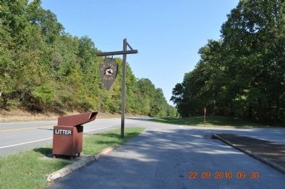
On Natchez Trace Parkway, 0.6 miles south of Columbia Highway (U.S. 412).
Near Natchez Trace Parkway (at milepost 385.9), 0.2 miles north of Summertown Highway (Tennessee Route 20), on the left when traveling north.
On Natchez Trace Parkway (at milepost 385.9), 0.2 miles north of Summertown Highway (Tennessee Route 20).
Near Natchez Trace Parkway (at milepost 385.9), 0.2 miles north of Summertown Highway (Tennessee Route 20), on the left when traveling north.
Near Metal Ford Road, 0.5 miles west of Natchez Trace Parkway.
Near Natchez Trace Parkway (at milepost 385.9), 0.2 miles north of Summertown Highway (Tennessee Route 20).
Near Metal Ford Road, 0.5 miles west of Natchez Trace Parkway.
Near Natchez Trace Parkway (at milepost 385.9), 0.2 miles north of Summertown Highway (Tennessee Route 20), on the left when traveling north.
Near Natchez Trace Parkway (at milepost 401.1) north of Sheboss Road, on the right when traveling north.
Near Natchez Trace Parkway (at milepost 407.7) south of Williamsport Pike (Tennessee Highway 50), on the right when traveling north. Reported missing.
Near Natchez Trace Parkway (at milepost 400.2), 7.6 miles south of Williamsport Pike (Tennessee Route 50), on the right when traveling north.
Near Natchez Trace Parkway (at milepost 401.4), 6.4 miles south of Williamsport Pike (Tennessee Road 50), on the right when traveling north.
Near Natchez Trace Parkway (at milepost 407) south of Williamsport Pike (Tennessee Route 50), on the right when traveling north.
Paid Advertisement
Near Natchez Trace Parkway (at milepost 407.7) south of Williamsport Pike (Tennessee Highway 50), on the right when traveling north.
Near Natchez Trace Parkway (at milepost 401.4), 6.4 miles south of Williamsport Pike (Tennessee Route 50) when traveling north.
Near Natchez Trace Parkway (at milepost 401.4), 6.4 miles south of Williamsport Pike (Tennessee Route 50) when traveling north.
On Natchez Trace Parkway (at milepost 352.9), 2 miles north of Tennessee Route 13, on the left when traveling north.
On Natchez Trace Parkway (at milepost 350.5), 0.2 miles south of Tennessee Route 13, on the right when traveling north.
On Natchez Trace Parkway south of Morgan Road, on the right when traveling south.
On Natchez Trace Parkway (at milepost 367.3), 2.7 miles south of Waynesboro Highway (U.S. 64), on the left when traveling north.
On Lawrenceburg Highway close to Gower Road.
On Natchez Trace Parkway (at milepost 363), 7 miles south of Waynesboro Highway (U.S. 64), on the left when traveling north.
On Natchez Trace Parkway (at milepost 423.9), on the right when traveling north.
Near Natchez Trace Parkway (at milepost 426.3), on the right when traveling north.
127 entries matched your criteria. Entries 101 through 127 are listed above.
⊲ Previous 100