Marker Logo
THE HISTORICAL
MARKER DATABASE
“Bite-Size Bits of Local, National, and Global History”


25 entries match your criteria.  


Entries Containing All of the Phrases «allen county» AND «ohio»

This list will also include matches for inflectional* forms of the words.
 
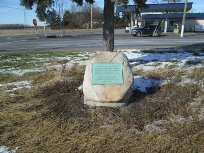
By Rev. Ronald Irick, November 13, 2013
Founders and Patriots Marker
RANKED BY RELEVANCE
1 ► Ohio, Allen County, Lima — Founders and Patriots of Allen County, Ohio — Ohio Sesquicentennial marker —
On Ottawa Road (Ohio Route 65) at North West Street ( Route 115), in the median on Ottawa Road.

2 ► Ohio, Allen County, Lima — Allen County, Ohio —
On Main Street at North Street ( Route 81), on the right when traveling south on Main Street.

3 ► Ohio, Allen County, Lima — The Hog Creek Settlement — Ward Cemetery — Pioneers in Allen County, Ohio —
On Thayer Road at Mirror Lake Drive, on the left when traveling north on Thayer Road.
4 ► Ohio, Allen County, Rockport — Old Church Site Rockport Cemetery — State of Ohio, Allen County — Monroe Township —
On Rockport Road, on the left when traveling west.

5 ► Ohio, Allen County, Lima — Ohio's First Electric Street Car Line —
On North Elizabeth Street, on the right when traveling north on North Elizabeth Street.

6 ► Ohio, Allen County, Lima — 1 — First Oil Well — Industry & Innovation • Lima, OH — Lima's Local History Hunt —
On East North Street at North Sugar Street, on the right when traveling west on East North Street.
7 ► Ohio, Allen County, Lima — 9 — Log House — Roots & Beginnings • Lima, OH — Lima's Local History Hunt —
On West Market Street at North Metcalf Street, on the right when traveling west on West Market Street.

8 ► Ohio, Allen County, Lima — 2-5 — Faurot Oil Well —
On North Street, on the left when traveling east.
9 ► Ohio, Allen County, Lima — 1-2 — Lima Locomotive Works —
On Elm Street, on the left when traveling east.

10 ► Ohio, Allen County, Lima — Johnny Appleseed Apple Tree — Malus pumila —
Near Ada Road (Ohio Route 81), on the right when traveling east.

11 ► Ohio, Allen County, Spencerville — Miami & Erie Canal Deep Cut / Miami & Erie Canal — Anthony Wayne Parkway —
On Ohio Route 66 0.2 miles north of Deep Cut Road, on the right when traveling south.

12 ► Ohio, Allen County, Lima — 6 — Neon Plant — Industry & Innovation • Lima, OH — Lima's Local History Hunt —
Near West Market Street at North Metcalf Street, on the right when traveling west.
13 ► Ohio, Allen County, Lima — 6-2 — Servicemen's Free Canteen —
On Central Avenue, in the median.
14 ► Ohio, Allen County, Lima — The Shawnee Indian Reservation —
On West Kibby Street at South Metcalf Street, on the right when traveling west on West Kibby Street.

15 ► Ohio, Allen County, Lima — Circular Street —
On South Main Street at Circular Street, on the right when traveling north on South Main Street.
Paid Advertisement
16 ► Ohio, Allen County, Spencerville — Site of the 86 Acre Homestead of Dye Sunderland —
On Fort Amanda Road at Sunderland Road, on the right when traveling west on Fort Amanda Road.

17 ► Kentucky, Allen County, Scottsville — Morgan in Scottsville — Confederate Invasion of Kentucky — August, 1862 —
On Smith Grove Road (South Court Street) at West Main Street (Kentucky Route 2152), on the left when traveling north on Smith Grove Road (South Court Street).

18 ► Kansas, Allen County, Iola — Major General Frederick Funston — September 11, 1865 - February 19, 1917 —
On Washington Street north of Madison Avenue, on the left when traveling north.
19 ► Ohio, Allen County, Lima — Detroit, Toledo & Ironton Railroad Station from Uniopolis, Ohio — Lincoln Park Train Exhibit —
Near South Shawnee Street.

20 ► Ohio, Allen County, Elida — Abraham Doner —
Near West Main Street west of South Greenlawn Avenue, on the left when traveling west.
21 ► Ohio, Allen County, Lima — Veterans Freedom Flag Monument —
On Buckeye Road 0.5 miles west of South Dixie Highway, on the left when traveling west.

22 ► Ohio, Allen County, Westminster, Auglaize Township — Haver Ridge Metro Park — A Place to Enjoy and Experience Nature —
On Bellefontaine Road (Ohio Route 117) 0.5 miles north of Madden Road, on the right when traveling north.

23 ► Missouri, Harrison County, Bethany — Harrison County —
On U.S. 136 at 192nd Avenue, on the right when traveling west on U.S. 136.

24 ► Kentucky, Allen County, Scottsville — Scottsville, 1862 —
Near North Bedelia Street (Kentucky Route 1386) 0.1 miles west of Dumont Hill Street, on the right when traveling west.

25 ► Ohio, Allen County, Lima — In Memory of Chief P-H-T and the Hawg Creek Shawnee —
On Shawnee Road, on the left when traveling north.
 
    Thin black lines indicate changes in relevance. Between each pair of lines entries are ordered geographically but all have the same relevance.
* Inflectional forms of words are their plurals, singulars, and possessives as well as gramatical tenses and similar variations.
 
CeraNet Cloud Computing sponsors the Historical Marker Database.
This website earns income from purchases you make after using our links to Amazon.com. We appreciate your support.
Paid Advertisement
Nov. 15, 2026