
26 entries match your criteria.
Entries Containing All of the Phrases «clay county» AND «kansas»
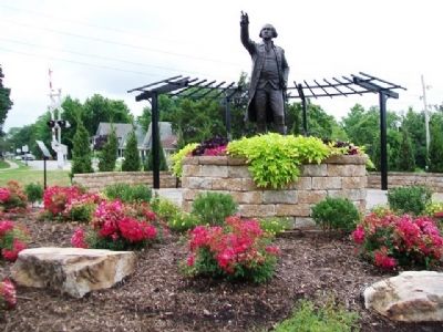
By William Fischer, Jr., July 30, 2013
Kansas City to Liberty to Excelsior Springs Interurban Depot Marker
RANKED BY RELEVANCE
1 ► Missouri, Clay County, Liberty — Kansas City to Liberty to Excelsior Springs Interurban Depot —  |
| On Mill Street (Missouri Route H) at Leonard Street ( Route 33), on the right when traveling east on Mill Street. | |||
| 2 ► Missouri, Clay County, Liberty — 38 — Liberty Arsenal — |
| On Southview Drive south of Seven Hills Road, on the left when traveling south. | |||
| 3 ► Missouri, Clay County, Liberty — Martha Lafite Thompson Nature Sanctuary — McGowan Interurban Railway Bridge and Passenger Station — Interurban RR Trail — |
| Near North La Frenz Road north of Mary Lane, on the right when traveling north. | |||
| 4 ► Missouri, Clay County, Liberty — Scales and Rails — |
| On Water Street north of Mill Street, on the left when traveling north. | |||
| 5 ► Missouri, Clay County, Liberty — 7 — Reconstruction, Great Migration and Civil Rights Eras — Liberty African American Legacy Memorial — |
| On West Shrader Street west of Gallatin Street, on the right when traveling east. | |||
| 6 ► Missouri, Clay County, North Kansas City — Curran Park — |
| On Swift Avenue at 18th Avenue, on the right when traveling south on Swift Avenue. | |||
| 7 ► Missouri, Clay County, Gladstone — 25 — Old Pike Road / Ferry Boat Operators at Kawsmouth — |
| On Northwest Old Pike Road at Northwest 51st Street, on the right when traveling south on Northwest Old Pike Road. | |||
| 8 ► Missouri, Clay County, Liberty — 54 — Garrison School — |
| On North Water Street 0.2 miles north of East/West Mississippi Street when traveling north. | |||
| 9 ► Kansas, Cloud County, Concordia — Hayes Rutherford Devore / Helen Weinhold Ross & Alfred Weinhold — |
| On East 9th Street at Cloud Street, on the right when traveling east on East 9th Street. | |||
| 10 ► Missouri, Platte County, Parkville — Attack on the Paw Paw Fort — Missouri's Civil War 1861 - 1865 — The Struggle for Platte County |
| On NW River Park Drive (Missouri Route 9) 0.1 miles east of East Street, on the right when traveling east. Reported permanently removed. | |||
| 11 ► Missouri, Clay County, Liberty — 4 — Business Owners — Liberty African American Legacy Memorial — |
| Near West Shrader Street west of Gallatin Street, on the right when traveling east. | |||
| 12 ► Missouri, Clay County, Liberty — 6 — Pioneer Families — Liberty African American Legacy Memorial — |
| On West Shrader Street west of Gallatin Street, on the left when traveling west. | |||
| 13 ► Missouri, Clay County, Liberty — The Liberty, Missouri Juneteenth Legacy — |
| On Grover Street south of Corbin Street, on the right when traveling south. | |||
| 14 ► Missouri, Clay County, Liberty — Interurban Railroad - Withers Station — [Westboro-Canterbury Greenway Trail] — |
| On South Withers Road 0.1 miles south of Owens Drive, on the right when traveling south. | |||
| 15 ► Missouri, Clay County, Liberty — Interurban Railway Bridge — [Westboro-Canterbury Greenway Trail] — |
| Near Park Lane south of Broadmore Lane, on the right when traveling south. | |||
| 16 ► Missouri, Jackson County, Independence — Price's Great Missouri Raid — The Battle of the Little Blue River — "They fought us on the blue grass ridges..." Pvt. James H. Campbell, 14th Mo. Confederate Cavalry — |
| On East Old Lexington Road west of North Blue Mills Road, on the left when traveling west. | |||
| 17 ► Missouri, Clay County, Liberty — Liberty — |
| On Water Street north of Kansas Street, on the left when traveling north. | |||
| 18 ► Missouri, Franklin County, Stanton — Saltpeter Cave — Missouri's Civil War — |
| Near Highway West (State Highway W), on the right. | |||
| 19 ► Missouri, Jackson County, Kansas City, South Kansas City — People and the Trails — Santa Fe, Oregon and California National Historic Trails — |
| On East Red Bridge Road, on the right when traveling west. | |||
| 20 ► Missouri, Clay County, Gladstone — 24 — Historic Linden, Missouri — |
| On North Campbell Street at Northeast 69th Street, on the right when traveling south on North Campbell Street. | |||
| 21 ► Missouri, Clay County, Liberty — 8 — Teachers and Educators — Liberty African American Legacy Memorial — |
| On West Shrader Street west of Gallatin Street, on the right when traveling east. | |||
| 22 ► Kansas, Clay County, Clay Center — Clay County Veterans Memorial — All Gave Some, Some Gave All — |
| On 5th Street at Lincoln Avenue, on the right when traveling north on 5th Street. | |||
| 23 ► Indiana, Clay County, Brazil — You Are Here — Historic National Road / Make History, Drive It — The Road That Built the Nation — |
| On East National Avenue (U.S. 40) west of Forest Avenue (Indiana Route 59), on the left when traveling east. | |||
| 24 ► Missouri, Clay County, Liberty — Clay County African American Pioneers — |
| On Franklin Street at Water Street, on the left when traveling west on Franklin Street. | |||
| 25 ► Missouri, Clay County, Liberty — 5 — Antebellum Era — Liberty African American Legacy Memorial — |
| Near West Shrader Street west of Gallatin Strret, on the left when traveling west. | |||
| 26 ► Missouri, Clay County, Liberty — 3 — Veterans — Liberty African American Legacy Memorial — |
| Near West Shrader Street west of Gallatin Street, on the right when traveling east. | |||
Thin black lines indicate changes in relevance. Between each pair of lines entries are ordered geographically but all have the same relevance.
* Inflectional forms of words are their plurals, singulars, and possessives as well as gramatical tenses and similar variations.
Nov. 19, 2026