By J. J. Prats, April 8, 2006
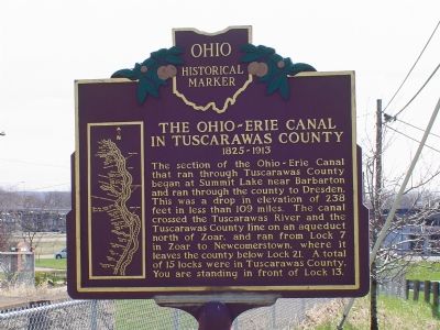
The Ohio-Erie Canal Marker
RANKED BY RELEVANCE
| On Commercial Avenue SE (Ohio Route 416) at Canal Avenue SE, on the left when traveling south on Commercial Avenue SE. |
| On High Avenue near Broadway Avenue, on the right when traveling west. |
| On East High Avenue (Ohio Route 39) at North Broadway Street ( Route 800), on the right when traveling west on East High Avenue. |
| On Dover Zoar Road NE (County Route 82) at Towpath Road NE (County Route 111), on the right when traveling north on Dover Zoar Road NE. |
| On Sherman Church Road (County Route 102) near 12221 Sherman Church Rd NE, on the right when traveling south. |
| On Newport Avenue 0.1 miles south of Trenton Avenue, on the right when traveling north. |
| On North Ray Street (Ohio Route 93) north of Route 651, on the left when traveling north. |
| On Center Street at North 4th Street, on the right when traveling east on Center Street. |
| On Front Street, on the left when traveling west. |
| On Winklepleck Road (County Route 73) at Route 516, on the right when traveling east on Winklepleck Road. |
| On Commercial Avenue SE (Ohio Route 416) south of Cookson Avenue SE, on the left when traveling south. |
| On U.S. 36 at Salem Park Road (Local Route 213), on the left on U.S. 36. |
| On Main Street (Ohio Route 49) at Main Street ( Route 121), on the right when traveling north on Main Street. |
| On Ohio Route 78 at Unionville Road, on the right when traveling west on Ohio Route 78. |
| On Bolanz Road east of Riverview Road (County Route 9), on the right when traveling east. |
| Near Valley Parkway east of Riverview Road, on the left when traveling east. |
| On West Street west of Columbus Road, on the right when traveling west. |
| Near Boston Mills Road at Ohio & Erie Canal Towpath Trail, on the right when traveling east. |
| Near Canal Road south of East Front Street ( Route 800). |
| On Broadway Street (Ohio Route 416) at High Avenue ( Route 39), on the right when traveling north on Broadway Street. |
| On South Main Street (Ohio Route 416) south of Cherry Street, on the right when traveling south. |
| On South Tuscarawas Avenue at Washington Street, on the right when traveling north on South Tuscarawas Avenue. |
| On Tremont Avenue Southwest at 5th Street Southwest, on the right when traveling east on Tremont Avenue Southwest. |
| On Treaty Line Road at Hoover-Moffitt Road, on the right when traveling east on Treaty Line Road. |
| On East High Avenue (County Route 259), on the right when traveling south. |
Thin black lines indicate changes in relevance. Between each pair of lines entries are ordered geographically but all have the same relevance.* Inflectional forms of words are their plurals, singulars, and possessives as well as gramatical tenses and similar variations.
Nov. 13, 2026
