THE HISTORICAL
MARKER DATABASE
“Bite-Size Bits of Local, National, and Global History”


16 entries match your criteria.  


Comanche Trail into Mexico Historical Markers

While there were actually many trails utilized by Comanches in Texas, “The Comanche Trail” typically refers to that system of trails used by Comanches travelling south through Texas on raids into Mexico. This trail is sometimes called the “Comanche War Trail” or “Comanche Trace”. Pekka Hämäläinen in his book The Comanche Empire says raids on the trail grew into a “veritable industry” generating a “massive northward flow of property from Mexico into Comancheria and its trade channels” to the north. The full extent of the trail stretched nearly 1,000 miles from Comancheria in the north, deep into Mexico. The Comanche Trail was in use for about a century, starting in the late 1700s.
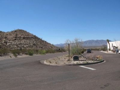
 
By Richard Denney, March 22, 2012
Comanche Trail Marker, View in context
1 ► Texas, Brewster County, Big Bend National Park — 994 — Comanche Trail —
On U.S. 385.
2 ► Texas, Brewster County, Big Bend National Park — Luna's Jacal —
On Old Maverick Road 6.5 miles south of Maverick Drive (Texas Highway 118), on the left when traveling south.
3 ► Texas, Brewster County, Marathon — 1258 — Double Mills —
On U.S. 385, on the right when traveling south.
4 ► Texas, Brewster County, Marathon — 2003 — Fort Peña Colorado (Red Rock) —
On Post Road.
5 ► Texas, Brewster County, Marathon — 3201 — Marathon —
On U.S. 90.
6 ► Texas, Crane County, Crane — 755 — Castle Mountain — (2 mi. East)
On U.S. 385 7.2 miles south of 6th Street, on the left when traveling south. Reported missing.
7 ► Texas, Ector County, Odessa — 996 — Comanche War Trail —
On Business Interstate 20 at Newell Road, on the left when traveling east on Interstate 20Business .
8 ► Texas, Howard County, Big Spring — 12670 — Big Spring State Park on Route of Old Comanche War Trail —
Near State Park Road 8 west of West Marcy Drive (County Route 700), on the right when traveling west.
9 ► Texas, Howard County, Big Spring — 15634 — Route of Marcy’s Trail —
On Belvedere Road 0.2 miles south of Whipkey Drive.
10 ► Texas, Kinney County, Brackettville — 3377 — Military Roads in Texas —
On East Military Highway (U.S. 90) at South Fort Street, on the right when traveling east on East Military Highway.
11 ► Texas, Pecos County, Fort Stockton — 4757 — Site of Comanche Springs —
On Spring Drive near East 1st Street.
12 ► Texas, Pecos County, Fort Stockton — 4798 — Site of Fort Stockton —
On South Main Street at West James Street, on the right when traveling south on South Main Street.
13 ► Texas, Pecos County, Fort Stockton — Tunis Creek Stage Coach Stop —
On Interstate 10 2 miles east of Farm to Market Road 2023, on the right when traveling east.
14 ► Texas, Pecos County, Girvin — 2564 — Horse Head Crossing on the Pecos River —
On Horse Head Road 3.1 miles north of Farm to Market Road 11, on the right when traveling north.
15 ► Texas, Ward County, Monahans — 3434 — Monahans Sandhills State Park and Museum —
Near State Highway Park Road 41 0.2 miles north of Interstate 20, on the left when traveling north.
Paid Advertisement
16 ► Texas, Winkler County, Kermit — 5853 — Willow Springs —
On State Highway 18 at County Route 401, on the left when traveling south on State Highway 18.
 
 
CeraNet Cloud Computing sponsors the Historical Marker Database.
This website earns income from purchases you make after using our links to Amazon.com. We appreciate your support.
Paid Advertisement
Oct. 27, 2026
