24 entries match your criteria.
Historical Markers and War Memorials
in the Rosebud Sioux Tribe Region
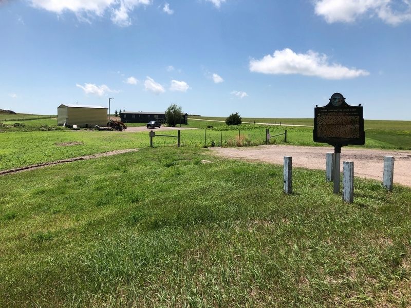
By Ruth VanSteenwyk, July 18, 2019
Civilian Conservation Corps Camp Marker
1 ► South Dakota, Bennett County, Tuthill — 540 — Civilian Conservation Corps Camp —  |
| On U.S. 18 at 230th Avenue (State Highway 73), on the right when traveling west on U.S. 18. | |||
| 2 ► South Dakota, Gregory County, Gregory — Dixon Town Hall — |
| On Main Street at East 5th Street, on the right when traveling north on Main Street. | |||
| 3 ► South Dakota, Gregory County, Gregory — Gregory Veterans Memorial — |
| On West 11th Street at Park Circle, on the right when traveling west on West 11th Street. | |||
| 4 ► South Dakota, Haakon County, Philip — Dakota, Minnesota and Eastern — |
| On East Oak Street at South Center Avenue, on the right when traveling east on East Oak Street. | |||
| 5 ► South Dakota, Haakon County, Philip — Molyneux Cabin — |
| On North Larimer Avenue (State Highway 73) at Bryan Street, on the right when traveling north on North Larimer Avenue. | |||
| 6 ► South Dakota, Jackson County, Cottonwood — "At War Every Day" — |
| Near Cottonwood Road. | |||
| 7 ► South Dakota, Jackson County, Cottonwood — A Landscape Lost to Time — |
| Near Cottonwood Road. | |||
| 8 ► South Dakota, Jackson County, Cottonwood — Peacekeeper — Cadillac-Gage 'Ranger' — Truck, Security Police, Armored Response/Convoy — |
| Near Cottonwood Road. | |||
| 9 ► South Dakota, Jackson County, Cottonwood — Sun Tzu's Nuclear Missile Prophecy — |
| Near Cottonwood Road. | |||
| 10 ► South Dakota, Jackson County, Interior — 510 — Civilian Conservation Corps Camps — |
| On State Highway 240 0.9 miles south of Interstate 90, on the right when traveling south. | |||
| 11 ► South Dakota, Jackson County, Interior — Typical Sod House Homesteader — |
| On State Highway 240 1.3 miles south of Interstate 90, on the right when traveling south. | |||
| 12 ► South Dakota, Lyman County, Iona — 152 — Historic Highway — |
| On State Highway 47 0.2 miles south of 266th Street, on the left when traveling south. | |||
| 13 ► South Dakota, Mellette County, White River — Mellette County Veterans Memorial — |
| Near U.S. 83. | |||
| 14 ► South Dakota, Pennington County, Philip — Invisible Warriors — |
| Near CS-23A (at milepost 127), 0.6 miles north of Interstate 90. | |||
| 15 ► South Dakota, Todd County, Okreek — Chauncey Eaglehorn — |
| On U.S. 18 (U.S. 18) when traveling west. | |||
| 16 ► South Dakota, Todd County, St. Francis, the Rosebud Indian Reservation — Kateri Tekakwitha — 1656 - 1680 — Glory of the Indian Race — |
| On Oak Street at K Avenue, on the right when traveling south on Oak Street. | |||
| 17 ► South Dakota, Todd County, St. Francis, the Rosebud Indian Reservation — Prayer of a Soldier of Christ — St. Ignatius de Loyola — A.M.D.G. — |
| Near Oak Street south of K Avenue, on the right when traveling south. | |||
| 18 ► South Dakota, Tripp County, Winner — Lakeview Methodist Church — |
| Near 317th Avenue north of U.S. 18, on the right when traveling north. | |||
| 19 ► South Dakota, Tripp County, Winner — Shorty McDonald Playground — |
| On East 7th Street east of South Main Street, on the right when traveling east. | |||
| 20 ► South Dakota, Tripp County, Winner — Tripp County Centennial — |
| Near 317th Avenue at U.S. 18, on the right when traveling north. | |||
| 21 ► South Dakota, Tripp County, Winner — Tripp County Historicl Museum — |
| On 317th Avenue at U.S. 18, on the right when traveling north on 317th Avenue. | |||
| 22 ► South Dakota, Tripp County, Winner — Winner Depot — |
| Near 317th Avenue north of U.S. 18, on the right when traveling north. | |||
| 23 ► South Dakota, Tripp County, Winner, Lamro Township — Tripp County Veterans Memorial — |
| On East 3rd Street, on the right when traveling west. | |||
| 24 ► South Dakota, Tripp County, Winner, Lamro Township — Tripp County World War I Memorial — |
| On East 3rd Street, on the right when traveling west. | |||