THE HISTORICAL
MARKER DATABASE
“Bite-Size Bits of Local, National, and Global History”


10 entries match your criteria.  


Related Historical Markers

Hanging Rock Battlefield Trail and other Related Markers
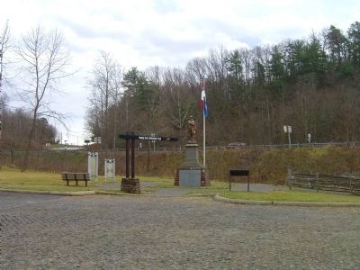
 
By Kevin W., December 28, 2008
Hanging Rock Battlefield Trail Marker
SHOWN IN SOURCE-SPECIFIED ORDER
1 ► Virginia, Roanoke County, Hanging Rock — Hanging Rock Battlefield Trail —
Near Dutch Oven Road at N. Electric Road (Virginia Route 419).
2 ► Virginia, Roanoke County, Hanging Rock — United Daughters of the Confederacy Monuments — Hanging Rock Battlefield Trail —
Near Thompson Memorial Drive (Virginia Route 311) at Kessler Mill Drive.
3 ► Virginia, Roanoke County, Hanging Rock — The Battle of Hanging Rock — A Union Retreat Disrupted —
On Dutch Oven Road near N. Electric Road ( Route 419), on the right when traveling east.
4 ► Virginia, Roanoke County, Hanging Rock — George Morgan Jones —
On Dutch Oven Road north of North Electric Road ( Route 419), on the left when traveling west.
5 ► Virginia, Roanoke County, Hanging Rock — Battle of Hanging Rock —
On Catawba Valley Drive (Virginia Route 311) north of North Electric Road ( Route 419), on the right when traveling west.
6 ► Virginia, Roanoke County, Hanging Rock — McCausland Attacks — Hanging Rock Battlefield Trail —
Near Thompson Memorial Drive (Virginia Route 311) at Kessler Mill Drive.
7 ► Virginia, Roanoke County, Hanging Rock — The Hanging Rock Coal Trestle — Hanging Rock Battlefield Trail —
Near Thompson Memorial Drive (Virginia Route 311) at Kessler Mill Drive.
8 ► Virginia, Roanoke County, Hanging Rock — Two Future Presidents In Wartime Retreat — Hanging Rock Battlefield Trail —
Near Thompson Memorial Drive (Virginia Route 311) at Kessler Mill Drive.
9 ► Virginia, Roanoke County, Hanging Rock — 100th Anniversary of Hanging Rock —
On N. Electric Road (Virginia Route 419) near U.S. 81, on the left when traveling west.
10 ► Virginia, Roanoke County, Hanging Rock — KH-7 — Hanging Rock —
On North Electric Road (Virginia Route 419) near U.S. 81, on the left when traveling west.
 
 
CeraNet Cloud Computing sponsors the Historical Marker Database.
This website earns income from purchases you make after using our links to Amazon.com. We appreciate your support.
Paid Advertisement
Nov. 11, 2026
