THE HISTORICAL
MARKER DATABASE
“Bite-Size Bits of Local, National, and Global History”


9 entries match your criteria.  


Related Historical Markers

Markers pertaining to bridges over the Niagara River Gorge.
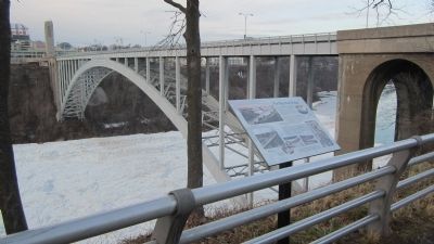
 
By Anton Schwarzmueller, January 16, 2014
The Falls View Bridges Marker
SHOWN IN SOURCE-SPECIFIED ORDER
1 ► New York, Niagara County, Niagara Falls — The Falls View Bridges —
Near Prospect Street.
2 ► New York, Niagara County, Niagara Falls — A Bridge to Freedom — "There was now but 'one wide river to cross'..." —
On Whirlpool Street at Ontario Avenue, on the right when traveling south on Whirlpool Street.
3 ► New York, Niagara County, Niagara Falls — 147 — United States Custom House —
On Whirlpool Street at Depot Avenue West, on the right when traveling north on Whirlpool Street.
4 ► New York, Niagara County, Lewiston — 612 — Bridge Ruins —
Near South 4th Street 0.8 miles south of Tuscarora Street.
5 ► New York, Niagara County, Lewiston — Suspension Bridge Tollhouse — July 21, 1899 to November 2, 1962 —
On Center Street (New York State Route 18F) at South 9th Street, on the right when traveling east on Center Street.
6 ► Ontario, Niagara Region, Niagara Falls — Rainbow Bridge —
On River Road 0.2 kilometers Hiram Street, on the right when traveling north.
7 ► Ontario, Niagara Region, Niagara Falls — International Rainbow Bridge Commemoration — King George VI and Queen Elizabeth — June 7, 1939 —
Near Niagara Parkway at Rainbow Bridge, on the right when traveling north.
8 ► Ontario, Niagara Region, Niagara Falls — Upper Steel Arch Bridge —
Near River Road at Clifton Hill, on the right when traveling north.
9 ► Ontario, Niagara Region, Niagara Falls — Upper Suspension Bridge —
Near River Road, on the right when traveling north.
 
 
CeraNet Cloud Computing sponsors the Historical Marker Database.
This website earns income from purchases you make after using our links to Amazon.com. We appreciate your support.
Paid Advertisement
Nov. 11, 2026
