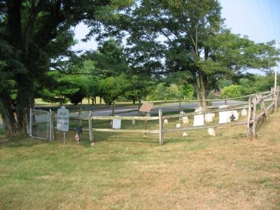
By Craig Swain, July 28, 2007
The Moler Family Cemetery
RANKED BY RELEVANCE
| On Bakerton Road at Morning Calm Lane on Bakerton Road. |
| On South George Street (West Virginia Route 115) at Washington Street ( Route 51), on the right when traveling south on South George Street. |
| On Mordington Ave. at Mordington Rd., on the left when traveling north on Mordington Ave.. |
| On Middleway Pike (West Virginia Route 51) east of Earle Road ( Route 51/1). |
| On South Samuel Street south of Hunter Street, on the left when traveling south. |
| On Middleway Pike (West Virginia Route 51) at Earle Road, on the right when traveling east on Middleway Pike. |
| On North Fairfax Boulevard at East Beltline Avenue, on the right when traveling south on North Fairfax Boulevard. |
| On South Mildred Street just north of West 3rd Avenue, on the left when traveling north. |
| On South George Street north of West 2nd Avenue, on the left when traveling north. |
| On North Mildred Street (West Virginia Route 115) at West Beltline Avenue, on the left when traveling north on North Mildred Street. |
| On North Mildred Street (West Virginia Route 115) just north of Ranson Park Alley, on the left when traveling north. |
| On West 2nd Avenue at North Lawrence Street, on the left when traveling west on West 2nd Avenue. |
| Near Church Street, on the right when traveling south. |
| On Flowing Springs Road (County Route 17) at County Route 17/2, on the right on Flowing Springs Road. |
| On Winchester Avenue (U.S. 11) at Packhorse Ford Road, on the right when traveling south on Winchester Avenue. |
| On Kanawha Trail (Virginia Route 311) 0.3 miles south of Sweet Springs Lane, on the right when traveling south. |
| On Washington Court just west of West Washington Street (Alternate U.S. 340), on the left when traveling west. |
| On Baxter Street at Warfield Way, on the left when traveling east on Baxter Street. |
| On Canal Road, on the right when traveling south. |
| On Lord Fairfax Parkway (U.S. 340), on the right when traveling south. |
| On S. Duke Street, on the right when traveling south. |
| On George Street at Washington Street on George Street. |
| On East German Street (State Highway 45) at Princess Street (County Route 230), on the right when traveling west on East German Street. |
| Near Charmian Road east of Buchanan Trail East/Waynesboro Road, on the left when traveling east. |
| On Washington Street, on the right when traveling west. Reported permanently removed. |
| On South Mt. Parvo Street at West Congress Street, on the right when traveling south on South Mt. Parvo Street. |
| On Route 9 Bike Path 0.4 miles south of Luther Jones Road (County Road 16/4), on the right when traveling north. |
| On Route 9 Bike Path 0.7 miles north of Leetown Road (County Road 1), on the right when traveling south. |
| On E Congress Street at S Church Street, on the right when traveling east on E Congress Street. |
| On Mansfield Drive (U.S. 250) at North Main Street (U.S. 250), on the right when traveling east on Mansfield Drive. Reported permanently removed. |
| On Summit Point Road (County Road 13) 0.2 miles west of McCormack Lane, on the right when traveling east. |
| On Kearneysville Pike (West Virginia Route 480) at Starkey's Landing, on the right when traveling north on Kearneysville Pike. |
| On Melvin Road (County Road 17/2) 0.1 miles Flowing Springs Road (County Road 17), on the right when traveling east. |
Thin black lines indicate changes in relevance. Between each pair of lines entries are ordered geographically but all have the same relevance.* Inflectional forms of words are their plurals, singulars, and possessives as well as gramatical tenses and similar variations.
Nov. 13, 2026
