THE HISTORICAL
MARKER DATABASE
“Bite-Size Bits of Local, National, and Global History”


33 entries match your criteria.  


Overland Trail Historical Markers

Established by Ben Holliday in 1862 from the remnants of the Overland Stage, this was the principal route for mail and passengers between northeastern Colorado and southwestern Wyoming in the 1860s.
 
By Barry Swackhamer, September 8, 2015
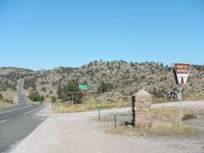
Virginia Dale Marker
1 ► Colorado, Larimer County, Livermore — Virginia Dale —
On U.S. 287 at County Route 43F, on the right when traveling north on U.S. 287.
2 ► Colorado, Larimer County, Livermore — 244 — Virginia Dale — Trails West — Welcome To Colorado —
On U.S. 287 near High Lonesome Road, on the left when traveling north.
3 ► Colorado, Sedgwick County, Julesburg — 19 — Old Julesburg —
On County Road 28 6 miles west of U.S. 385, on the right when traveling west.
4 ► Idaho, Bingham County, Blackfoot — 188 — Central Ferry Station —
On West Bridge Street at South Meridian Street, on the left when traveling west on West Bridge Street.
5 ► Idaho, Elmore County, Mountain Home — Oregon Trail 1864 —
On U.S. 20 near Northeast Teapot Road, on the right when traveling south.
6 ► Idaho, Twin Falls County, Hansen — First Trading Post —
On U.S. 30 near Little Cedar Street, on the left when traveling west.
7 ► Idaho, Twin Falls County, Hansen — Old Rock Creek —
On Stricker Cabin Road at East 3200 North (Pumpland Road), on the left when traveling east on Stricker Cabin Road.
8 ► Idaho, Twin Falls County, Hansen — 86 — Rock Creek Station —
On Stricker Cabin Road near East 3200 North (Pumpland Road), on the right when traveling east.
9 ► Kansas, Johnson County, Gardner — 6 — Overland Trails —
On Main Street 0.1 miles North Oak Street, on the right when traveling west.
10 ► Kansas, Johnson County, Merriam — 03 — The Overland Trails — Merriam Historic Plaza Walking Path —
On East Frontage Road.
11 ► Kansas, Johnson County, Olathe — Trail Campground..To Farm..To Park —
Near West 167th Street.
12 ► Kansas, Marshall County, Marysville — Overland Stage —
On South 10th Street.
13 ► Kansas, Washington County, Bremen — Trail Junction —
On 1st Road, on the right when traveling east.
14 ► Nebraska, Otoe County, Nebraska City — Official Oregon Trail Marker —
On South 5th Street at Central Avenue, on the left when traveling south on South 5th Street.
15 ► Nebraska, Otoe County, Nebraska City — Site of the Overland Trail —
On North 11th Street at Central Avenue, on the left when traveling south on North 11th Street.
Paid Advertisement
16 ► Nebraska, York County, York — Moving People and Goods on the Overland Trail —
On Interstate 80 at milepost 355.2, on the right when traveling west.
17 ► Utah, Salt Lake County, Salt Lake City, Rio Grande — COTU-1 — Central Overland Trail - Washington Square — [Previously Emigrant Square] —
On State Street, on the right when traveling north.
18 ► Utah, Tooele County, Rush Valley — 98 — Rush Valley Station — Pony Express 1860-61 —
On Pony Express Trail Road, on the left when traveling east.
19 ► Wyoming, Albany County, Laramie — Big Laramie Stage Station —
On State Highway 230 near County Route 33, on the left when traveling west.
20 ► Wyoming, Albany County, Laramie — Old Overland Trail —
On State Highway 230 near Gerhart Road, on the left when traveling west.
21 ► Wyoming, Albany County, Laramie — The Overland Trail —
On Snowy Range Road (State Highway 130) near Cactus Hill Road, on the right when traveling west.
22 ► Wyoming, Albany County, Tie Siding — The Overland Stage Line —
On U.S. 287, on the right when traveling north.
23 ► Wyoming, Carbon County, Elk Mountain — Wagonhound Rest Area —
Near Interstate 80 at Elk Mountain Arlington Road.
24 ► Wyoming, Carbon County, Saratoga — This Marker on the Overland Trail —
On State Highway 130 0.7 miles south of Pass Creek Rd, on the right when traveling south.
25 ► Wyoming, Carbon County, Wamsutter — Overland Trail —
On State Highway 789 near Interstate 80, on the right when traveling south.
26 ► Wyoming, Carbon County, Wamsutter — The Overland Stage Station Route —
On State Highway 789 near Interstate 80, on the right when traveling south.
27 ► Wyoming, Sweetwater County, Green River — The Overland Stage —
On Uinta Drive (State Highway 530) at W. Astle Avenue, on the right when traveling north on Uinta Drive.
28 ► Wyoming, Sweetwater County, Green River — The Overland Stage Station Route —
On Uinta Drive (State Highway 530) near West Astle Avenue, on the right when traveling north.
29 ► Wyoming, Sweetwater County, Point of Rocks — Almond Overland Stage Station —
On I-80 Service Road North (State Highway 377), on the left when traveling east.
30 ► Wyoming, Sweetwater County, Point of Rocks — Overland Stage Route —
On I-80 Service Road South, on the left when traveling west.
31 ► Wyoming, Sweetwater County, Point of Rocks — Point of Rocks Stage Station —
On Black Butte Road at Oregon Trail on Black Butte Road.
Paid Advertisement
32 ► Wyoming, Sweetwater County, Rock Springs — Rock Spring Stage Station Site —
On Springs Drive near Raindance Drive, on the right when traveling north.
33 ► Wyoming, Uinta County, Fort Bridger — Fort Bridger —
On Business Interstate 80 at Main Street, on the right when traveling east on Interstate 80Business .
 
 
CeraNet Cloud Computing sponsors the Historical Marker Database.
This website earns income from purchases you make after using our links to Amazon.com. We appreciate your support.
Paid Advertisement
Nov. 11, 2026