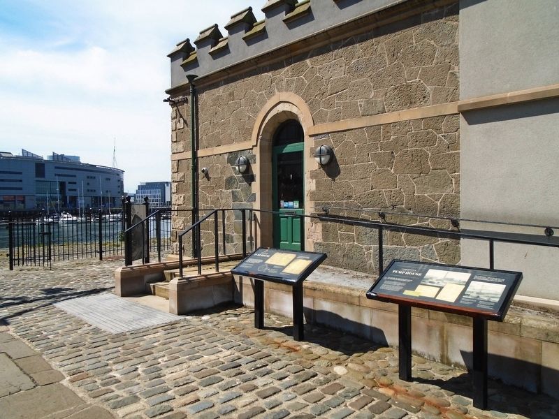
In the mid-1920s, the original steam-powered pumps were replaced by ones driven by electric motors.
Each of the 125 horsepower electric motors, which can still be seen inside, drives a pump in the underground well. Above the motors you can . . . — — Map (db m135438) HM
On Donegall Quay (Northern Ireland Route A2) at Queen's Square, on the left when traveling south on Donegall Quay.
Welcome to the Quays at the mouth of the River Lagan. Set around the Lagan Weir the Quays incorporate Queen's Quay, Hanover Quay, Gregg's Quay and Donegall Quay, all closely linked with the origins of Belfast. The city derives its name from the . . . — — Map (db m135226) HM
On Donegall Place at Castle Street, on the right when traveling south on Donegall Place.
This plaque records the fact that on
28th. June 1701
Arthur Chichester, 3rd. Earl of Donegall
by warrant of
his late Majesty King William III
formed the 35th Regiment of Foot
which has since become famous as
The Royal Sussex . . . — — Map (db m134891) HM
C.S. 'Jack' Lewis
Ulsterman, Writer, Scholar, Teacher, Christian
Born 1898, Reborn 1931
The Searcher, by sculptor Ross Wilson, represents the narrator of The Magician's Nephew, Digory Kirke. In this story he has a wardrobe made from an . . . — — Map (db m135550) HM
On Donegall Square North (Northern Ireland Route A1) at Callender Street/Donegall Square East, on the left when traveling east on Donegall Square North.
KEY
(1) (2) The illuminated blue lines demonstrate the actual size and location of the Titanic (1) and Olympic (2) ships constructed on these two Slipways.
(3) The turfed and decked areas denote the proportions of people that survived . . . — — Map (db m135002) HM
On Donegall Square East just south of Donegall Square North ( Route A1), on the right when traveling south.
Titanic Memorial Garden is a permanent tribute to over 1,500 passengers and crew who died after the ship struck an iceberg and sank in the North Atlantic during its maiden voyage in April 1912.
When RMS Titanic departed Southampton on 10 . . . — — Map (db m134337) HM
[Front]
On 31 May 1911, SS 401, Titanic, slid down Slipway No. 3 at the Queen's Yard of Harland and Wolff and settled on the waters of the Victoria Channel in Belfast Lough. In her brief life she would be the largest, most luxurious vessel . . . — — Map (db m135088) HM
On Bedford Street just south of Franklin Street, on the left when traveling south.
For almost 150 years, the Ulster Hall has brought spectacle and delight to the people of Belfast. It was built at a time when the city was attracting major artists and needed a bigger concert hall. The Ulster Hall Company was formed in 1859 to . . . — — Map (db m134240) HM
On Bombay Street just east of Clonard Gardens, on the right when traveling east.
In loving memory of
Vol. Tom Williams
"C. Coy" 2nd Battalion
Belfast Brigade IRA
who lived here
and was executed in
Belfast Gaol
2nd Sept 1942 Aged 19 years
ar dheis de go rabh a anam
[To the honor of his . . . — — Map (db m134711) HM
On Donegall Square North (Northern Ireland Route A1) at Donegall Place, on the right when traveling east on Donegall Square North.
Belfast has been shaped by time and circumstance. Its buildings tell the story of change and development, of commerce and industry, entertainment and religion.
Belfast city centre is the vibrant heart of a thriving metropolis, which has shifted . . . — — Map (db m133803) HM
On Wellington Place (Northern Ireland Route A1) just east of College Square East ( Route A1), on the right when traveling east.
The growth in prosperity from cotton and linen during the Napoleonic wars saw Belfast's centre of gravity shift from its ancient heartland around High Street, out towards the White Linen Hall, where the present City Hall now stands. Wellington . . . — — Map (db m134188) HM
On Donegall Square East just south of Donegall Square North ( Route A1), on the right when traveling south.
In loving and most grateful memory of
my beloved husband
William James Pirrie
1st Viscount K.P. P.C. H M.L.
Born 31st May 1847 - Died 7th June 1924.
Only son of
James Alexander Pirrie and . . . — — Map (db m134345) HM
On Donegall Square South (Northern Ireland Route A1) at Donegall Square West, on the right when traveling west on Donegall Square South.
Pro Deo et Patria
Erected by
The City of Belfast
in memory of
her heroic sons
who made
the supreme sacrifice
in
The Great War
1914 - 1918
1939 - 1945
Faithful unto death
they are remembered
with pride and . . . — — Map (db m133959) WM
On Donegall Square North (Northern Ireland Route A1) at Donegall Square West, on the right when traveling east on Donegall Square North.
Mayor of Belfast 1892 and 1893.
Lord Mayor 1901, 1902, 1903, 1905 and 1906.
Freeman of the City.
M.P. for Belfast-North-.
Obit 1907.
Erected by his many friends
in appreciation of the numerous
public services rendered
by him to . . . — — Map (db m133963) HM
On Boyne Bridge Place at Hope Street, on the right when traveling north on Boyne Bridge Place.
[Captions:]
1. Mr R. J. Ross, Headmaster of Mabel St. School from 1886-1921
2. Saturday night dancing at the Orange Hall in Sandy Row
3. John Brown pictured outside his popular 'Ribbon Shop'
4. A friendly chat on the street
5. . . . — — Map (db m295931) HM
On Royal Avenue at Library Street, on the left when traveling north on Royal Avenue.
The scars on this stone were caused in the German air raids of the Second World War. Despite severe damage to be building, the Belfast Telegraph was published without interruption. — — Map (db m257663) HM
121 entries matched your criteria. Entries 101 through 121 are listed above. ⊲ Previous 100