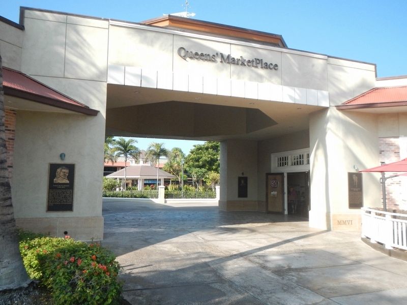
Also known as Tamehamalu, Victoria Kamāmalu was the daughter of Kamehameha I and married Liholiho Kamehameha II. Only 5 years after he took the throne, the King and Queen sailed to London for a state visit with King George IV. While in England, . . . — — Map (db m110409) HM
On King's Trail, on the right when traveling north.
Before you lies one of the major concentrations of ancient rock carvings in the Hawaiian Islands. Boundaries were not crossed casually in old Hawaii, and the thousands of surface carvings here, just north of the border between the ancient . . . — — Map (db m4247) HM
Near Old Puako Road near Hapuna Beach Road, on the right when traveling south.
January, 1944
The second AM Trac BN., U.S. Marines established Camp Henry C. Drewes on this site; here trained until May, 1944
Here we rested from battle...
Prepared for another...
And prayed for peace.
Seal at center: . . . — — Map (db m110378) HM
On Mamalahoa Highway (Hawaii Route 190) at Pu'uopelu Road, on the right when traveling west on Mamalahoa Highway.
Four stones make up this monument:
The 2nd and 5th Marine Divisions
trained here to bring peace
to the Pacific
Parker Ranch & Camp Tarawa 1943-1945
This monument honors the V Amphibious Corps (VAC), and . . . — — Map (db m108940) HM WM
Near Akoni Pule Highway (Hawaii Route 270), on the left when traveling north.
Archaeologists seek to understand people and places of the past by studying the sites and cultural remains left behind. Students from the University of Hawai'i conducted extensive excavations here between 1968 and 1970 to learn about the people of . . . — — Map (db m110325) HM
Near Akoni Pule Highway (Hawaii Route 270), on the left when traveling north.
The ahupua'a is a traditional land division that runs mauka from the mountains to makai (seaward). The ahupua'a of Lapakahi encompasses more than 2,000 acres along the leeward slopes of the Kohala Mountains. The distance from the upland forests . . . — — Map (db m110324) HM
Near Kawaihae Road near Kawaihae Harbor Road, on the left when traveling north.
The submerged remains of Hale o Kapuni Heiau, a temple dedicated to shark akua (deities), are believed to lie just offshore. The heiau was built by a chief whose family revered sharks, believing that the family's 'aumākua (deified ancestors) . . . — — Map (db m110377) HM
On Daniel K. Inouye Highway (Saddle Road) (Route 200 at milepost 27) near Mauna Kea Access Road, on the left when traveling east.
Traditional native uses of the Humu'ula area included bird catching and, at much higher elevations, adze quarrying. They were replaced by sandalwood harvesting and hunting wild cattle, and ultimately ranching and astronomy. Over time, travelers . . . — — Map (db m110792) HM
On Daniel K. Inouye Highway (Saddle Road) (Hawaii Route 200 at milepost 28) at Mauna Kea Access Road, on the right when traveling east on Daniel K. Inouye Highway (Saddle Road).
Sheep raising became economically important within the interior of Hawai'i during the second half of the nineteenth century. In the 1860s, the Waimea Grazing and Agricultural Company established a station for sheep at Humu'ula. By 1873 it had a . . . — — Map (db m110787) HM
Near Kawaihae Road (Hawaii Route 270), on the left when traveling north.
The remains of Mailekini Heiau, a temple used before the time of Kamehameha, stand before you. Many mysteries surround Mailekini Heiau; its early history, kept orally and secretly within the priesthood, was never recorded. Historians agree that . . . — — Map (db m110367) HM
Near Kawaihae Road (Route 270), on the left when traveling north.
Who would suspect that the area at the base of this hill is one of the most significant cultural sites in Hawai'i? This plain-looking patch of earth was the site of Pelekane, one of several known royal compounds traditionally used by Hawaiian kings. . . . — — Map (db m110369) HM
On Daniel K. Inouye Highway (Saddle Road) (Route 200 at milepost 28) at Mauna Kea Access Road, on the right when traveling east on Daniel K. Inouye Highway (Saddle Road).
What is a kīpuka?
Pu'uhuluhulu, a 500-year old patter cone, is a kīpuka ( an older oasis within a newer lava flow). It preserves native plants and acts as a seed bank to revegetate the more recent lava flows that surround it. . . . — — Map (db m110790) HM
Near Kawaihae Road near Kawaihae Harbor ( Route 270), on the left when traveling north.
Build a heiau on Pu'ukoholā, the "hill of the whale," dedicate it to your war god, and you will achieve your dream - you will rule the islands. Responding to this prophecy told by Kapoykahi, a famous seer, Kamehameha built the . . . — — Map (db m110330) HM
Near Spencer Beach Park Road 0.2 miles west of Kawaihae Road ( Route 270), on the right when traveling west.
Build a heiau on Pu'ukohola, the "hill of the whale," dedicate it to your war god, and you will achieve your dream — you will rule the islands. Responding to this prophecy told by Kapoukahi, a famous seer, Kamehameha built the heiau . . . — — Map (db m172849) HM
On Mamalahoa Highway (Hawaii Route 19) near Lindsey Road, on the left when traveling west.
With the first cattle arriving in the Hawaiian Islands in 1793 as gifts for King Kamehameha I, it was not long before they overpopulated and plundered the countryside from the mountains to the seashores. Determined to bring them under control and . . . — — Map (db m108949) HM
On Hawai'i Belt Road (Hawaii Route 19), on the right when traveling south.
This commemorative boot is symbolic of the 1908 victory of four Waimea paniolo who reigned as World Champion steer ropers in the Cheyenne Frontier Days Rodeo in Wyoming. — — Map (db m190123)
117 entries matched your criteria. Entries 101 through 117 are listed above. ⊲ Previous 100