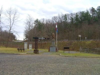
Welcome to the Hanging Rock Battlefield Trail. This 1.6 mile linear park is the Roanoke Valley’s first rails-to-trails project converting a former railroad right-of-way into a hiking and biking trail. The project’s master plan presents an . . . — — Map (db m15104) HM
When Miss Massie Garst died in 1960, she bequested the Hanging Rock and Buzzard’s Roost to the Virginia Division United Daughters of the Confederacy. She will that this site be preserved as memorial to the brave soldiers who fought and died in the . . . — — Map (db m15103) HM
On June 21, 1864, following two days of fighting at Lynchburg, Confederate Gen. Robert Ransom’s cavalry, pursuing Union Gen. David Hunter’s retreating column, engaged in a conflict that would ultimately become known as the Battle of Hanging Rock. . . . — — Map (db m4012) HM
Near the site, on the morning of June 21, 1864, Union Major General David Hunter’s ambulances, artillery, and supply and munitions wagons crossed the ford at Mason’s Creek. The wagon train stalled, and was left unprotected because U.S. Brig. General . . . — — Map (db m15100) HM
The Hanging Rock coal trestle functioned as a coal unloading facility, and was built by the Norfolk and Western Railway in 1943 from a standard plan used for this type of structure.
At the turn of the century, most industries utilized a . . . — — Map (db m15094) HM
On June 21, 1864, two future presidents marched with Major General David Hunter’s Army of Western Virginia on its retreat from Lynchburg to West Virginia by way of Hanging Rock and the old New Castle Turnpike.
Colonel Rutherford Birchard . . . — — Map (db m15101) HM
Commemorating the 100th Anniversary of the Skirmish at Hanging Rock
June 21, 1864
Erected by the William Watts Chapter, U. D. C.
June 21, 1964 — — Map (db m3844) WM
On June 31, 1864 General Hunter, retreating from defeat at Lynchburg by General Early, met Confederate forces led by General John McCausland. After losing some of his artillery here, Hunter continued his withdrawal northwest through New Castle to . . . — — Map (db m3843) HM