On Kootenay Highway (Provincial Highway 93/95) 1.3 kilometers north of Burns Avenue, on the left when traveling north.
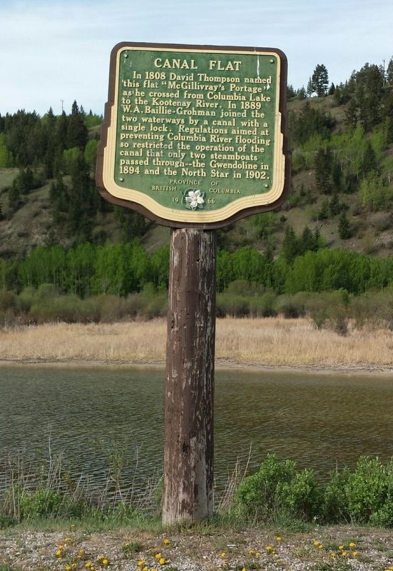
In 1808 David Thompson named this flat “McGillivary's Portage” as he crossed from Columbia Lake to the Kootenay River. In 1889 W.A. Baillie-Grohman joined the two waterways by a canal with a single lock. Regulations aimed at preventing Columbia . . . — — Map (db m188022) HM
On Van Horne Street South (Provincial Highway 3) south of 5th Avenue South, on the right when traveling south.
The Canadian Pacific Railway helped open up south-east British Columbia with a strategic line through the Rocky Mountain Crowsnest Pass. It also helped maintain Canadian sovereignty over Kootenay mineral wealth which had been flowing south to . . . — — Map (db m187918) HM
On Provincial Highway 93/95 close to St. Mary's Street.
Gold miners poured into this area in the 1860’s crossing the Kootenay River at the foot of this street. The settlement that grew up here was first called Galbraith’s Ferry.
In 1887 the N.W.M.P. established a post here when friction developed . . . — — Map (db m100115) HM
On Kootenay Highway (Provincial Highway 3) 0.8 kilometers east of Ha Ha Creek Road, on the left when traveling south.
A colourful steamboat era preceded the railways. During mining boom days of 1893-98 a fleet of sternwheelers ran north from the railway at Jennings, Mont., to Ft. Steele and vicinity.
Carrying prospectors, freight, and ore they battled . . . — — Map (db m187987) HM
On Crowsnest Highway (Provincial Highway 3/95) 0.4 kilometers south of Half Moon Avenue, on the right when traveling south.
Kootenay gold discoveries attracted thousands of prospectors from Washington Territory in the late 1850s and 1860s. In those years all trails led south into Washington and Idaho and the vast bulk of the treasure and commerce enriched those regions. . . . — — Map (db m187913) HM
On Crowsnest Highway (Provincial Highway 3/95) 0.3 kilometers south of Half Moon Avenue, on the right when traveling south.
In 1893 a Kootenay Indian, Pierre,
found a rich galena outcrop in
the hills nearby. Father Coccola
of St. Eugene Mission arranged
sale of the claims, and with the
proceeds built a new home for
Pierre and a new mission church.
Development of . . . — — Map (db m187928) HM
On Kootenay Highway (Provincial Highway 93) 2.2 kilometers south of Stanley Street, on the right when traveling south.
In 1841, Sinclair guided 200 Red River settlers from Fort Garry through the Rockies to Oregon in an attempt to hold the territory for Great Britain. By 1854 he had recrossed the mountains several times by routes which later were followed by trails . . . — — Map (db m187991) HM
On Crowsnest Highway (Provincial Highway 3) 0.8 kilometers north of British Columbia-Alberta boundary line, on the left when traveling west.
Rivers born in Canada's Rockies
carved passes eastward to Hudson
Bay or westward to the Pacific.
This one was long used by Indians,
but not shown on maps until the
Palliser Expedition of 1860, and
then only from hearsay. Michael
Phillipps . . . — — Map (db m187912) HM
On Crowsnest Highway (Provincial Highway 3) 3.3 kilometers south of Douglas Fir Road, on the right when traveling south.
Dr. Dawson was one of the most renowned of the early mapmakers of the Pacific Slope. In 1883 Dr. Dawson explored the Crow's Nest Pass for the Geological Survey of Canada. His report demonstrated his extraordinary ability to provide not only . . . — — Map (db m187904) HM
On Crowsnest Highway (Provincial Highway 3) 0.4 kilometers west of Elk Valley Coal Road, on the right when traveling west.
Gone but still remembered — no formal boundaries
divided the communities of Natal, Michel and Middletown —
“home” to thousands of coal miners for generations. Workers
came from many parts of Europe and North America to toil
in these mines. . . . — — Map (db m187935) HM
On Kootenay Highway (Provincial Highway 93) 0.7 kilometers south of Simpson River Trailhead, on the right when traveling north.
[English] Born in the Scottish Highlands, Simpson joined the Hudson's Bay Company in 1820. In 1821 he became governor of the Northern Department, and in 1826 governor-in-chief in Rupert's Land. An energetic administrator with a . . . — — Map (db m201674) HM
On Laurier Street, 0.2 kilometers south of Daly Street, on the left when traveling south.
Timber in abundance, woodsmen ready to work, a river to float logs, and a railway to transport products: ingredients critical to the emergence of early twentieth century mills in the Kootenay River basin. The Crows Nest Pass Lumber Company at . . . — — Map (db m187939) HM