10 entries match your criteria.
Historical Markers in Kootenay Boundary, British Columbia
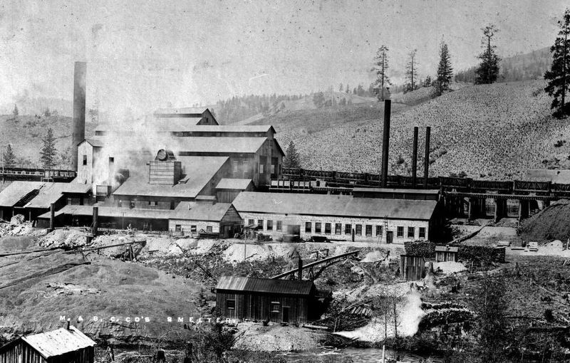
B.C. Department of Mines via B.C. Archives I-55689 (public domain), circa 1905
The Sunset Smelter
| 1 ► British Columbia, Kootenay Boundary, Boundary Falls — Boundary Falls Smelter — |
| 2 ► British Columbia, Kootenay Boundary, Christina Lake — Cascade — Gateway to the Boundary Country — |
| 3 ► British Columbia, Kootenay Boundary, Eholt — Eholt — Divisional Point of the Boundary — |
| 4 ► British Columbia, Kootenay Boundary, Grand Forks — The Doukhobors — |
| 5 ► British Columbia, Kootenay Boundary, Greenwood — Copper Street — |
| 6 ► British Columbia, Kootenay Boundary, Greenwood — Greenwood Smelter — |
| 7 ► British Columbia, Kootenay Boundary, Midway — Kettle Valley Railroad — |
| 8 ► British Columbia, Kootenay Boundary, Midway — Midway — Railways and Hotels — |
| 9 ► British Columbia, Kootenay Boundary, Rossland — The Rossland Mines — |
| 10 ► British Columbia, Kootenay Boundary, Silica — The Dewdney Trail — |