10 entries match your criteria.
Historical Markers in Kootenay Boundary, British Columbia
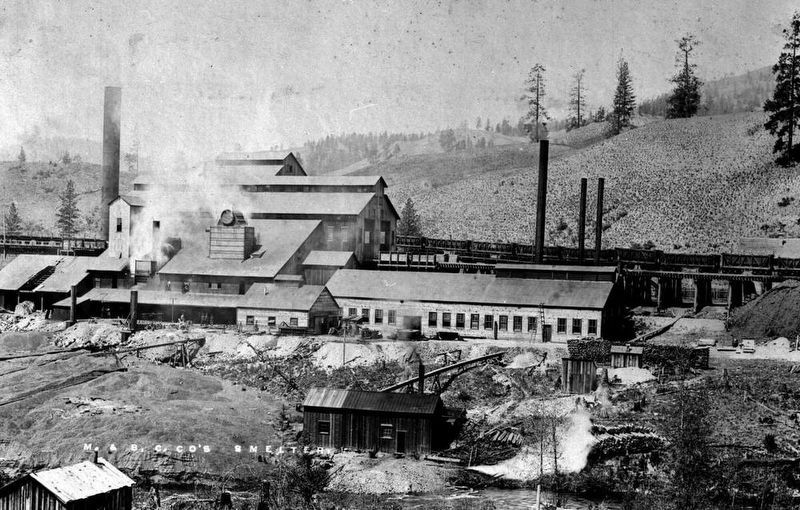
B.C. Department of Mines via B.C. Archives I-55689 (public domain), circa 1905
The Sunset Smelter
| On Crowsnest Highway (Provincial Highway 3) at Boundary Smelter Road, on the right when traveling east on Crowsnest Highway. |
| On British Columbia 395, 0.1 kilometers east of Crowsnest Highway (Provincial Highway 3), on the left when traveling east. |
| On Crowsnest Highway (Provincial Highway 3) 2 kilometers west of Wilgas Lake Rest Area, on the left when traveling west. |
| On Crowsnest Highway (Provincial Highway 3) 3.4 kilometers west of Stewart Creek Road, on the left when traveling west. |
| On Smelter Viewpoint at Butte Avenue, on the right when traveling south on Smelter Viewpoint. |
| On Smelter Viewpoint at Butte Avenue, on the left when traveling north on Smelter Viewpoint. |
| On Crowsnest Highway (Provincial Highway 3) just west of Beamish Street, on the right when traveling west. |
| On 5th Avenue at Florence Street, on the right when traveling east on 5th Avenue. |
| On Provincial Highway 3B at Paterson-Trail Highway (Provincial Highway 22), on the right when traveling west on Provincial Highway 3B. |
| Near Paterson-Trail Highway (Provincial Highway 22) 1.1 kilometers north of King George Park Road. |
May. 2, 2024