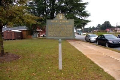
On North Railroad Street 0 miles east of Magnolia Street (Georgia Route 96), on the left when traveling east.
Major General Ezekiel Wimberly commanding the Twiggs Militia erected and garrisoned three forts along the Ocmulgee River for frontier protection. Born in Bertie County, North Carolina, September 1, 1783, son and grandson of Revolutionary soldiers, . . . — — Map (db m38736) HM
On Main Street north of 2nd Avenue, on the left when traveling north.
Born in Bertie County, North Carolina, Walton fought in the Revolution for that state. He settled in the Cumberland country in 1784. Walton served in the legislatures of North Carolina and Tennessee and as a Smith County magistrate. He built . . . — — Map (db m68351) HM
On South King Street (State Highway 308) at East Water Street (U.S. 17), on the right when traveling north on South King Street.
Acting on orders from General Robert E. Lee in the winter of 1863-64, Confederate forces under the command of Major General George E. Pickett were deployed throughout eastern North Carolina preparatory to as an attempt at clearing the enemy from the . . . — — Map (db m60628) HM
On West Water Street at Monroe Street, on the right when traveling west on West Water Street.
In its edition of August 27, 1851, the Plymouth Villager made a backhanded confirmation of the presence of abolitionists in Washington County, North Carolina. "A coat of tar and feathers is in waiting for the gentleman who will come about . . . — — Map (db m276306) HM
On South Queen Street south of East Water Street (U.S. 17) when traveling south. Reported missing.
To disrupt Confederate recruiting efforts here in Windsor, the Bertie County seat, three Federal transports steamed from Plymouth on the night of January 29, 1864, under U.S. Navy Lt. Cmdr. Charles W Flusser. USS Whitehead and USS . . . — — Map (db m60627) HM
On South Queen Street south of West Water Street when traveling south.
Windsor's residents slept peacefully the night of January 29-30, 1864, unaware of what the morning would bring, as U.S. Navy Lt. Cmdr. Charles W. Flusser led three gunboats their way to disrupt Confederate recruiting efforts. USS Massasoit . . . — — Map (db m226118) HM
On Cannon's Ferry Road 0.4 miles west of Dillard’s Mill Road, on the left when traveling north. Reported missing.
After Union Gen. Ambrose E. Burnside captured Roanoke Island in February 1862, U.S. Navy vessels patrolled the Chowan River from its mouth in North Carolina to Franklin, Virginia, located on the Blackwater River, a tributary. The Chowan River . . . — — Map (db m231989) HM
On River Road 0.2 miles north of East Main Street (Business U.S. 17), on the left when traveling west.
POW Camps Across the United States
There were POW camps across the United States, setup by the federal government. By May of 1945, the United States held 378,000 German prisoners of war, across 155 base camps and 511 branch camps. They were . . . — — Map (db m186841) HM
On South Water Street north of Shepard Street, on the left when traveling north.
As we mark the occasion of the 100th anniversary of the women's right to vote, we honor our foremothers — the brave women suffragists around the United States who protested and picketed for their constitutional right to vote. The ratification of . . . — — Map (db m276339) HM
On State Highway 11 near Blount Hall Road (State Highway 1103), on the right when traveling south.
Built before 1762 by Jacob Blount, member of Assembly, 1754-1762, 1764-1771, and of Provincial Congress, 1775 - 1776. Stood 90 Yds. N.W. — — Map (db m65465) HM