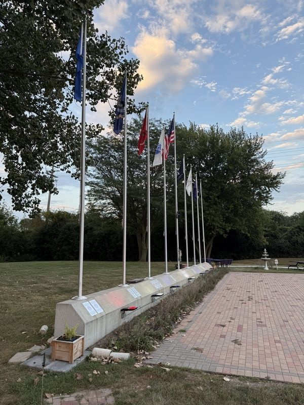
Near West Prairie Drive east of Peace Road, on the right when traveling east.
In 1912, an enterprising and forward-thinking group of farmers, businessmen, and bankers joined together to form the DeKalb County Soil Improvement Association. This grassroots coalition became the DeKalb County Farm Bureau, the first Farm Bureau . . . — — Map (db m230909) HM
On State Street (Illinois Route 64) near Main Street ( Route 23).
[Front panel:]
DeKalb County
To the memory of the men who fought to preserve the Union: "That the nation shall under God, have a new birth of freedom, and that government of the people, by the people and for the people shall not perish from . . . — — Map (db m257950) WM
On West Lincoln Highway (Illinois Route 38) east of Castle Drive, on the right when traveling west.
On May 22, 1895, Governor John Peter Altgeld signed an act establishing the Northern Illinois State Normal School. The first building, "The Castle on the Hill", was constructed here on what was once the site of the DeKalb County Fairgrounds. . . . — — Map (db m310416) HM
Near Brainard Street 0.2 miles south of Chicago Avenue, on the right when traveling west.
This land was home to the Potawatomi people before they were pushed out by waves of United States settler encroachment, federal policies of indigenous removal, and treaties negotiated under threat of military action. In this area, 1832, was a key . . . — — Map (db m257030) HM
On State Street (Illinois Route 64) near Main Street ( Route 23), on the right when traveling west.
Sycamore's historic district was approved and entered in the National Register of Historic Places in 1978. The classical revival style DeKalb County Courthouse serves as a keystone for the district's other 226 structures. Built in 1903, the . . . — — Map (db m257947) HM
Isaac Leonard Ellwood was born in Salt Springville, New York, on August 3, 1833. Already ambitious as a young man, he drove a mule team on the Erie Canal. In 1851 he made his way west to seek his fortune in the gold fields of California. He clerked . . . — — Map (db m310642) HM
On Fairview Drive east of Nelson Road, on the right when traveling east.
Many path-breaking agricultural innovations result from the creative minds of farmers. Such was the case in the development of the yield monitor, which measures grain yield and maps it to the specific part of a field as the grain is being . . . — — Map (db m312119) HM
On East Dixie Avenue (Kentucky Route 61) at South Crestwood Street, on the left when traveling north on East Dixie Avenue.
"The Parrott gun was placed in the pike; it was opened as soon as the last message from Colonel Smith was received; and, as suddenly as if its flash had ignited them, Palmer's four guns roared out from the hill on the left of the road, about six . . . — — Map (db m170819) HM
On Clifford Drive just west of Hickory Street, on the left when traveling west.
In the early 20th century William George Eckhardt (1879-1959) was a pioneer in DeKalb County's leading role in agricultural innovation. Eckhardt, an agronomy professor at the University of Illinois, was an expert in the blossoming field of soil . . . — — Map (db m310352) HM
On Nelson Road north of Lincoln Highway (Illinois Route 38), on the right when traveling north.
On this farm two entrepreneurs begin a small experiment in 1925, the results of which have helped transform agriculture and the economies of Illinois, this nation and the world. Driven by the desire to improve farmers' productivity, Charlie Gunn . . . — — Map (db m311831) HM
On Edward Street east of South Avenue, on the right when traveling west.
In the mid to late 1800s, northern Illinois witnessed substantial agricultural innovations. Along with such developments as John Deere's steel plow and the barbed wire of Glidden-Ellwood-Haish, the Marsh Harvester brought significant change to . . . — — Map (db m310389) HM
On Oak Street west of North 4th Street, on the right when traveling west.
Known for his inventive genius, eccentric personality, and generous philanthropy, Jacob Haish is perhaps most remembered as an inventor of barbed wire. Born in Germany, he immigrated to this country in 1832 and came to DeKalb County in the 1840s.
. . . — — Map (db m230903) HM
Near Chief Shabbona County Forest Preserve 0.5 miles south of Preserve Road.
It was 1775, one year before the American Revolution that an Indian boy was born near the banks of the Kankakee River. A boy who would grow up to befriend the new nation's people. His Ottawa parents named him “Shab-eh-nay” (Shabbona), which means . . . — — Map (db m78301) HM
The Pottawatomi call themselves Neshnabek, which translates literally as the "People".
The first mention of the Pottawatomi is located in The Jesuit Relations of 1640. Jean Nicolet, a French fur trader, encountered these people in 1634 along . . . — — Map (db m258067) HM
Near State Street (Illinois Route 64) west of Main Street ( Route 23), on the right.
To the men from DeKalb County who died in Vietnam during the Vietnam Conflict
Francis A. Anderson • Dale C. Brewer • Eatterson Byrd, Jr. • David Donnelly • Rodney G. Drake • Jimmy R. Harrison • Richard A. Henke • Richard L. Jossendal • George . . . — — Map (db m257965) WM