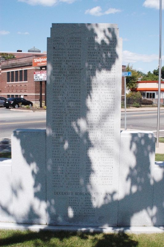
In honor of the men and women of Ward Six who served in World War II and dedicated to those who made the supreme sacrifice to God and country
Their memory perpetuated by the McDonaugh Square Associates 1941-1945
Reverse side of memorial, 2 rows . . . — — Map (db m97369) WM
In commemoration of the enterprise and resolute spirit with which Salem arose from her ashes looked calamity in the face and rebuilt her walls on this spot in the pathway of the great fire of June 25, 1914. Which swept from the west to the water’s . . . — — Map (db m230548) HM
There are three sides of inscription:
Time will not dim the glory of their deeds
Then a panel that says Erected by Laurier Associates and dedicated to the 2105 volunteers of St. Joseph Parish — — Map (db m97367) WM
Roll of honor 1917-1918
Then two rows of names
World War I
Donated by the city of Salem Rededicated by Mayor Anthony V. Salvo November 11, 1986 — — Map (db m97368) WM
When the Civil War broke out in 1861, an unprepared federal government was forced to rely on emergency recruits. The Salem Light Infantry was mustered into service no less than three times, while members of the elite Second Corps Cadets served as . . . — — Map (db m221818) HM
The Lay of the Land
Roxbury was founded in the summer of 1630. For over two centuries, it covered a tremendous area, about two miles wide by eight miles long, although early settlement was concentrated in the eastern end of the town, . . . — — Map (db m214985) HM
A Cooperative Project Between the City of Salem, the Town of Marblehead, and the Commonwealth of Massachusetts PARC Grant Program
Conserved 2013
This 4.23-acre public green space lies on the Salem-Marblehead boundary at the mouth of the . . . — — Map (db m221283) HM
In 1629, along with the royal charter, the fledgling settlement at Salem in Massachusetts
Bay received a shipment of green and red uniforms, drums, and weapons for the purpose of forming
a defensive militia. In 1636 the General Court organized . . . — — Map (db m220824) HM
In 1924, San Diego socialites and patrons of the arts, Miss Alice Lee and her partner, Miss Katherine Teats, commissioned renowned architect Louis Gill to build this historic home. Gill's design for a distinctive “Canyon House” features interior . . . — — Map (db m312270) HM
Dr. Samuel Huston (also spelled Houston) came to Towanda with David F. Barstow and John C. Adams in 1827 from Essex County, Massachusetts. Dr. Huston married Emeline Mix, oldest daughter of Col. Hiram Mix of a prominent Towanda family. Huston . . . — — Map (db m153951) HM
Just to the East stood Mann Meeting House, the first Methodist Episcopal Church in this region. It was built before 1794 and abandoned about 1880. The site is now occupied by the Macedonia Colored Baptist Church. — — Map (db m3080) HM
Daniel Davis was born on December 18, 1808, in Amesbury, Essex County, Massachusetts, the third child of Wells Davis and Mary Kelly Davis. As a young man Davis traveled to Nauvoo, Illinois, where he was converted to The Church of Jesus Christ of . . . — — Map (db m127586) HM
In the wake of the Boston Tea Party, the British Crown enacted punitive measures against the colonies. These action created considerable unrest, particularly in Massachusetts. In Essex County, colonial militias began to drill, stockpile stores of . . . — — Map (db m220826) HM
1629. The First Militia Company in Massachusetts Bay is organized in Salem.
1636. With the need for greater military organization, the East Regiment, later the Essex Regiment, is organized on December 13, 1636. This date marks the . . . — — Map (db m249322) HM
Washington Railroad Depot Burns
Confederate General Marmaduke's forces were advancing on Washington as October 1864 approached, with fear and widespread panic among the town's residents. Many citizens crossed the river to evade the advance of . . . — — Map (db m239173) HM
Lineage of Leatha Howard Holland Webster and the Canadian Connection
The Howard-Holland traces its roots to the Montgomery County plantations of the Gaithers, Howse and Griffith families. From census records and manumission . . . — — Map (db m188339) HM
One-eighth of a mile distant.
On a part of the 300 acres
granted to Governor John
Endecott, is the pear tree
planted by the Governor in
1632. This tree still bears
fruit. — — Map (db m46192) HM
In 1763 Ralph Wormeley III of Rosegill sold this house to James Mills, a Scottish merchant. In 1791 Arthur Lee bought it and 1,000 adjacent acres to be his home in retirement. Lee named this estate Landsdowne in honor of his friend, William . . . — — Map (db m316385) HM
Thin black lines indicate changes in relevance. Between each pair of lines entries are ordered geographically but all have the same relevance.
* Inflectional forms of words are their plurals, singulars, and possessives as well as gramatical tenses and similar variations.