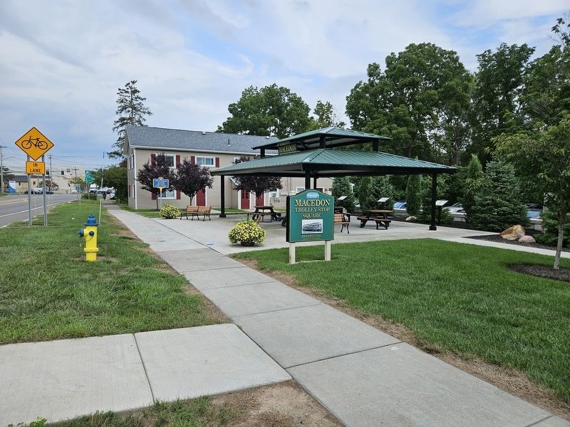
On Bay Street (New York State Route 14 Connector Road) west of Lummis Street, on the right when traveling west.
Site of only building left standing after the burning of Sodus Point by the British. In the Old Tavern, Asher Warner, an American patriot, mortally wounded by the British, died June 20, 1818. — — Map (db m270572) HM WM
On William Street just south of Canal Street, on the right when traveling south.
Dr. Randy Mitchell, an intense local history supporter, was impressed by the work that artists Corky Goss and Chip Miller were completing across the street, so he commissioned them to transform the alley-way wall of his dental office. As expected . . . — — Map (db m296481) HM
Author and editor Washington Irving was born in New York City on April 3, 1783. Irving achieved international fame for his fictional works, including the stories Rip Van Winkle and The Legend of Sleepy Hollow, as well as for his . . . — — Map (db m127213) HM
On Leach Road 0.1 miles south of Water Street, on the left when traveling north.
Enlarged Erie Canal Lock 55, Lyons, New York
H.G. Hotchkiss Peppermint Company
Rochester, Syracuse & Eastern Rail Road
Fifteen Miles on the Erie Canal, Wayne County, New York
Enlarged Erie Canal (1840-1905) Lock E-55, located just east . . . — — Map (db m117683) HM
On Grand Street at Broad Street, on the left when traveling west on Grand Street.
Forest Lawn Cemetery was part of a parcel owned by Samuel Dexter, who came to Michigan in 1824 from New York State. He purchased 926 acres of land that was incorporated as the village of Dexter. For years, Dexter offered cemetery plots free to . . . — — Map (db m171679) HM
On Geneva Street (New York State Route 14) at Montezuma Street, on the left when traveling north on Geneva Street.
It is 1880 and you are riding on a packet boat through Lyons, New York; as you pass and through Lock 55 the air is thick with the smell of peppermint oil having just been loaded for shipment by the Hotchkiss Building. Your packet boat just turned . . . — — Map (db m246034) HM
On Butternut Street at Church Street, on the left when traveling north on Butternut Street.
From 1856 to 1960, 21 Butternut S. was home to the Wayne County Jail and Sheriff's office and residence. While in use, this jail housed many notable criminals, including infamous train robber Oliver Curtis Perry, bank robber “Big Ed” Kelly, and . . . — — Map (db m296415) HM
On Water Street at Leach Road, on the left when traveling west on Water Street.
The H. G. Hotchkiss
Essential Oil
Company
Established 1839
Has Been Placed On The
National
Register Of
Historic Places
By The United States
Department Of The Interior
June 1988 — — Map (db m270940) HM
On Main Street (New York State Route 414), on the right when traveling south.
Soldiers Memorial Town Hall Built 1886 for meetings and gatherings. John E. Sherman Post 401 G.A.R. also met here. Became Rose Free Library 1962. — — Map (db m255628) HM
On Ontario Center Road 0.2 miles south of Brick Church Road, on the left when traveling north.
The Baptist congregation met for the first time on July 3, 1834, and employed George B. Davis as their first pastor. Their first meeting house, on the south-west corner of Ontario Center, was not built until 1834. The congregation later built a . . . — — Map (db m172678) HM
On Hancock Avenue, on the left when traveling north.
(Front):111th New York Infantry. 3rd Brigade, 3rd Division 2nd Corps. (Back):111th New York Infantry Arrived early morning July 2nd 1863, position near Ziegler's Grove. Went to relief of 3rd Corps in afternooon; took this position . . . — — Map (db m14566) HM WM
On Michigan Avenue 0.1 miles east of Capital Avenue Southwest, on the right when traveling north.
Erastus Hussey Stationmaster
Erastus Hussey came to Michigan from New York State in 1824 and purchased land in Wayne County. Hussey returned to New York for a time, but in 1839 he and his wife, Sarah, purchased a building located about 125 . . . — — Map (db m177310) HM
On North McClure Road 1 mile south of Ohio Route 81, on the left when traveling south.
On March 18, 1942, four U.S. Army Air Corps pilots lost their lives within a quarter mile of this marker. Three months after Japan bombed Pearl Harbor, these pilots left Wayne County Airport near Detroit flying P-39F Airacobra pursuit planes. . . . — — Map (db m156914) HM
On Wheatfield Road at Birney Lane, on the right when traveling east on Wheatfield Road.
(Front): Mustered in August and September 1862 Mustered out May 28, 1865 Recruited in Bradford, Susquehanna, and Wayne CountiesPresent at Gettysburg 9 offices and 200 men Killed and died of wounds 1 officer 41 men, total 42 Wounded 5 officers . . . — — Map (db m12977) HM WM
On Hancock Highway (Pennsylvania Route 191), on the left when traveling north.
Excerpts from the address delivered by General Lyman L. Lemnitzer, Army Chief of Staff, at the dedication of the Dyberry Dam on Wednesday, Aug. 19, 1959:
Today, as always, it is a very genuine pleasure to be in Wayne County and see my . . . — — Map (db m222422) HM
Near Bova Road 0.1 miles west of U.S. 209, on the right when traveling west.
After its heyday in the late 1850's to 1870's, the canal gradually lost business to the faster, more efficient railroads, which could ship coal in the dead of winter and the dark of night. This loss of business resulted in layoffs of boats, fewer . . . — — Map (db m142843) HM
On East Main Street (New York State Route 31) at Fayette Street, on the left when traveling east on East Main Street. Reported missing.
1822 The Erie Canal was completed to Palmyra
1827 The Village of Palmyra was incorporated
1830 The Book of Mormon was printed in the Grandin Building.
1849 Palmyra held the first fair in New York State. It later became the . . . — — Map (db m284363) HM
On 9th Street at Court Street, on the left when traveling east on 9th Street.
On a clear day, September 11, 2001 America suffered surprise attacks by foreign terrorists upon her homeland. At the World Trade Center in New York, the Pentagon outside Washington, and finally in a field near a village named Shanksville in . . . — — Map (db m101307) HM WM
On 8th Street at Oak Street (U.S. 60), on the right when traveling south on 8th Street.
Ceredo Early History
Founded in 1857 by Massachusetts congressman Eli Thayer, Ceredo was the Nation's only attempt to form an abolitionist community in the old South. As a pre-War industrial town Ceredo was beginning to thrive, but with . . . — — Map (db m291707) HM
On William Street just south of Canal Street, on the left when traveling south.
The former plain facade of Dobbins Drug Store and The Olde Pharmacy Gift Shop is now Generations. Impressed by Corky and Chips' unique artistic techniques and abilities, pharmacist Sean Dobbins commissioned them to create a permanent tribute to his . . . — — Map (db m296450) HM
On Wayneport Road at North Canal Road, on the right when traveling north on Wayneport Road.
Macedon's
Wayneport Historic Area
At one time known as West Macedon, Wayneport was the
first port in Wayne County east of Rochester on the original
Clinton's Ditch. The first post office in Macedon was located here.
On the south side of . . . — — Map (db m117596) HM
On Ridge Road-Main Street (County Route 103) at Lake Avenue ( Route 21), on the left when traveling west on Ridge Road-Main Street.
Mural scene descriptions:
- As a representation of Williamson’s Dutch heritage the Windmill Vacation Cabins in East Williamson had a replica of a working windmill as its center of attraction. Circa 1960’s
- Early 1900’s Main Street . . . — — Map (db m274741) HM
Moosic Mountain, rising over 1,200 feet above Carbondale's anthracite coal mines, was a formidable barrier to the markets of New York City. The Delaware and Hudson Canal system could be used to move coal from Honesdale to Kingston, New York, but a . . . — — Map (db m104135) HM
On Park Street at Dyberry Place, on the right when traveling east on Park Street.
The Lackawaxen River is a 31.3-mile-long tributary of the Delaware River in northeastern Pennsylvania.
Lackawaxen is a Native American name. In Lenape it means "swift waters." The Lenape inhabited eastern PA, New Jersey, Delaware, and . . . — — Map (db m153010) HM
On Main Street (U.S. 6) south of Park Street, on the left when traveling south.
The Lackawaxen River is a 31.3-mile-long tributary of the Delaware River in northeastern Pennsylvania.
Lackawaxen is a Native American name. In Lenape it means "swift waters." The Lenape inhabited eastern Pennsylvania, New Jersey, Delaware, . . . — — Map (db m163628) HM
On Huron River Drive 0.1 miles east of Sterling Street, on the right when traveling east. Reported unreadable.
Early settlers to Huron Township came from eastern states, including Massachusetts, New York and Pennsylvania. Immigration peaked in the 1830s, spurred by the sale of government land.
Among early settlers to Huron Township were William Sr. . . . — — Map (db m171691) HM
On Water Street at Leach Road, on the left when traveling east on Water Street.
H.G. Hotchkiss Peppermint Mural
Artist: Dawn Jordan July 2009 Mural #7
In this mural Dawn Jordan depicts the "essence” of the business operations which
at one time produced the world famous Hotchkiss Peppermint Oil. Included . . . — — Map (db m117671) HM
On Texas Palmyra Highway (U.S. 6), on the right when traveling south.
Locks raise and lower canal boats where the elevation of the land changes. The 972 feet elevation difference between Honesdale, PA on the left side of the blue diagram below, and Kingston, NY on the right side, is drawn using 108 steps. Each . . . — — Map (db m122270) HM
On State Street (U.S. 89) at the road to Mount Carmel Cemetery, on the left when traveling north on State Street.
In memory of Isaac Behunin,
Mormon Pioneer, Early Utah Settler and
Credited with the naming of Zion Canyon
Early Mormon Pioneer
Isaac Behunin was born October 20, 1803 in Richland, New York to Albert and Nancy Lord Bohanan (Bohannon). . . . — — Map (db m40465) HM
Or Better Known In Ireland As:
The Great Potato Famine
1845-1850
Ancient Order of Hibernians
We remember the old ones
and the younger for we are the
harvest of the Hunger. They
sleep forever in the land of
their birth and our . . . — — Map (db m165616) HM
Near Ontario Center Road 0.2 miles south of Brick Church Road.
[left panel]: Map of Phelps & Gorham’s Purchase 1790. In 1776, at the start of the Revolutionary War, the Iroquois Indians held claim to this territory. In 1788, Oliver Phelps of Connecticut, and Nathanial Gorham of Massachusetts purchased 2,600,00 . . . — — Map (db m172822) HM
On North Carolina Highway 58 (State Highway 58) at Fort Run Road (State Highway 1058), on the right when traveling south on North Carolina Highway 58.
Tuscarora stronghold. Site of decisive battle of the Tuscarora War, March 20-23, 1713, when 950 Indians were killed or captured. Site 1 mi. N. — — Map (db m222352) HM
On Highland Boulevard (State Highway 118) at Queen Street, on the right when traveling north on Highland Boulevard.
Fortified Indian town & site of the Tuscarora conspiracy of Sept., 1711. Capitulated, 1712, after a 10-day siege by Col. John Barnwell. Site is 4 mi. N. — — Map (db m65288) HM
Thin black lines indicate changes in relevance. Between each pair of lines entries are ordered geographically but all have the same relevance.
* Inflectional forms of words are their plurals, singulars, and possessives as well as gramatical tenses and similar variations.