By Dale K. Benington, July 23, 2013
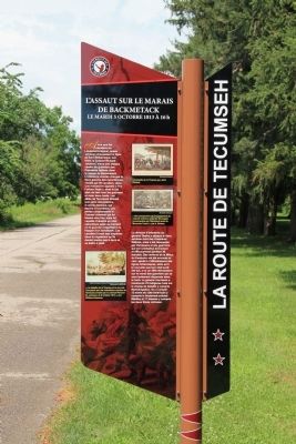
Assault on Backmetack Marsh Marker
| Near Longwoods Road (Provincial Highway 2) 4.2 kilometers east of Victoria Road (Provincial Highway 21), on the right when traveling east. |
| On Longwoods Road (County Route 2), on the right when traveling east. |
| On Longwoods Road (Provincial Highway 2) east of Victoria Road (Provincial Highway 21), on the right when traveling east. |
| On Longwoods Road south of County Highway 18, on the right when traveling east. |
| Near Longwoods Road (Provincial Highway 2) 4.2 kilometers east of Victoria Road (Provincial Highway 21), on the right when traveling east. |
| Near Longwoods Road (Provincial Highway 2) 4.2 kilometers east of Victoria Road (Provincial Highway 21), on the right when traveling east. |
| Near Longwoods Road (Provincial Highway 2) 4.2 kilometers east of Victoria Road (Provincial Highway 21), on the right when traveling east. |
| Near Longwoods Road (Provincial Highway 2) 4.2 kilometers east of Victoria Road (Provincial Highway 21), on the right when traveling east. |
| Near Longwoods Road (Provincial Highway 2) 4.2 kilometers east of Victoria Road (Provincial Highway 21), on the right when traveling east. |
| Near Longwoods Road (Provincial Highway 2) 4.2 kilometers east of Victoria Road (Provincial Highway 21), on the right when traveling east. |
| Near Longwoods Road (Provincial Highway 2) 4.2 kilometers east of Victoria Road (Provincial Highway 21), on the right when traveling east. |
| On Longwoods Road (Provincial Highway 2) 4.2 kilometers east of Victoria Road (Provincial Highway 21), on the right when traveling east. |
| Near Longwoods Road (Provincial Highway 2) 4.2 kilometers east of Victoria Road (Provincial Highway 21), on the right when traveling east. |
| On Longwoods Road (Provincial Highway 2) east of Victoria Road (Provincial Highway 21), on the right when traveling east. |
| Near Longwoods Road (Provincial Highway 2) 4.2 kilometers east of Victoria Road (Provincial Highway 21), on the right when traveling east. |
| Near Longwoods Road, 4.2 kilometers east of Victoria Road, on the right when traveling east. |