11 entries match your criteria.
Related Historical Markers
Fort Yargo State Park
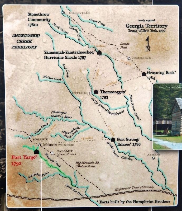
Marker detail: Georgia Territory
Treaty of New York, 1790
SHOWN IN SOURCE-SPECIFIED ORDER
| On Fort Yargo Road, 0.2 miles east of South Broad Street (State Highway 81), on the left when traveling south. |
| Near Fort Yargo Road east of South Broad Street (Georgia Highway 81), on the left when traveling south. |
| Near Fort Yargo Road east of South Broad Street (Georgia Highway 81), on the left when traveling south. |
| Near Fort Yargo Road east of South Broad Street (Georgia Highway 81), on the left when traveling south. |
| Near Fort Yargo Road east of South Broad Street (Georgia Highway 81), on the left when traveling south. |
| Near Fort Yargo Road east of South Broad Street (Georgia Highway 81), on the left when traveling south. |
| Near Fort Yargo Road east of South Broad Street (Georgia Highway 81), on the left when traveling south. |
| Near Fort Yargo Road east of South Broad Street (Georgia Highway 81), on the left when traveling south. |
| On Fort Yargo Road, 1 mile south of Loganville Highway (Georgia Highway 81), on the right when traveling south. |
| On Broad Street, 0.4 miles south of South Broad Street (Georgia Route 81), on the left when traveling south. |
| On Fort Yargo Road, 1 mile south of Loganville Highway (Georgia Highway 81), on the right when traveling south. |
May. 22, 2024