On Fisher Avenue / White's Ferry Road (Maryland Route 107) at W Willard Road, on the left when traveling east on Fisher Avenue / White's Ferry Road.
Famed commander, Lt. Col. E.V. (“Lige”) White, of the 35th BN Va. Cavalry C.S.A., and many members of his command were natives of this area. This town became the headquarters of Union Brig. Gen. Charles P. Stone’s 12,000-man corps of . . . — — Map (db m2112) HM
On Fisher Avenue / Whites Ferry Road (Maryland Route 107) at Elgin Road / Beallsville Road (Route 109), on the right on Fisher Avenue / Whites Ferry Road.
Located at the intersection of the two main roads, mid-19th century Poolesville was Montgomery County’s second-largest town. Its residents had decidedly secessionist tendencies and many sons fighting for the South. In the fall of 1862, as the . . . — — Map (db m1729) HM
On Beallsville Road (Maryland Route 109) at Darnestown Road (Maryland Route 28), on the right when traveling south on Beallsville Road.
On September 9, 1862, the running engagement between Illinois, Indiana, and Virginia cavalry units that began the day before in Poolesville continued in Beallsville when two Federal regiments forced the single regiment of Virginia cavalrymen posted . . . — — Map (db m1681) HM
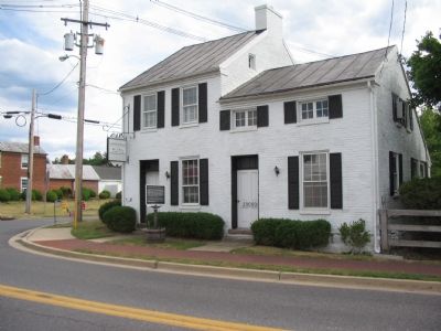
On Barnesville Road just west of West Harris Road, on the left when traveling west.
On the evening of September 5, 1862, Gen. Wade Hampton’s and Gen. Fitzhugh Lee’s Confederate cavalry brigades bivouacked around Barnesville. They rode the next day to their base camp at Urbana, leaving the 9th Virginia Cavalry to guard . . . — — Map (db m156129) HM
Near Old Hundred Road (Maryland Route 109) at Comus Road (Maryland Route 95), on the left when traveling north. Reported missing.
You are looking at Sugarloaf Mountain, where the running cavalry fight that began in the late afternoon on September 9, 1862, in Barnesville came to a halt. By the next morning, the 7th and 9th Virginia Cavalry had been brought to bay here at the . . . — — Map (db m1683) HM
On Comus Road (Maryland Route 95) at Sugarloaf Mountain Road, on the right when traveling west on Comus Road.
You are at the foot of Sugarloaf Mountain, where on September 5-6, 1862, Union observers watched the Army of Northern Virginia cross the Potomac River to invade Maryland. A signal station had been established here in the summer of 1861, one in a . . . — — Map (db m245994) HM
On Frederick Road (Maryland Route 355) at Hyattstown Mill Road, on the right when traveling north on Frederick Road. Reported missing.
The roadside village of Hyattstown became the front line when Confederate cavalry stationed to the north in Urbana clashed with Union cavalry reconnoitering from Clarksburg to the south. On the evening of September 8, 1862, Maj. Alonzo W. Adams and . . . — — Map (db m1727) HM
Near Urbana Pike (Maryland Route 355) at Fingerboard Road (Maryland Route 80), on the right when traveling west. Reported permanently removed.
Constructed in 1754 on the banks of the Rappahannock River in Virginia, this building was reconstructed here in 1846 and became Landon Female Academy. Early in September 1862, while infantry of Gen. Robert E. Lee’s Army of Northern Virginia rested . . . — — Map (db m1739) HM
On Michael's Mill Road (Maryland Route 880) at Fingerboard Road (Maryland Route 80), on the right on Michael's Mill Road.
On the south end of this park, the road from Urbana to Buckeystown crossed the Monocacy River over a stone bridge. Some of the Confederate troops camped here on September 6, 1862, while some crossed the bridge to bivouac on a knoll overlooking the . . . — — Map (db m1737) HM
On West Patrick Street (State Highway 144), on the left when traveling west.
Fresh from victory at the Second Battle of Manassas, Gen. Robert E. Lee’s Army of Northern Virginia crossed the Potomac River on September 4–6, 1862, to bring the Civil War to Northern soil and to recruit sympathetic Marylanders. Union Gen. George . . . — — Map (db m236181) HM
On East Patrick Street (State Highway 144), on the left when traveling west.
Fresh from victory at the Second Battle of Manassas, Gen. Robert E. Lee’s Army of Northern Virginia crossed the Potomac River on September 4–6, 1862, to bring the Civil War to Northern soil and to recruit sympathetic Marylanders. Union Gen. . . . — — Map (db m97907) HM
Near Clarke Place, on the right when traveling west.
1777 Built at direction of Maryland General Assembly
1778-79 Quartered Hessian and Convention prisoners captured at Bennington and Saratoga
1782 Quartered Hessian and Bayreuth Yager Regiments following Cornwallis' surrender
1799 . . . — — Map (db m2739) HM
On Counsil Street, on the right when traveling east.
Connections with the Civil War abound around this Courthouse Square, where the first official act of defiance against the British crown - the 1765 Stamp Act Repudiation - occurred almost a century earlier. In 1857, Roger Brooke Taney, Chief Justice . . . — — Map (db m2815) HM
On West Patrick Street (State Highway 144), on the left when traveling west.
As the Confederate army marched through Frederick on September 10, 1862, feisty local Unionists—mostly women—showed their defiance by waving the Stars and Stripes. The poet John Greenleaf Whittier immortalized one of them in “The Ballad of Barbara . . . — — Map (db m2693) HM
On East Patrick Street (State Highway 144), on the left when traveling west.
In this building, soldiers who died in one of the many area hospitals following the battles of South Mountain, Antietam, Gettysburg, and Monocacy were embalmed and prepared for interment at nearby Mount Olivet Cemetery or for shipment home. James . . . — — Map (db m97908) HM