21 entries match your criteria.
Related Historical Markers
Battle of Prairie Grove by Markers
By Craig Swain, August 30, 2010
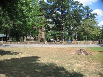
Markers and Monuments in front of Visitor Center
SHOWN IN SOURCE-SPECIFIED ORDER
| On East Douglas Street (U.S. 62), on the right when traveling west on East Douglas Street. |
| On East Douglas Street (U.S. 62), on the right when traveling west. |
| On East Douglas Street (U.S. 62), on the right when traveling west. |
| On East Douglas Street (U.S. 62), on the right when traveling west. |
| On East Douglas Street (U.S. 62), on the right when traveling west. |
| On East Douglas Street (U.S. 62), on the right when traveling west. |
| On East Douglas Street (U.S. 62), on the right when traveling west. |
| On South Battlefield Park Road (County Route 80) at East Douglas Street (U.S. 62), on the right when traveling north on South Battlefield Park Road. |
| On South Battlefield Park Road (County Route 80) at East Douglas Street (U.S. 62), on the right when traveling north on South Battlefield Park Road. |
| On East Douglas Street (U.S. 62), on the right when traveling west. |
| Near East Douglas Street (U.S. 62), on the right when traveling west. |
| Near East Douglas Street (U.S. 62), on the right when traveling west. |
| Near Park Tour Road, on the right when traveling east. |
| Near Park Tour Road, on the right when traveling east. |
| Near Park Tour Road, on the right when traveling east. |
| Near Park Tour Road, on the right when traveling east. |
| Near Park Tour Road, on the right when traveling east. |
| Near Park Tour Road, on the right when traveling east. |
| Near Park Tour Road, on the right when traveling east. |
| On North Mock Street (County Road 652) at Collins Drive, on the right when traveling north on North Mock Street. |
| On West Buchanan Street (U.S. 62) at Katie Smith Street, on the right when traveling west on West Buchanan Street. |
May. 18, 2024