Fresh Water Springs in this pleasant high ground once drew European settlers. Farmers called the area "Crystal Spring." In 1859 the half-mile Crystal Spring Racetrack opened on land to your left. For 75 cents, Washingtonians hopped a . . . — — Map (db m109288) HM
The City Park across the street was once Emery Place, the summer estate of Matthew Gault Emery.
A prominent builder, Emery was Washington City's last elected mayor during the period of home rule. He was succeeded in 1874 by a . . . — — Map (db m72816) HM
English, Irish and German settlers, as well as enslaved and free African Americans, were the first non-natives to claim Brightwood. Farmers dominated until the Civil War. Then in the 1890s electric streetcars allowed government workers to live . . . — — Map (db m121018) HM
The Grand, Neo-classical Revival style building that you see across Georgia Avenue north of Missouri opened in 1925 as the Bank of Brightwood, thanks to efforts of the Brightwood Citizens Association. Designed by Treasury Department architect . . . — — Map (db m72818) HM
In 1818 the Private Rockville and Washington Turnpike Co. began building a road to link Washington City to Rockville, Maryland. This road helped create a village. A toll gate on what today is Georgia Avenue between Quackenbos and Rittenhouse . . . — — Map (db m72819) HM
The School Building Just Ahead of You Opened In 1912 as the Military Road School, the area's third public elementary for African Americans. For decades it was the only public school serving black children in Upper Northwest and nearby . . . — — Map (db m110235) HM
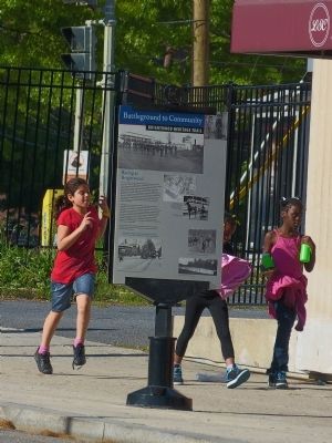
Even before emancipation freed Washington's enslaved people in April 1862, a free African American community had developed here amid the European American farmers. The District of Columbia, unlike its neighbors, permitted the formerly enslaved . . . — — Map (db m143796) HM
Apple and Peach Trees once covered the slopes to your left, some 40 acres' worth, all planted by noted horticulturalist John Saul (1819-1897). In the 1870s Saul was one of Brightwood's largest landowners. In addition to these orchards, he . . . — — Map (db m143797) HM
We have Harry Wardman to thank for the rich variety of Sheridan Street rowhouses. Wardman, considered Washington's most prolific developer, built hundreds of offices, apartments, hotels, and comfortable rowhouses from 1899 to 1939. When he . . . — — Map (db m72823) HM
In the 1930s as now, this area was a family friendly, "move-up" destination for hard-working government clerks and professionals. Like many DC neighborhoods, Brightwood had covenants prohibiting sales to certain white ethnics and African . . . — — Map (db m72777) HM
On July 11 and 12, 1864, this intersection was the center of the only Civil War battle fought in the District of Columbia. Here, Union sharpshooters at Fort Stevens, supported by forces across the
northernmost of Washington's ring of . . . — — Map (db m123226) HM
This busy section once was a "Country Road" to Washingtonians looking for peace and recreation. If you drove by here a century ago, you would have passed woods and large estates, and might even have seen fox hunters. Across Georgia was the . . . — — Map (db m72813) HM
After the rebels were turned back as the Battle of Fort Stevens ended in 1864, scores of Union Soldiers lay cold and silent. Forty-one of them are buried here in this tiny plot dedicated to their sacrifice.
President Abraham Lincoln, who . . . — — Map (db m165669) HM
Back in the 1920s, most people walked or rode a streetcar to go shopping. Then cars became affordable, and people drove everywhere. Soon the shopping center, with free parking, was born. In 1937 Brightwood's "Park and Shop" opened on Georgia . . . — — Map (db m72826) HM
Across Quackenbos Street Emory United Methodist Church. Named to honor Bishop John Emory of Maryland (1789-1835), the congregation dates from 1832.
From the beginning, Emory welcomed all races but, like most Washington churches then, . . . — — Map (db m118907) HM
Hearing those words, President Abraham Lincoln ducked down from the Fort Stevens parapet during the Civil War battle that stopped the Confederates from taking Washington. On July 9, 1864, some 15,000 Rebels led by General Jubal A. Early . . . — — Map (db m72829) HM
Elizabeth Proctor Thomas (1821-1917), a free Black woman whose image appears on each Brightwood Heritage Trail sign, once owned 11 acres in this area. Known, respectfully in her old age as "Aunt Betty," Thomas and her husband James farmed and . . . — — Map (db m72830) HM
The Large Structure across Georgia Avenue opened in 1909 as a "car barn" for the Brightwood Railway. The facility could service more than 40 streetcars at once, and often did so late at night. As a young boy in the 1950s, Thomas Reardon . . . — — Map (db m72831) HM