127 entries match your criteria. Entries 101 through 127 are listed.⊲ Previous 100
Natchez Trace Historical Markers
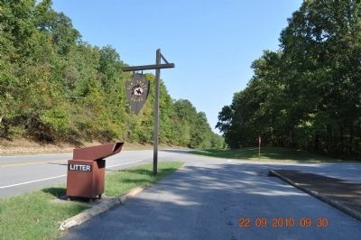
The Natchez Trace was a historical path that extended nearly 500 miles from Natchez, Mississippi to Nashville, Tennessee and was used as a main route of travel from pre-colonial times to the early 1800s. This series includes markers about the Natchez Trace and markers located along the Natchez Trace Parkway.
over which pioneers traveled through Lawrence County, Tennessee, which was organized Oct. 21, 1817.
The county seat, Lawrenceburg, was created on Nov. 23, 1819, and named in honor of Capt. James Lawrence, naval hero of the War of 1812. . . . — — Map (db m36078) HM
Before 1805 the Chickasaw Indians owned all the land in this vicinity. Only the Natchez Trace – part of which remains here – had made inroads into tribal territory.
When the Indians ceded land to the United States in the early . . . — — Map (db m84626) HM
From here north for approximately 40 miles the parkway passes through or near a geologic region of limestone rich in phosphate deposits.
Abandoned mine shafts in limestone ledges on both sides of the parkway in this immediate area are silent . . . — — Map (db m84647) HM
Beneath this monument erected under Legislative Act by the State of Tennessee, A.D., 1848, reposes the dust of Meriwether Lewis, a Captain in the United States Army, Private Secretary to President Jefferson, Senior Commander of the Lewis and Clark . . . — — Map (db m36068) HM
In 1809, renowned explorer Meriwether Lewis traveled up the Old Natchez Trace on his way to Washington, D.C. He stopped here at an inn called Grinder’s Stand, and died during the night.
What is a Compass Rose?
A compass rose is a symbol . . . — — Map (db m84631) HM
“I was roused from this melancholy reverie by the roaring of Buffalo River, which I forded with great difficulty.”
Alexander Wilson, 1811
Here travelers on the Natchez Trace crossed the river which was fordable except after . . . — — Map (db m84658) HM
This plainly visible, though long deserted road is a section of The Natchez Trace, evolved from Buffalo and Indian Trails, into The First National Highway of the South-West, cut and opened under authority of the United States Government, after . . . — — Map (db m42767) HM
Here, about 1820, stood a charcoal-burning furnace used to manufacture pig iron. All that remain of this pioneer enterprise are a slag pile and the evidence of a mill race, used to bring water from Buffalo River to operate the furnace’s air blasting . . . — — Map (db m84657) HM
The Natchez Trace, a very old trail, was traveled by many early Americans. Captain Meriwether Lewis, leader of the Lewis and Clark Expedition and governor of the Upper Louisiana Territory, died near this point in 1809 while traveling the Natchez . . . — — Map (db m84633) HM
Tobacco Farm- You see here a typical early 1900's tobacco farm. A 10-minute loop walk takes you through the field and to the barn where you see tobacco hanging to dry.
Old Trace- From here you may drive north on a narrow 2 -mile section of the . . . — — Map (db m60218) HM
The 500 mile long Natchez Trace of the early 1800's, then known as the Natchez Road, connected Nashville on the Cumberland River with Natchez on the Mississippi River. This historic wilderness road crossed the Duck River 1/4 mile south of here. John . . . — — Map (db m84260) HM
Travel on the Natchez Trace was an adventure in the early 1800's. The 500-mile trail traversed a sprawling wilderness where only Indians, outlaws, and wild animals were at home. Travelers needed a place to find food, supplies, and rest.
At . . . — — Map (db m84620) HM
On this model farm, Burley tobacco is grown and air-cured. It’s a hard crop to raise, each acre requiring about 250 hours of labor. (Wheat is only three hours!)
William Coleman has been growing tobacco here for over 40 years. Listen as he . . . — — Map (db m84579) HM
One of the few remaining buildings associated with the Old Natchez Trace is the house of ferry operator John Gordon.
In the early 1800s Gordon made an agreement with the Chickasaw Chief George Colbert to operate a trading post and ferry on the . . . — — Map (db m60217) HM
One of the few remaining buildings associated with the Old Natchez Trace is the house of ferry operator John Gordon. Built in 1817-18, the Gordon House was one of the first brick homes in this area.
In the early 1800's, Gordon settled here as . . . — — Map (db m84261) HM
This monument, located on the Natchez Trace at the site of the Tobacco Farm, honors the farming industry of Maury County, Tennessee. Maury County was named in honor of Abram Maury and was the home of the 11th United States President, James K. Polk. . . . — — Map (db m84584) HM
Burley tobacco must be air-cured for four to six weeks in the barn before it’s ready for market. Listen.
Burely is a light brown, aromatic tobacco used chiefly in cigarettes. A small percentage is used for pipe and chewing tobacco.
. . . — — Map (db m84583) HM
In frontier language, a stand was an inn or a trading post—sometimes both—usually located on a well traveled route. Such a place was established on the Old Natchez Trace, near here, in 1849 by John McGlamery. Although the stand did not . . . — — Map (db m84673) HM
In this locality was a tavern and blacksmith shop which served travelers on the Natchez Trace from early 19th century days. Its early proprietor who came here in 1818, is buried in the cemetery to the northeast along with members of his family. — — Map (db m83159) HM
This early interstate road building venture produced a snake-infested, mosquito-beset, robber-haunted, Indian-traveled forest path. Lamented by the pious, cussed by the impious, it tried everyone’s strength and patience.
When the trail became . . . — — Map (db m84674) HM
In 1663, King Charles II of England granted the
colony of Carolina all the land between 31 and 36 degrees
north latitude from the Atlantic Ocean "west
in a direct line as far as the South Seas."
The separation of North and South Carolina . . . — — Map (db m69634) HM WM
A mile to the south, the Old Natchez Trace crossed a depression in the flat, dogwood-covered ridge. After heavy rains it became almost impassable for wagons. Its name “Dogwood Mudhole” recalls the ordeals of frontier travel. It shows too . . . — — Map (db m84670) HM
Crossing the highway here, this famous road followed ancient Indian trails used by the travelers between Natchez and Nashville. It was built in 1801 by Army Engineers. Officially "The Columbian Road", it was for many years the only highway linking . . . — — Map (db m80314) HM
This small branch receives its name from the clean and fresh, or “sweet”, flavor of its water. Thousands of years of erosion and flooding have gradually built up the fertile bottom lands that you see under cultivation near here. . . . — — Map (db m84672) HM
The high ground you are on is part of a long ridge that divides central Tennessee. Streams south of the divide flow to the Duck and Tennessee Rivers, while streams to the north empty into the Cumberland River.
Travelers in the early days of the . . . — — Map (db m136447) HM
This Monument memorializes War of 1812 soldiers buried along the Old Natchez Trace, and it honors the service of all brave volunteers who marched on the Natchez Trace during the War of 1812 to help establish American Independence.
The Natchez . . . — — Map (db m83188) HM
127 entries matched your criteria. Entries 101 through 127 are listed above. ⊲ Previous 100