While there were actually many trails utilized by Comanches in Texas, “The Comanche Trail” typically refers to that system of trails used by Comanches travelling south through Texas on raids into Mexico. This trail is sometimes called the “Comanche War Trail” or “Comanche Trace”. Pekka Hämäläinen in his book The Comanche Empire says raids on the trail grew into a “veritable industry” generating a “massive northward flow of property from Mexico into Comancheria and its trade channels” to the north. The full extent of the trail stretched nearly 1,000 miles from Comancheria in the north, deep into Mexico. The Comanche Trail was in use for about a century, starting in the late 1700s.
You are now traveling the Comanche Trail blazed by Comanche Indians, en route from
the western plains to Mexico, and traveled later by emigrants and soldiers. It
extended south from the Horse Head Crossing of the Pecos by Comanche Springs . . . — — Map (db m53931) HM
Here at the edge of Alamo Creek, Gilberto Luna raised a large family in this small house called a jacal (hah-KAHL). Built from rock, earth, and plant fiber, the dwelling was well adapted to desert conditions: notice a dramatic temperature difference . . . — — Map (db m53935) HM
A natural watering place in prehistoric time, as evidenced by artifacts found here. Used later by Indians and Spaniards on roads from northern Mexico. As Maravillas Creek developed from a draw into water channel, old water hole vanished. About . . . — — Map (db m53933) HM
Established in 1880 as a means of preventing Indian raids into Mexico. Raided by Apaches in 1881. Abandoned in 1893 after Western Texas had been permanently cleared of Indians. — — Map (db m73723) HM
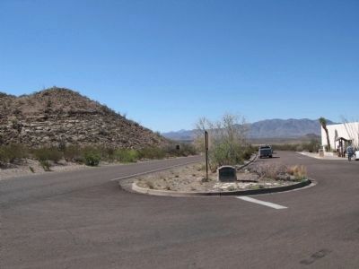
Fort Peña Colorado, the last active fort in this area, on the old Comanche Trail, about 4 miles to the southwest was established in 1879.
Marathon was founded in 1881. Named by an old sea captain, A.E. Shepard, for the Plain of Marathon, in . . . — — Map (db m26436) HM
About 3,000 ft. elevation. Since 17th century, a landmark in travel from Texas points to Mexico and California. According to tradition, named by Spaniards for resemblance to ancient castles. Has associations with stories of lost trains of gold and . . . — — Map (db m203144) HM
A barbed, bristling flying wedge—the Comanches—rode into 18th century Texas, driving the Wichitas and Caddoes east, the Apaches west, becoming lords of the south plains. Harassed the Spanish and Anglo-Americans along frontier from Corpus . . . — — Map (db m73339) HM
For Comanche war parties, about 1750 to 1875, the Big Spring was an oasis. Here paths from northeast, north and northwest twined into the War Trail that led to San Antonio and other Texas points, and down into Mexico. At the Big Spring, parties from . . . — — Map (db m73315) HM
Mapped by Captain Randolph B. Marcy in charge of U.S. Army detail guarding citizens bound for California Gold Rush.
Captain Marcy exploded theory that West Texas was a desert. In making his map, he traveled along a chain of springs and lakes . . . — — Map (db m73316) HM
The routes that moved troops in early Texas often followed old Indian trails, usually were little more than deep wagon ruts. This one, the Chihuahua Road—joining Ft. Clark with other southwest posts—was widely used, 1850-1880. The Comanche War . . . — — Map (db m234647) HM
Used as a watering place and camping ground by Indians since pre-Columbian times, the springs were possibly visited about 1536 by Spaniard Cabeza de Vaca on his wanderings through Texas. The expedition of Juan de Mendoza, with his party of . . . — — Map (db m201800) HM
Established on the Comanche Trail, March 23, 1859, as a protection to the San Antonio-San Diego mail route. Named in honor of Commodore Robert Field Stockton, 1795-1866, who captured California for the United States. A stage stand on the San Diego . . . — — Map (db m84320) HM
Replica of San Antonio and San Diego overland stage coach stop. This building was constructed of the stone from the original site which is ½ mile south-east of this location near Tunis Springs. The remains of a large Comanche Indian camp still . . . — — Map (db m73308) HM
Here crossed the undated Comanche Trail from Llano Estacado to Mexico. In 1850 John R. Bartlett while surveying the Mexican boundary found the crossing marked by skulls of horses; hence the name “Horse Head”. The Southern Overland Mail . . . — — Map (db m53225) HM
In these shifting seas of sand, rich in stone evidences of primitive men, today's visitors find flint points, sandstone metates and manos of peoples who were here as early as 10,000 years ago and late as the 1870s. Bones of great mammoths and . . . — — Map (db m73307) HM
Located 6.6 miles east of this site in the Sand Hills, Willow Springs was known to Comanche Indians and to West Texas pioneers as an important source of water. It was frequently used by gold seekers on their way to California after the 1849 gold . . . — — Map (db m73313) HM