Marker Logo HMdb.org THE HISTORICAL
MARKER DATABASE
“Bite-Size Bits of Local, National, and Global History”


27 entries match your criteria.  


Susquehanna and Tidewater Canal Historical Markers

Built between 1835 and 1839, the 45-mile long Susquehanna (PA) and Tidewater (MD) Canal ran from Wrightsville, Pennsylvania to Havre de Grace, Maryland.
 
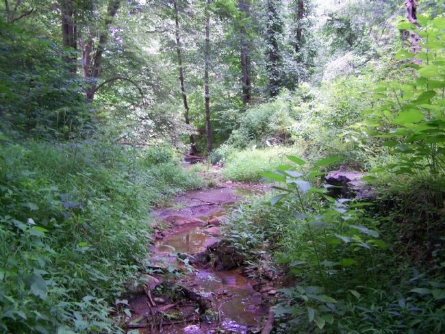
Remains of a Lock image, Touch for more information
By Beverly Pfingsten, July 21, 2007
Remains of a Lock
1 Maryland, Cecil County, Conowingo — The Proprietors of the Susquehanna Canal
On Susquehanna River Road (Maryland Route 222) 2 miles south of Conowingo Road (U.S. 1), on the right when traveling south.
2 Maryland, Harford County, Darlington — Berkley Crossroads
On Castleton Road at Berkley Road on Castleton Road.
3 Maryland, Harford County, Havre de Grace — Canal Lock #9
On Lapidum Road, on the right when traveling north.
4 Maryland, Harford County, Havre de Grace — How a Lock Works
Near Conesto Street, 0.2 miles Erie Street. Reported permanently removed.
5 Maryland, Harford County, Havre de Grace — Rock Run Landing
On Rock Run Road at Stafford Road, on the right when traveling east on Rock Run Road.
6 Maryland, Harford County, Havre de Grace — Susquehanna State ParkTown of Lapidum
On Lapidum Road west of Stafford Road, on the right when traveling west.
7 Maryland, Harford County, Havre de Grace — The Lock House
On Conesteo Street on Conesteo Street.
8 Maryland, Harford County, Havre de Grace — The Mouth of Deer Creek
On Stafford Road, on the right when traveling north.
9 Maryland, Harford County, Havre de Grace — The Susquehanna and Tidewater Canal
Near Conesteo Street close to Erie Street. Reported permanently removed.
10 Maryland, Harford County, Havre de Grace — Toll House & Tidewater Canal
On Rock Run Road at Stafford Road, on the right when traveling east on Rock Run Road.
11 Maryland, Harford County, Havre de Grace — Tollhouse and Covered Bridge at Rock Run
Near Stafford Road at Rock Run Road, on the right when traveling west.
12 Maryland, Harford County, Whiteford — Peach Bottom Slate Region
On Pylesville Road (Maryland Route 165) just north of Whiteford Road (Maryland Route 136), on the right when traveling north.
13 Pennsylvania, Lancaster County, Columbia — Columbia: a Transportation HubLancaster-York Heritage Region — Susquehanna River Water Trail —
Near Walnut Street west of Locust Street, on the right when traveling west.
14 Pennsylvania, York County, Airville — The Canal Boats
Near Riverside Road east of River Road, on the right when traveling east.
15 Pennsylvania, York County, Airville — The Canal Community
On Riverside Road east of River Road.
Paid Advertisement
16 Pennsylvania, York County, Airville — The Locks
On River Road.
17 Pennsylvania, York County, Airville — The Susquehanna & Tidewater Canal
Near Riverside Road east of River Road.
18 Pennsylvania, York County, Airville, Lower Chanceford Township — Susquehanna and Tidewater Canal
On Furnace Road (Pennsylvania Route 425) 0.1 miles north of Goram Road, on the left when traveling north.
19 Pennsylvania, York County, Airville, Lower Chanceford Township — Susquehanna Canal
On Furnace Road (Pennsylvania Route 425) 0.1 miles north of Goram Road, on the left when traveling north.
20 Pennsylvania, York County, Delta, Peach Bottom Township — The World Famous Peach Bottom Slate"Best Roofing Slate in the World"
Near Green Road, 0.1 miles east of Ridge Road, on the right when traveling south.
21 Pennsylvania, York County, Holtwood, Lower Chanceford Township — Lock No. 12Link with the Past
Near River Road north of Holtwood Road (Pennsylvania Route 372), on the right when traveling north.
22 Pennsylvania, York County, Long Level, Lower Windsor Township — Susquehanna and Tidewater Canal
On Long Level Road (Pennsylvania Route 624) 0.3 miles south of Calvary Church Road, on the left when traveling north.
23 Pennsylvania, York County, Long Level, Lower Windsor Township — Susquehanna Canal
On Long Level Road (Pennsylvania Route 624) 0.3 miles south of Calvary Church Road, on the left when traveling north.
24 Pennsylvania, York County, Wrightsville — Susquehanna and Tidewater Canal
On Front Street at Orange Street, on the left when traveling south on Front Street.
25 Pennsylvania, York County, Wrightsville — Susquehanna Canal
On S. Front Street (Pennsylvania Route 624) at Orange Street, on the right when traveling north on S. Front Street.
26 Pennsylvania, York County, Wrightsville — The Susquehanna and Tidewater Canal
Near Maple Street, 0.1 miles east of S. Front Street, on the right when traveling south.
27 Pennsylvania, York County, Wrightsville — Wrightsville
On Lincoln Highway (Pennsylvania Route 462) at Hellam Street, on the right when traveling east on Lincoln Highway.
 
 
CeraNet Cloud Computing sponsors the Historical Marker Database.
This website earns income from purchases you make after using our links to Amazon.com. We appreciate your support.
Paid Advertisement
Apr. 29, 2024