By Mick Secord, December 11, 2011
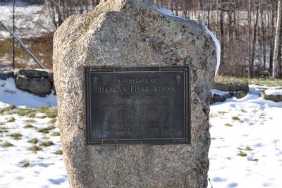
Chief Justice Harlan Fiske Stone Marker
| On Local Route 63, 0.1 miles north of Old Chesterfield Road, on the right when traveling north. |
| On Durkee Street, 0.1 miles east of Main Street (New Hampshire Route 10/119), on the left when traveling east. |
| On Main Street (New Hampshire Route 10/119) south of Richmond Road (New Hampshire Route 119), on the left when traveling north. |
| On U.S. 302 at Mt. Washington Hotel Road, on the left when traveling north on U.S. 302. |
| On State Highway 26, on the left when traveling east. |
| On Weeks State Park Road at Prospect Street (U.S. 3), on the left when traveling east on Weeks State Park Road. |
| On Groton Road at West Shore Road, on the right when traveling west on Groton Road. |
| On New Hampshire Route 175. |
| On Route 136 at New Hampshire Route 47 on Route 136. |
| On Second New Hampshire Turnpike (New Hampshire Route 31) 0.1 miles north of West Main Street, on the right when traveling north. |
| On Main Street north of Hollis Street, on the left when traveling north. |
| On King Street (U.S. 3), on the right when traveling north. |
| On King Street (U.S. 3), on the right when traveling north. |
| On King Street (U.S. 3), on the left when traveling north. |
| On King Street (U.S. 3A) just north of Queen Street, on the right when traveling north. |
| On King Street (U.S. 4) at Depot Street, on the right when traveling north on King Street. |
| On New Hampshire 3A at Interstate 89 on New Hampshire 3A. |
| On Mountain Road (New Hampshire Route 132), on the left when traveling north. |
| On North Main Street at Capitol Street, on the right when traveling south on North Main Street. |
| On North Main Street south of Horseshoe Pond Lane, on the left when traveling north. |
| Near North Main Street at Capitol Street, on the right when traveling south. |
| On Main Street (U.S. 3/202) south of Capitol Street, on the left when traveling south. |
| On Park Street east of North State Street, on the right when traveling west. |
| On Main Street (U.S. 3/202) at Park Street, on the right when traveling south on Main Street. |
| On Bouton Street at Church Street, on the right when traveling south on Bouton Street. |
| On Park Street just east of North State Street, on the right when traveling west. |
| On Bouton Street (U.S. 3) at Church Street, on the right when traveling south on Bouton Street. |
| On North Main Street (U.S. 202), on the right when traveling south. |
| On Main Street (U.S. 3/202) south of Capitol Street, on the left when traveling south. |
| On South Main Street (U.S. 3), on the right when traveling south. |
| On North Main Street, on the right when traveling north. |
| On Church Street at Bouton Street, on the right when traveling west on Church Street. |
| On Stark Highway South (New Hampshire Route 13) at New Hampshire Route 77, on the right when traveling south on Stark Highway South. |
| On North Road, 0.7 miles north of Salisbury Road (New Hampshire Route 127), on the right when traveling north. |
| On New Hampshire Route 114 at Meetinghouse Hill Road on State Route 114. |
| On Front Street, on the right. |
| On West Main Street, on the right when traveling north. |
| On Congress Street just west of Pleasant Street. |
| On Main Street (New Hampshire Route 153) 0.3 miles south of Paulson Road, on the left when traveling south. |
| On NH Rt 4- Portland Avenue (New Hampshire Route 4) at Sligo Road, on the right on NH Rt 4- Portland Avenue. |
| On Maple Avenue, 0.1 miles west of Buenavista Road, on the right when traveling west. |