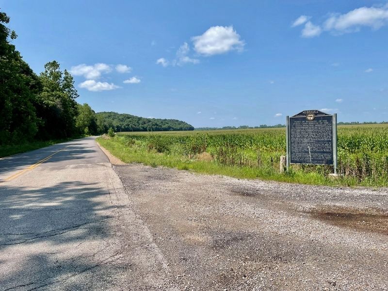
The Kansas-Nebraska Act of May 30, 1854 created the territories of Nebraska and Kansas, which had to be surveyed before settlement could proceed. In November 1854, Captain Thomas J. Lee of the U.S. Army Topographic Engineers determined the . . . — — Map (db m251349) HM
Two miles west is Troy, named for the famous city of Greek antiquity. Following the organization of Doniphan county in 1855 Troy was named the county seat and business began there in 1856. Initially it played a secondary role to such Missouri river . . . — — Map (db m47397) HM
When the 1854 Kansas-Nebraska Act first allowed settlement in Kansas speculators flooded across the Missouri River to survey new towns. Within a few days, Leavenworth was platted as the first city in Kansas. Additional towns on and near the river . . . — — Map (db m252101) HM
This survey monument lies on the 40th parallel north latitude which also is the boundary between the present states of Kansas and Nebraska. In 1803 this area was but a small portion of a large, French-owned region known as Louisiana. That year, . . . — — Map (db m288114) HM
The present system of Government Land Surveys called "The Rectangular System" was adopted by Congress on the 7th of May, 1785. It has been in use ever since and is the legal method of describing most land.
By this system, all distances and . . . — — Map (db m288118) HM
This 5x6 hundred pound obelisk shaped iron monument was cast in St. Louis, MO, in 1854 and was placed at this location one hundred feet above the road on May 8, 1855 by Charles Manners. The location was determined from astronomical observations . . . — — Map (db m288123) HM
As early as the 1600s, the Kanza (or Kaw) Indians migrated from their home east of the Mississippi River and up the Missouri River into what is now northeastern Kansas. In the 1700s, the Kanza occupied two villages on the west bank of the Missouri: . . . — — Map (db m44816) HM
Welcome to the Glacial Hills, rich with Kansas history and spectacular views of the mighty Missouri River.
It is hard to imagine a time when the land traversed by the Glacial Hills Scenic Byway was once covered by almost 500 feet of ice. . . . — — Map (db m289445) HM
As early as the 1600s, the Kanza (or Kaw) Indians migrated from their home east of the Mississippi River and up the Missouri River into what is now northeastern Kansas. In the 1700s, the Kanza occupied two villages on the west bank of the Missouri: . . . — — Map (db m55930) HM
As early as the 1600s, the Kanza (or Kaw) Indians migrated from their home east of the Mississippi River and up the Missouri River into what is now northeastern Kansas. In the 1700s, the Kanza occupied two villages on the west bank of the Missouri: . . . — — Map (db m53945) HM
White Cloud
In 1804, Lewis and Clark rested on the bluffs of the Missouri on lands of the Iowa Nation. Named for an Iowa chief, White Cloud incorporated some 50 years later, reaching a population of more than 2,000 as a steamboat port, . . . — — Map (db m253163) HM
This is the oldest surviving courthouse designed by George P Washburn of Ottawa. Before coming to town, Washburn had worked for the Kansas City architectural firm of Cross and Taylor where he supervised construction of Union railroad depots . . . — — Map (db m67586) HM
The Dorrington House and Barn were
built on this site by abolitionists David and Ann Dorrington upon their arrival in 1857. David, who acquired the contract to transport mail between Falls City and Topeka, Kansas, used mail wagons to
move freedom . . . — — Map (db m254882) HM
Eighteen byre and bluff barns in Doniphan County, built between 1860 and 1933, are now listed on the National Register of Historic Places.
The distinctive barns of Doniphan County help tell the story of the people who settled this . . . — — Map (db m252063) HM
The Iowa, Sac and Fox Mission was one of many Indian missions built in what is now Kansas between 1820 and 1862. Established in 1837 by Reverend Samuel and Eliza Irvin and Reverend William and Julia Hamilton, the mission was sponsored by the . . . — — Map (db m121796) HM
This courthouse has been
placed on the
National Register
of Historic Places
by the United States
Department of the Interior
Doniphan County Bicentennial Commission
Doniphan County, Kansas 1855-1976
Dedicated July 4, 1906 . . . — — Map (db m47712) HM
With the faith and courage of
their forefathers who made
possible the freedom of these
United States
The Boy Scouts of America
dedicate this replica of the
Statue of Liberty as a pledge
of everlasting fidelity
and loyalty . . . — — Map (db m47713) HM
Highland University
1909
Erected by the People
and dedicated
to their best interests
—————
[Stone] From
Old Mission
1837
—————
Names of the College
Highland . . . — — Map (db m47804) HM
Thin black lines indicate changes in relevance. Between each pair of lines entries are ordered geographically but all have the same relevance.
* Inflectional forms of words are their plurals, singulars, and possessives as well as gramatical tenses and similar variations.