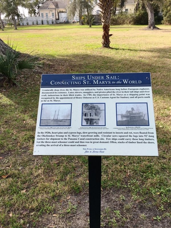
Near Bartlett Street at St Marys Street West, on the left when traveling north.
A naturally deep river, the St. Marys was utilized by Native Americans long before European explorers documented its existence. Later, slavers, smugglers, and pirates plied the river in their tall ships and river craft, industrious in their . . . — — Map (db m144992) HM
On West 3rd Street just west of Bedell Avenue (U.S. 17), on the left when traveling west.
Woodbine was founded in 1893 on the banks of the Satilla River. It grew from earlier river-side sawmill communities established in the mid 1800's. Harvesting timber was a major occupation, and large rafts of logs were floated down the river to the . . . — — Map (db m155789) HM
On South Lee Street (U.S. 17) just north of West William Avenue, on the left when traveling north.
His OriginJacob Joseph was born of slave parents around 1845 and lived on the Murray Plantation in Walterboro, South Carolina. Based on the results of a DNA genealogy testing from family members, it was determined that Jacob's descendents were . . . — — Map (db m222206) HM
Near Beach View Drive 0.1 miles north of South Riverview Drive.
1 African was owned by a free black barber in Augusta, GA. 1 African, known as the "Wild African Boy" was arrested from John duBignon's land and taken to a slave hostel in Savannah owned by George Wylly where he attracted many onlookers for . . . — — Map (db m168401) HM
Near North Martin Luther King Jr. Boulevard, on the left when traveling north.
David Lang was born on May 9, 1838 in Camden County, Georgia. After graduating from the Georgia Military Academy in 1857, he moved to Florida and worked as a surveyor for Suwannee County. At the outbreak of the Civil War he enlisted as a private and . . . — — Map (db m79580) HM
On Georgia Route 41 0 miles north of Fort Perry Road (County Route 49), on the right when traveling north.
One half mile due east lies the site of Fort Perry, along the Old Federal Road. A stockade fort, defended by block houses, this post was ordered erected by General John Floyd, of Camden county, as he led a body of 400 Georgia Militiamen through this . . . — — Map (db m27255) HM
On Ocean Highway (U.S. 17), on the right when traveling south.
John Houstoun McIntosh, son of George McIntosh, was born at Rice Hope, May 1, 1773. When a young man, he settled in East Florida and became a leader of the U.S. citizens living there. He was appointed "Governor or Director of the Republic of . . . — — Map (db m11316) HM
When called upon by a Union officer to surrender during Sherman's assault, December 13, 1864, Clinch responded with a blow of his sword. After three sabre, six bayonet, and two gunshot wounds, he was taken. — — Map (db m13075) HM
On Charlie Smith Sr. Highway (Georgia Route 40 Spur) 0 miles north of Kings Bay Road, on the left when traveling north.
These are the ruins of a tabby sugar works built by John Houston McIntosh at New Canaan Plantation soon after 1825. In his sugar house McIntosh installed what was, according to Thomas Spalding, the first horizontal cane mill worked by cattle power. . . . — — Map (db m21289) HM
On Bedell Avenue (Georgia Hwy 25) (U.S. 17) at East 4th Street, on the right when traveling north on Bedell Avenue (Georgia Hwy 25).
Formed from old Colonial parishes: St. Mary and St. Thomas. Camden one of eight original counties of Georgia created by the State Constitution of 1777. County named for Charles Pratt, Earl of Camden, Chief Justice and Lord Chancellor of England. . . . — — Map (db m168000) HM
On East Magnolia Avenue 0.1 miles east of Burton Street, on the left when traveling east.
(Side 1)
Near this site once stood "Four-Story Cottage," the home of Robert Wilton Burton. A one-story house with wide porch and bay window, Burton built it in 1885 with proceeds from the sale of four stories to children's magazines. Born . . . — — Map (db m74440) HM
On Avenue K east of 43rd Street, on the right when traveling east.
Born in Georgetown, South Carolina, Levi Charles Meyers Harby was the son of Solomon Harby and Rebecca (Moses) Harby. During the War of 1812, Levi served in the U.S. Navy. He was commissioned as a midshipman and stationed at Charleston. After the . . . — — Map (db m127578) HM
On North Coastal Highway (Georgia Route 25), on the right when traveling west.
From South Carolina line to Florida line
distance of 136 miles. Traversing
Chatham, Bryan, Liberty, McIntosh,
Glynn and Camden Counties.
First work done in 1735 when the road
from Savannah to Darien, probably the
first road in Georgia, was . . . — — Map (db m15150) HM
Near Sudley Manor Drive 0.1 miles east of Copeland Drive, on the right when traveling east.
A Busy Part of the Plantation
The empty yard that you see in front of you would once have been bustling with activity. This area of the plantation, called the kitchen yard, was used for food preparation primarily for the Chinn family. . . . — — Map (db m152403) HM
Thin black lines indicate changes in relevance. Between each pair of lines entries are ordered geographically but all have the same relevance.
* Inflectional forms of words are their plurals, singulars, and possessives as well as gramatical tenses and similar variations.