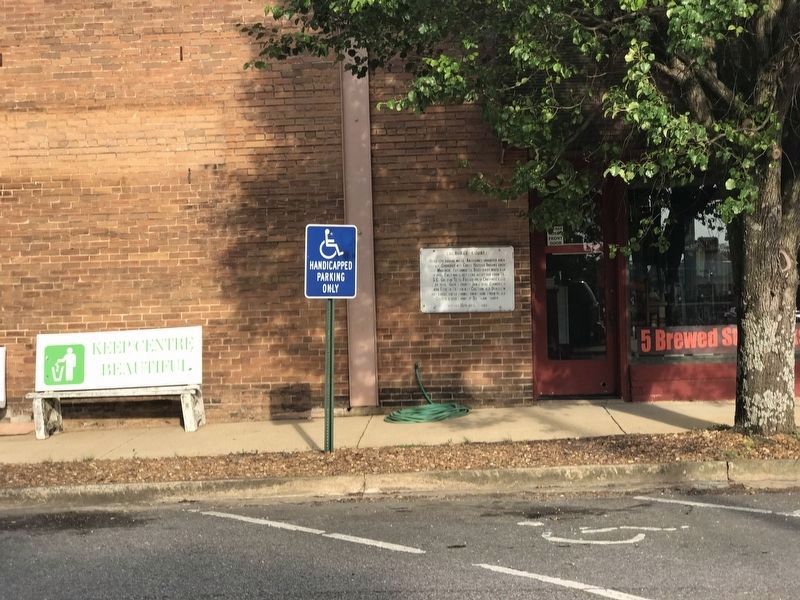
On Cedar Bluff Road at West Main Street (Business U.S. 411), on the right on Cedar Bluff Road.
Area 575 square miles. Aborigines inhabited area 4000 B.C. Cherokee and Creek Historic Indians about 1300-May 1838. Hernando De Soto-First white man July 1540. First white settlers about 1810 from VA, NC, SC, GA, and Tenn. Formed Cherokee Cession . . . — — Map (db m133321) HM
On County Route 8 at Alabama Highway 9, on the right when traveling east on County Route 8.
On the night of May 2, 1863, John H. Wisdom passed through Spring Garden on his way to warn Rome, Ga. about approaching U.S. Troops. Wisdom, originally from Rome, Ga., lived near Gadsden which was part of Cherokee Co. at that time. Upon learning . . . — — Map (db m133475) HM
On Old Alabama Route 9 west of Sewell Ferry Road, on the right when traveling west.
This general area is believed to be the site of the Indian village of Costa visited by DeSoto July 2, 1540. The very old cedar trees may have been here at that time. They are some of the largest in the Southeast. These cedars are among the . . . — — Map (db m114988) HM
On Jackson Drive east of Bay Springs Road, on the left when traveling east.
Hatcher School was created as a result of the dreams and sacrifices of the people of the community. Black children in Centre had to travel to Cedar Bluff to attend school. The State purchased land and citizens of the community provided funding and . . . — — Map (db m133323) HM
On East Main Street (Business U.S. 411) at Iris Drive, on the right when traveling east on East Main Street.
Dedicated on November 19, 1948 has been listed in the Alabama Register of Landmarks and Heritage by the Alabama Historical Commission June 27, 2019 — — Map (db m181355) HM
On Shinbone Valley Road (County Road 127) 0.8 miles north of Jamestown Rd (County Route 15), on the right when traveling south.
In 1902, a coal mine was opened at Lake Lahusage in neighboring DeKalb County. The mined coal was carried by a "dinky line" to the brow of Lookout Mountain at Five Points in Cherokee County. The TAG railroad built a spur line about 2½ miles in . . . — — Map (db m202239) HM
Col. Charles Rattray served in the 57th Ill. Infantry. He served in Sherman's command at Gaylesville in October 1864. He fell in love with Theodora McWhorter and promised to return and marry her when the war ended. He was a man of his word. His . . . — — Map (db m202257) HM
On State Highway 273 at County Road 81, on the left when traveling north on State Highway 273.
David was born 4 of 12 children, served in combat in Vietnam, was wounded and is a highly decorated war veteran. David is a best selling author, a veteran advocate, and State Commander of the American Legion. He is a former college instructor and . . . — — Map (db m114742) HM
On County Road 29 at County Road 8, on the right when traveling north on County Road 29.
During the late 1920s and early 1930s the Spring Garden School "on the hill across the road" was a two-story wooden structure. Grades one through nine were taught in two rooms upstairs and two rooms downstairs. In 1936, a new brick building was . . . — — Map (db m202242) HM
On County Route 15 south of County Route 830, on the right when traveling south.
Born in Lockhart, Alabama in 1915, Tarzan played alongside Bear Bryant on the University of Alabama's 1934 National Championship Team and was honored as an All-American in 1936. He went on to play for the New York Giants, winning a NFL Championship . . . — — Map (db m115273) HM
On Main Street (U.S. 231) 0.1 miles east of Bailey Street, on the right when traveling south.
In late April 1863, Union colonel Abel D. Streight set out on a raid
from Eastpoint. Mississippi, to Rome, Georgia, charged with disrupting
crucial Confederate supply lines. Streight crossed into north Alabama
with 1,700 men. including members . . . — — Map (db m295685) HM
Near East Keetoowah Street just east of South Muskogee Avenue (Business U.S. 62), on the left when traveling east.
Principal Chief of the Cherokee 1828-1866 Born October 3, 1790 in Turkeytown, Alabama. The son of a one-quarter Cherokee maiden and a Scotsman, John Ross was elected as the first Principal Chief of the Cherokee Indians in 1828 and . . . — — Map (db m259375) HM
Near East North Loop Road 0.2 miles east of West Ave.
In loving memory of the pioneering spirit of James Newton Hampton, 1835-1890
and Malinda Winifred Coker Hampton, 1840-1929.
Malinda came with her parents, Joseph and Malinda Brown Coker from Alabama to Cherokee County Texas in 1846. James . . . — — Map (db m295582) HM
Settlement of the Earle's Chapel community began several years before the organization of Cherokee County. W. J. Ragsdale (1811-1884), a veteran of the Texas War for Independence, and his wife Patsy McAdams (1816-1898) had settled on Prairie Branch . . . — — Map (db m122852) HM
On County Road 36 0.1 miles north of New Home Church Road, on the right when traveling north.
William M. Bailey (born 1859 in Cherokee Co.; died 1909 in Blount Co.) settled 40 acres on what became Co. Rd 36 to the west and New Home Church Rd to the east in 1893. He brought three small sons from Cherokee Co. after the death of his first wife . . . — — Map (db m42599) HM
Near Locust Street at County Highway 1419, on the left when traveling north.
(preface)
In 1838, the United States government deported more than 16,000 Cherokee Indian people from their homelands in Tennessee, Alabama, North Carolina, and Georgia, and sent them to Indian Territory (now Oklahoma). Thousands of . . . — — Map (db m156081) HM
Near Locust Street at County Highway 1419, on the left when traveling north.
(preface)
In 1838, the United States government deported more than 16,000 Cherokee Indian people from their homelands in Tennessee, Alabama, North Carolina, and Georgia, and sent them to Indian Territory (now Oklahoma). Thousands of . . . — — Map (db m156080) HM
On East Sam Rayburn Drive (State Highway 56) east of North Center Street (State Highway 78), on the right when traveling east.
Texas Ranger, T.C. Robinson once described him, “He kills men just to see them kick. He can take two six shooters and turn them like wheels in his hands and fire a shot from each at every revolution.” Others have described Fannin . . . — — Map (db m128660) HM
Francis L. Sampson
1912-1996
Francis L. Sampson's amazing record as a war hero put him in history books. As the "Paratrooper Padre" in World War II, he was one of the 20th century's best-known Army Chaplains. His real life story of . . . — — Map (db m126926) HM WM
Thin black lines indicate changes in relevance. Between each pair of lines entries are ordered geographically but all have the same relevance.
* Inflectional forms of words are their plurals, singulars, and possessives as well as gramatical tenses and similar variations.