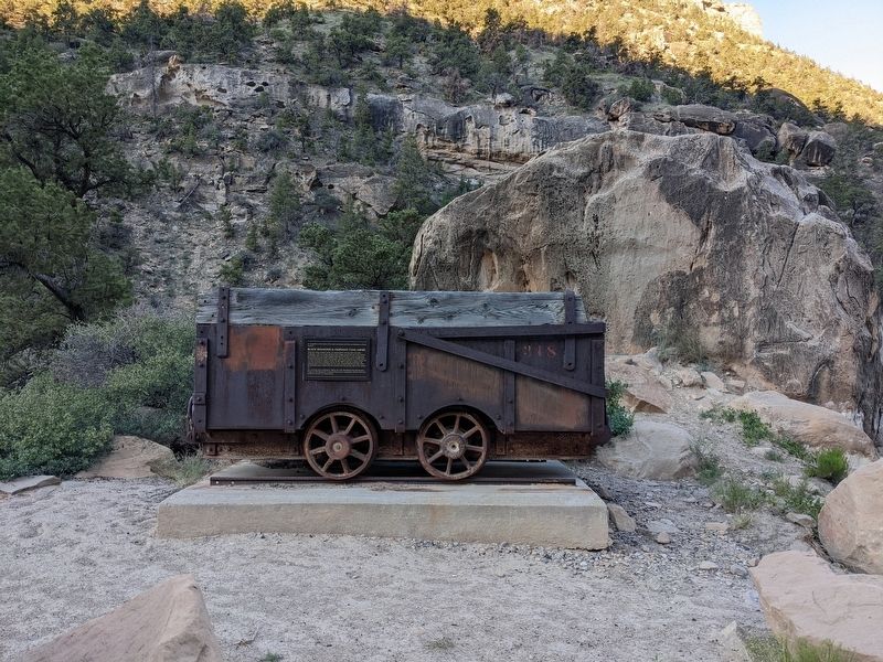
In recognition of the labors of the early coal miners and their contributions to Emery County:
Black Diamond & Oliphant Coal Mines
These two mines, located nearby, are representative of early Utah coal mines.
Production at the two . . . — — Map (db m240513) HM
On State Street (U.S. 89) at the road to Mount Carmel Cemetery, on the left when traveling north on State Street.
In memory of Isaac Behunin,
Mormon Pioneer, Early Utah Settler and
Credited with the naming of Zion Canyon
Early Mormon Pioneer
Isaac Behunin was born October 20, 1803 in Richland, New York to Albert and Nancy Lord Bohanan (Bohannon). . . . — — Map (db m40465) HM
On North 600 East Street, on the right when traveling south.
Peter Julius Christofferson (1843-1910) was born February 16, 1843, in Saersley, Holbek, Denmark, to Hans and Elizabeth Nielsen Christofferson (Christopherson). Following the conversion of his father’s family to The Church of Jesus Christ of . . . — — Map (db m301629) HM
Missionary, pioneer, church leader, farmer, shoemaker, merchant
After whom the city of Draper, Utah is named
Born- April 24, 1807
Midland District, Upper Canada
Baptized into LDS Church March 20, 1833
Migrated to Utah . . . — — Map (db m224770) HM
On South University Avenue, on the right when traveling north.
The Provo City and County Building, now called the Historic Utah County Courthouse, was built between 1920-1926. Joseph Nelson, the architect, traveled with a committee to the West Coast to gather ideas from other administration buildings, prepared . . . — — Map (db m149096) HM
On West 300 North Street at North 100 West Street, on the right when traveling west on West 300 North Street.
This house has two markers
John Patten House
The John Patten House was constructed c.1854 of limestone. John Patten came to Utah in 1850 and settled in Manti. He was active in community affairs serving as a representative to the . . . — — Map (db m74950) HM
On West Main Street (Utah Route 24) at S 400 W, on the left when traveling west on West Main Street.
Early inhabitants of Wayne County and the Bicknell area were the Paleo-Indians, Anasazi, Fremont, Ute, and Paiute Native Americans. The Fremont River, which runs 2 miles south of Bicknell, was named after John C. Fremont, an early explorer who . . . — — Map (db m271861) HM
On South Main Street at East Center Street, on the right when traveling north on South Main Street.
Gunnison Sugar Factory
The sugar industry in Gunnison Valley began in 1901 when Bishop C.A. Madsen offered a prize for beet-growing. Farmers planted the new crop and shipped them for processing to Lehi and later to Elsinore. In 1904, Madsen . . . — — Map (db m260679) HM
On North State Street north of Main Street, on the right when traveling north.
Mt. Pleasant, a small town nestled at the foot of the mountains in Sanpete County near the geographic center of Utah, was settled early in 1859. During June the men kept busy tending their crops and building a fort, twenty-six rods by twenty-six . . . — — Map (db m75169) HM
On South Spring Lake Road at 12400 South, on the left when traveling south on South Spring Lake Road.
When the Ute Indian Chief, Black Hawk died on September 27, 1870 near Spring Lake and was buried by his tribe in a nearby ravine, there was laid to rest a man designated by Brigham Young as "The most formidable foe amongst the Redman" that the . . . — — Map (db m148894) HM
Bridging the Past, Present, Future
It was late November 1849, when a vanguard of pioneers arrived with their songs of praise, their Bibles and Books of Mormon. Within their hearts was a burning desire to help build Zion near the designated . . . — — Map (db m243386) HM
Thin black lines indicate changes in relevance. Between each pair of lines entries are ordered geographically but all have the same relevance.
* Inflectional forms of words are their plurals, singulars, and possessives as well as gramatical tenses and similar variations.