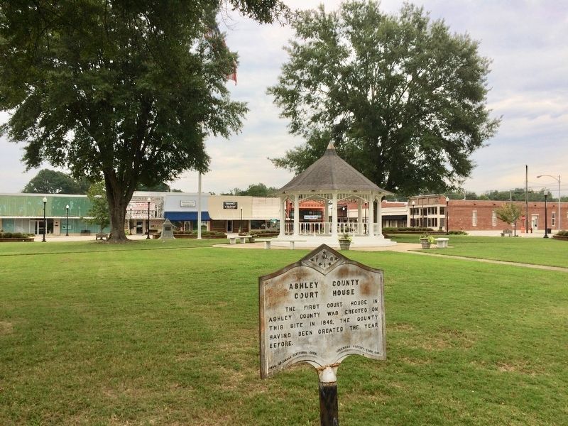
On East Jefferson Street east of North Oak Street, on the left when traveling east.
Ashley County in the Civil War
Thirteen companies were raised and organized in Ashley County for Confederate service during the Civil War: Co. F, 2nd Arkansas Cavalry; Cos. A, B, K and L, 3rd Arkansas Infantry; Co. F, 8th Arkansas Infantry . . . — — Map (db m107691) HM
On North Mulberry Street at East Adams Street, on the left when traveling north on North Mulberry Street.
World War I
Dedicated
to the sons of
Ashley County
Arkansas
Who Made The Supreme Sacrifice
For Humanities Defense
in the World War
1914 — 1918
_______
{List of the honored . . . — — Map (db m108565) WM
On East Cedar Street at North Main Street (Business U.S. 63), on the right when traveling west on East Cedar Street.
The first temporary court house in Bradley County was erected on this site in 1842, two years after the creation of the county, and continued in use until 1858, when a court house built of brick was erected. — — Map (db m121054) HM
On County Road 11E east of County Road 25, on the right when traveling west.
One of the very oldest settlements of this county. Here in 1840–1850 settled the Bakers, Barnetts, Booths, Couches, Deeses, Dixons, Garretts, McDonalds, McWilliams, and other pioneer families Near this point Harvey Crowley Couch, Arkansas . . . — — Map (db m121240) HM
On Columbia Road 11 East at Columbia Road 25, on the left when traveling east on Columbia Road 11 East.
This building was presented to School District No. 3 by Harvey C. Couch
1928
and dedicated to the education of the children of his friends, former schoolmates and neighbors of Calhoun.
(School Board names not transcribed) . . . — — Map (db m305139) HM
On U.S. 371 at East Columbia Road (County Road 60), on the right when traveling north on U.S. 371.
One of the oldest settlements in Columbia County. Here Colonel John Dockery had his plantation and home. Here T.P. Dockery, who became a general in the War Between the States, was born and reared. The Caddo Indian Trail from Camden on the Ouachita . . . — — Map (db m121136) HM
On South Court Square at South Jefferson Street, on the left when traveling east on South Court Square.
Third courthouse on this site. Bid for construction of a new courthouse was let in 1905 for $58,631. Designed by W.S. Hull and built of blond brick with stone detailing, it is considered an example of second renaissance revival architecture. . . . — — Map (db m121341) HM
Near South Washington Street at East Ross Street, on the right when traveling south.
John P. McCown was born Aug. 19, 1815, in Sevierville, Tenn. An 1840 graduate of West Point, he served in the Mexican and Seminole wars before resigning from the U.S. Army on May 17, 1861. McCown joined the Confederate army, rising to the rank of . . . — — Map (db m121139) HM
On West Pine Street (U.S. 371) at North Railroad Avenue, on the right when traveling west on West Pine Street.
In honor of all who served and in memory of all who gave their lives to keep our country a land of freedom Army • USMC • Navy • USAF — — Map (db m287612) WM
On U.S. 165 near Ellington Farm Road (County Road 210), on the right when traveling north.
On February 19, 1942, Pres. Franklin
Roosevelt signed into law Executive
Order No. 9066, interning over 120,000
persons of Japanese ancestry, and
this act irrevocably changed their
lives. The majority of these people
were American citizens. As . . . — — Map (db m170318) HM
Near South Main Street (State Highway 83) south of East Shelton Avenue, on the right when traveling south.
Drew County, named for Governor Thomas S. Drew, was organized in 1845 and Monticello was laid out in 1849 as the county seat. Many pioneer families whose sons and daughters became prominent in the affairs of State and Nation lived here. — — Map (db m85085) HM
On South Main Street (State Highway 83) south of East Shelton Street, on the right when traveling south.
(side 1)
Sixteen Confederate companies were raised in Drew County during the Civil War. Two, the "Confederate Stars" and "Selma Rifles," joined the 3rd Arkansas Infantry and fought with the Army of Northern Virginia. Three, the "Cut-off . . . — — Map (db m85087) HM
Near West Oakland Avenue at North Hyatt Street, in the median.
To the
Confederate
Soldiers
of Drew County.
1861—1865
Furl that banner! True,
'tis gory,
yet 'tis wreathed around
with glory,
and 'twill live in song
and story,
though its folds are
in the dust.
Father Ryan . . . — — Map (db m85093) WM
Erected by the citizens of Drew County in honor of all who served or who may serve and dedicated to those who gave their lives that we might be free. Veterans Day 1988.
World War I
B.C. Bast, George F. Cater, Chisley Garrison, Forrest . . . — — Map (db m85089) WM
Hernando de Soto
Wintered on this Ridge
November, 1541 - March 6, 1542
The Spanish Explorer with his Conquistadores used the slough,
now part of the lake, to enter the Ouachita River to visit the Indians
along the banks. Here Juan . . . — — Map (db m305043) HM
On South West Avenue south of West Block Street, on the right when traveling south.
Bennett. G. Clark and Sarah W. Clark deeded this land to William Rust, John H. Cornish, John R. Hampton, and William H. Hines, trustees of El Dorado Female Institute, in 1847. May 7, 1858 Albert Rust deeded additional land to Robert Goodwin. . . . — — Map (db m121358) HM
On North Washington Avenue north of West Main Street, on the left when traveling north.
El Dorado
Masonic Temple
has been placed on the
National Register
of Historic Places
by the United States
Department of the Interior
Erected 1924 — — Map (db m121976) HM
On North Jefferson Avenue south of East Elm Street, on the right when traveling south.
In honor of the brave
Americans who served
and those that gave
their lives on behalf
of a grateful nation
Reverse
Gulf War
August 2, 1990 — February 28, 1991
Iraq War
March 20, 2003 — December . . . — — Map (db m121766) WM
On North West Avenue, on the right when traveling north.
Dedicated to the memory of Major O. L. Bodenhamer
June 27, 1891 - June 19, 1933
National Commander 1929-1930
The American Legion — — Map (db m305143) WM
On South Jefferson Avenue at East Cedar Street, on the right when traveling south on South Jefferson Avenue.
Within a few short months El Dorado's population doubled, and, before the year
was out, it doubled again before peaking two years later at over 40,000. With the
population explosion came oilmen from Louisiana and Texas, but along with them
on . . . — — Map (db m121352) HM
Near South Jefferson Avenue at East Cedar Street, on the right when traveling south.
On January 10th, 1921, shortly after 4:00 P.M., on a cold January day, a
deafening roar from a drilling rig one mile west of El Dorado announced the
discovery of oil in Arkansas. Dr. Samuel Busey brought in the Armstrong #1
as an earthshaking, . . . — — Map (db m121350) HM
On South Jefferson Avenue near East Cedar Street, on the right when traveling south.
A little over a year after the initial oil discovery by Dr. Busey, the Oil
Operators Trust--Murphy #1, a wildcat well staked on a geologic feature
called the Norphlet dome, drilled into the gas-cap of what would become the
huge Smackover Oil . . . — — Map (db m121356) HM
On South Jefferson Avenue at East Cedar Street, on the right when traveling south on South Jefferson Avenue.
During the oil boom numerous individuals, or wildcatters, made their mark on
the South Arkansas scene. H. L. Hunt, at one time the richest man in the world,
opened a barrelhouse on Hamburger Row, made his financial stake there, and
then . . . — — Map (db m121357) HM
On North Jefferson Avenue north of East Main Street, on the right when traveling north.
• Marshal Guy Tucker (1) argues with Walter (2) and Tom (3) Parnell at east gate of
courthouse fence. Tucker draws pistol and covers them.
• Jim Parnell (4) approaches fence and Tucker warns him not to get behind him.
• Harrison Dearing (5) . . . — — Map (db m121343) HM
On North Jefferson Avenue north of East Main Street, on the right when traveling north.
Marshal Guy B. Tucker, Constable Harrison
Dearing, and other supporters, faced the four
Parnell Brothers, Jim, Mat, Tom, and Walter.
Killed Constable Harrison Dearing.
Killed Walter Parnell.
Killed Tom Parnell.
Wounded Dr. Robert . . . — — Map (db m121342) HM
On East Elm Street at North Jefferson Avenue, on the right when traveling east on East Elm Street.
This marks the site of the second court house built in Union County. Completed May 1st, 1848. The spot was originally a pond where ducks gathered in season. Emigrants in search of home sites frequently camped alongs its banks. It was filled in under . . . — — Map (db m121292) HM
On Mount Holly Highway (Arkansas Route 160) 0.4 miles east of Stephens Highway ( Route 57), on the right when traveling east.
Mount Holly Cemetery is the final resting place of 15 Confederate soldiers, including Asa S. Morgan, who in 1861 recruited the El Dorado Sentinels, which became Co. A, 1st Arkansas Infantry. Morgan later served as colonel of the 26th Arkansas . . . — — Map (db m121172) HM
On Stephens Highway (Arkansas Route 57) south of Mt Holly Highway ( Route 160), on the right when traveling north.
Founded in 1843 by Scotch Presbyterians, it became an educational center with two academies ~ The Academy or Old Field School established in 1845, and Mount Holly Academy in 1848 under J.M. Hogg. More than 200 students attended these schools . . . — — Map (db m121268) HM
On South Broadway Street north of West 8th Street, in the median.
Dedicated to an outstanding athlete
who attained national recognition for his
home town throughout a brilliant athletic career.
Football All-American
University of Arkansas -1948
United States Naval Academy 1945
United States . . . — — Map (db m121409) HM