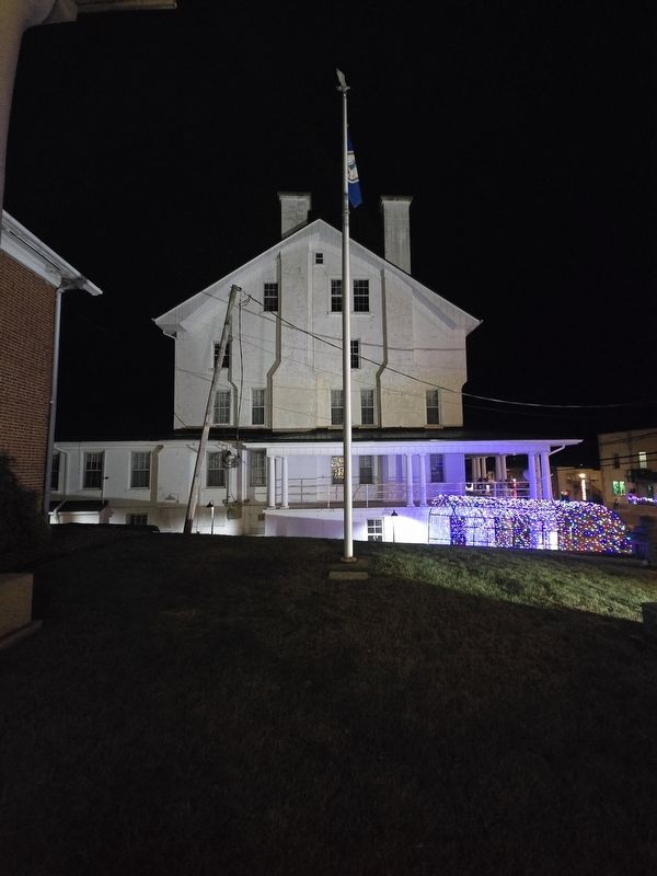
On Danville Pike / East Stuart Drive (Old U.S. 58) just west of Snake Creek Road (County Route 670), on the right when traveling west.
During the 1842 session of the Virginia General Assembly, despite opposition, John Carroll successfully sponsored a bill partitioning Grayson County and forming a new county, thus fulfilling his campaign pledge. Local tradition holds that the . . . — — Map (db m190031) HM
On Greenville Road (Virginia Route 640) at Justice Road ( Route 634), on the right when traveling west on Greenville Road.
Grayson County, formed in 1792 from Wythe County, was named for William Grayson, one of Virginia's first two United States senators. Its court initially met at William Bourne's farm near present-day Fries. Here at Old Town, earlier known as . . . — — Map (db m182112) HM
On East Stuart Drive (Old U.S. 58) east of Floyd Pike (U.S. 221), on the right when traveling east.
Caroll County. Carroll County has been richly productive of traditional musicians for generations. Legendary musical families have lived in Carroll since the late colonial period, including the Stonemans, Meyers, Meltons, and Edmonds families. . . . — — Map (db m104638) HM
On Danville Parkway (U.S. 58), on the right when traveling east.
Carroll County. Area 458 Square Miles. Formed in 1842 from Grayson, and named for Charles Carroll of Carrollton, signer of the Declaration of Independence. New River runs through this county.
Floyd County. Area 376 . . . — — Map (db m25470) HM
On Byllesby Road (County Route 602) at Buck Dam Road, on the left when traveling east on Byllesby Road.
"Forged by mountains, river and America's desire for progress, the 57-mile New River Trail State Park provides you unparalleled opportunities for physical, intellectual and spiritual adventures."
On Carrolton Pike (U.S. 58) near Coulson Church Road (County Route 620), on the right when traveling west.
Ernest V. ‘Pop’ Stoneman (1893–1968) composer, musician and pioneer country music artist was reared near here. His 1924 hit song, “The Titanic” was among the earliest in country music. He and his wife, fiddler and singer Hattie . . . — — Map (db m104640) HM
On West Main Street (County Route 1001) at Scenic Road and Ivanhoe Road ( Route 94), on the left when traveling west on West Main Street.
On 10 Dec. 1923, millhand Henry Whitter of
Fries, Virginia, recorded nine songs in New York
City for OKeh Records. Released early in 1924,
the coupling of “Wreck on the Southern Old 97”
and “Lonesome Road Blues” became one of the
first . . . — — Map (db m65717) HM
On West 18th Street at Baynard Boulevard on West 18th Street.
African American Medal of Honor Recipients Memorial
The Medal of Honor takes its place in our country as the highest award for military valor. The honor, awarded by the President in the name of Congress, may only be accorded an . . . — — Map (db m173924) HM WM
On West Confederate Avenue, on the left when traveling south.
(Front):Davis' Brigade - Heth's Division A.P. Hill's Corps Army of Northern Virginia Confederate States of America Afternoon July 2 - July 4, 1863 (Back):The 11th Mississippi Infantry Regiment, under the command of Col. Francis M. . . . — — Map (db m11596) HM WM
On Ivanhoe Road (Virginia Route 94) south of Hilltown Road (County Road 758), on the left when traveling south.
Grayson County Formed in 1792 from Wythe. Named for William Grayson, one of the first two United States senators from Virginia. Headwaters of New River are in this county.
Carroll County Formed in 1842 from Grayson, and named for . . . — — Map (db m228312) HM
On North Main Street (U.S. 52) just north of Mill Street, on the right when traveling north.
This Hillsville residence gently and graciously recaptures its rightful position as an historical home that echoes the lives and periods of the three families who lived here. A pair of chimneys on the north and south sides balances the original . . . — — Map (db m173423) HM
On Carrolton Pike (U.S. 58) west of Snake Creek Road (County Route 670), on the right when traveling west.
Woodlawn. Woodlawn and adjacent areas of Carroll County have made a rich contribution to America’s traditional music. Ernest V. (Pop) Stoneman lived here. His recording career with his family began in 1924 and spanned decades of technology, . . . — — Map (db m104648) HM
On Woodlawn Road (Route 872) east of Snake Creek Road (County Route 620), on the right when traveling east.
Woodlawn Mate and Female Academy, a private
school, was Founded in 1878 and became the
Woodlawn Normal Institute in 1898, a preparatory
school for teachers. Named Woodlawn in 1907,
it became the first public high school in Carroll
County after . . . — — Map (db m104653) HM
On West Stuart Street west of North Jefferson Street, on the right when traveling east.
Carroll County Area 458 Square Miles. Formed in 1842 from Grayson, and named for Charles Carroll of Carrollton, signer of the Declaration of Independence. New River runs through this county.
Grayson County Area 425 . . . — — Map (db m182119) HM
On 2nd Street NW (Virginia Route 99), on the right when traveling west.
Erected by the state bar association
of Virginia as a memorial of the legal
accomplishments, the fidelity to duty
and the courage unto death of
Thornton Lemmon Massie
judge of the twenty first Virginia circuit
who was assassinated while . . . — — Map (db m162946) HM
On West Baltimore Street (State Highway 140) at Park Road, on the left when traveling west on West Baltimore Street.
On June 29, 1863, Union Gen. George G. Meade ordered the Army of the Potomac to Pipe Creek to counter any move toward Washington or Baltimore by Gen. Robert E. Lee’s Army of Northern Virginia and to engage the Confederates in battle. Meade . . . — — Map (db m155348) HM
Near South Center Street north of Gist Road, on the right when traveling south.
Landon C. Burns was born in 1897 in Virginia. He graduated from the University of Maryland with a B.S. Degree in Agriculture Education and later earned an M.S. Degree in Rural Sociology. The man who was often called "Mr. Carroll County" was . . . — — Map (db m114412) HM
On West Main Street (Maryland Route 851) at Baldwin Drive, on the right when traveling west on West Main Street. Reported missing.
In June 1863, as Gen. Robert E. Lee and the Army of Northern Virginia marched north, Gen. J.E.B. Stuart’s Confederate cavalry rode east of the main army. Soon, Federal cavalry hunted Stuart. Before dawn on June 29, several former area residents . . . — — Map (db m13883) HM
On West Main Street at Baldwin Drive, on the right when traveling west on West Main Street.
In late June 1863, Gen. J.E.B. Stuart's Confederate cavalry pounded through this area on a raid while, to the west, Gen. Robert E. Lee and the main body of the Army of Northern Virginia marched northward. Before dawn on June 29, several former area . . . — — Map (db m252269) HM
Near Littlestown Pike (Maryland Route 97). Reported permanently removed.
At daybreak on June 30, 1863, Gen. J. E. B. Stuart arrived here from his bivouac at the Orendorff farm north of Westminster. He then gathered his brigade commanders to discuss Union Gen. Judson H. Kilpatrick’s cavalry division, which was encamped . . . — — Map (db m201547) HM
Near Littlestown Pike (Maryland Route 97) 0.4 miles north of Saw Mill Road West, on the right when traveling north.
At daybreak on June 30, 1863, Gen. J.E.B. Stuart arrived here from his bivouac at the Orendorff farm north of Westminster. He then gathered his brigade commanders to discuss Union Gen. Judson H. Kilpatrick's cavalry division, which was encamped . . . — — Map (db m155339) HM
On Uniontown Road 0.1 miles Route 84, on the right when traveling east.
On June 27, 1863, Union Gen. Winfield S. Hancock’s II Corps, Army of the Potomac camped at Monocacy Junction near Frederick. The next day, Gen. George G. Meade assumed command of the army and devised a plan to march it through Frederick and Carroll . . . — — Map (db m3014) HM
On South Center Street at Farm Museum Road, on the right when traveling south on South Center Street.
On June 29, 1863, Confederate Gen. Robert E. Lee’s infantry was in Pennsylvania, and Gen. J.E.B. Stuart’s cavalry arrived here on the outskirts of Westminster. Gen. Fitzhugh Lee’s division led the column, which numbered 6,000 including cavalrymen . . . — — Map (db m13826) HM
On Emerald Hill Lane just north of Longwell Avenue, on the right when traveling north.
In June 1864, Confederate Gen. Robert E. Lee sent Gen. Jubal A. Early's corps from the Richmond battlefields to the Shenandoah Valley to counter Union Gen. David Hunter's army. After driving Hunter into West Virginia, Early invaded . . . — — Map (db m201507) HM
On Rebel Drive at Dormitory Row North, on the right when traveling east on Rebel Drive.
In 1920, this building was dedicated in honor of James Zachariah George (1826-1897). Born in Georgia, George moved with his family to Mississippi in 1834, settling two years later in Carroll County.
At the outbreak of war between the United . . . — — Map (db m219881) HM
Near Duncan Road (Route 670), on the left when traveling south.
Sergeant John Ezra Buffington, with five other men of his regiment, stormed the ramparts of the Confederate works near this position during the attack on April 2, 1865. The commander of the brigade that included the 6th Maryland wrote after the . . . — — Map (db m285345) HM
On U.S. 221 0.1 miles east of Borderline Road, on the right when traveling east.
CARROLL COUNTY
Area 458 Square Miles
Formed in 1842 from Grayson, and named for Charles Carroll of Carrollton, signer of the Declaration of Independence. New River runs through this county.
FLOYD COUNTY
Area 376 Square . . . — — Map (db m206711) HM
On Scenic Road (Virginia Route 94) north of Walnut Lane (Route 860), on the right when traveling north.
Fries is named for Colonel Francis H. Fries of
North Carolina, founder of the Washington
Mills Company. By 1900, Fries and his
associates had determined that the New River
could power a textile mill. The town was
incorporated in 1902, and by . . . — — Map (db m65695) HM
On Main Street (Maryland Route 140) north of Bond Avenue, on the left when traveling north.
This modest roadside way station grew into a town center for the farms and estates of northwest Baltinore County and Carroll County. By 1900, Reisterstown was home to some 1,000 people. Descendants of early residents shaped town life as owners of . . . — — Map (db m274872) HM
On Watt House Road (Virginia Route 718) 0.2 miles south of Cold Harbor Road ( Route 156), on the left when traveling south.
(front)
11th Mississippi
Infantry Regiment
Law's Brigade
Hood’s Division
Jackson’s Corps
Lee's Army
of
Northern Virginia
C.S.A.
Dedicated 2016
In their honor
The men who carried this position were soldiers . . . — — Map (db m174711) HM WM
Thin black lines indicate changes in relevance. Between each pair of lines entries are ordered geographically but all have the same relevance.
* Inflectional forms of words are their plurals, singulars, and possessives as well as gramatical tenses and similar variations.