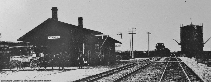
Near East Main Street (County Highway E48) at North Washington Street (County Highway X20), on the right when traveling east.
As of 1900, the United States had an excellent rail network but no system of long-distance highways. Private associations made the earliest attempts to blaze "auto trails," giving them colorful names and emblems. The most famous road across Iowa . . . — — Map (db m184820) HM
On 1st Street Southwest at Old Lincoln Highway (10th Avenue Southwest), on the left when traveling east on 1st Street Southwest.
The Lincoln Highway ran through the central business districts of hundreds of small towns and cities across the U.S., giving substance to slogans proclaiming the highway as the "Nation's Main Street." To small-town merchants, the Lincoln Highway . . . — — Map (db m184844) HM
On 1st Street Southwest just north of 3rd Avenue Southwest, on the right when traveling north.
From 1923 to 1937, the Cedar Rapids Police Department and City Jail occupied the King Building, which stood here from 1910-1969. The department and jail moved to 310 Second Avenue SW in 1937. The city's first African American police officer, Virgil . . . — — Map (db m216498) HM
On West Mount Vernon Road (County Road E48) 0.1 miles south of Irish Lane, on the left when traveling south.
At first, the Lincoln Highway through Iowa consisted mainly of dirt roads, which were fine when dry but impassable when wet. Motorists were advised against trying to cross Iowa in rainy weather.
The goal of the Lincoln Highway Association (LHA) . . . — — Map (db m158227) HM
On Central City Road 0.3 miles east of Marion Road (Iowa Route 13), on the right when traveling east.
Clark was born in Sangerville, Maine on January 26, 1841. He enlisted with the 6th Maine Infantry in July 1861, and was commissioned as a lieutenant in February 1862. He later served as captain and assistant adjutant general of volunteers from May . . . — — Map (db m285996) HM
On Central City Road 0.3 miles east of Marion Road (Iowa Route 13), on the right when traveling east.
Linn County Freedom Rock Central City, IA
The Linn County Fairgrounds in Central City is honored to be the site of the 99th County Freedom Rock®. The journey to the finished piece you see began in July of 2018 when the announcement was . . . — — Map (db m286000) HM WM
Near Lincoln Highway (U.S. 30) just west of Monroe Avenue, on the right when traveling west.
In 1912, there were approximately one million motor vehicles registered in the United States but few good roads. Most of the roads outside of urban areas were dirt that turned to mud when wet. Long-distance travel by car was still very much a . . . — — Map (db m162418) HM
On Central City Road 0.3 miles east of Marion Road (Iowa Route 13), on the right when traveling east.
Mancil "Manny" V. Root, Musician (rank equivalent to PVT) served with Company E of the 36th Wisconsin Infantry. He was the youngest veteran of the Civil War and enlisted when he was 11 years old. Mancil V. Root settled in Linn County for his last . . . — — Map (db m285995) HM
On West Mount Vernon Road (County Route E 48), on the right when traveling west.
This tablet commemorates
the advent of the first white
settler in Linn County, Iowa
William Abbe
a true pioneer- a worthy citizen
erected by
Ashley, Mayflower, Marion, Linn & Balliet Chapters
Daughters of the American . . . — — Map (db m96858) HM
Near A Avenue at West 1st Street, on the right when traveling north.
Points of Interest If you are planning any exploration, please be respectful of private property. 1. BURMEISTER’S ISLAND: Located at Benton/Black Hawk County line, this privately owned island is a haven for numerous wildlife and . . . — — Map (db m239656) HM
On West Mount Vernon Road (County Road E48) 0.8 miles west of Smyth Road, on the right when traveling west.
This is the site of the first and only seedling mile of concrete
pavement in the state of Iowa on the Lincoln Highway. The Linn
County Engineer at the time was R. W. Gearhart and the project
was constructed by Ford Paving Company of Cedar . . . — — Map (db m161620) HM
On 3rd Avenue Southeast at 1st Street Southeast, on the right when traveling east on 3rd Avenue Southeast.
Reimagining post-flood core districts in 2008, community leaders saw grand potential for this strategic urban block. Three damaged buildings were acquired and demolished, making this site prime for redevelopment. While awaiting a project, those . . . — — Map (db m279570) HM
Near C Street Southwest east of C Street Southwest.
Reopening the Landfill
Following the devastating flood of the Cedar River in 2008, the Solid Waste Agency received permission from the State of Iowa to reopen the closed landfill and accept only flood debris.
The top 30 acres of the . . . — — Map (db m278972) HM
Opened in 1965
The City of Cedar Rapids opened this landfill in a former quarry. The property came under control of the Cedar Rapids Linn County Solid Waste Agency in 1994 when a partnership was formed between Linn County, the City of Cedar . . . — — Map (db m278884) HM
Thin black lines indicate changes in relevance. Between each pair of lines entries are ordered geographically but all have the same relevance.
* Inflectional forms of words are their plurals, singulars, and possessives as well as gramatical tenses and similar variations.