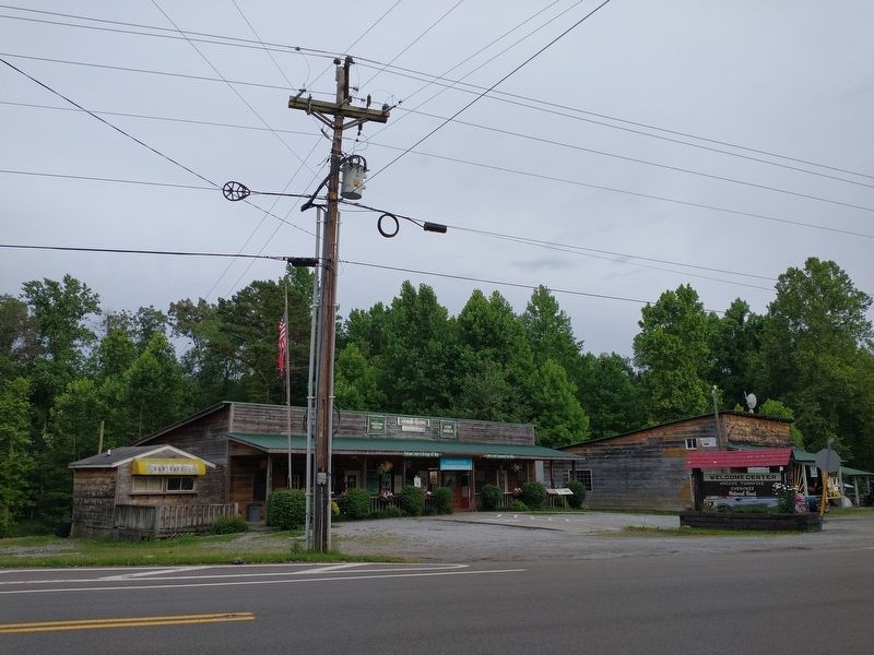
On Tennessee Route 68 at Hot Water Road, on the right when traveling north on Tennessee Route 68.
For more than a century, Coker Creek was the economic center of Tennessee’s eastern gold district. Prospectors began working the area as early as 1827 when it was still within the Cherokee Nation. Tennessee’s first state geologist, Gerard Troost, . . . — — Map (db m227675) HM
On Benton Station Road at Ward Street, on the right when traveling west on Benton Station Road.
Like most of Appalachian Tennessee, Polk County was a divided land during the Civil War.
Residents formed both Confederate and Federal units. Benton, the county seat, was a regional crossroads, but Ducktown, where the Burra Burra Copper Company . . . — — Map (db m178020) HM
On Blue Ridge Drive (Georgia Route 5) 0 miles south of Toccoa Street ( Route 60), on the right when traveling south.
North of here on Madden Branch in Polk County, Tennessee, on November 29, 1864, during the American Civil War, six Georgians trying to enlist in the U.S. Army—Thomas Bell, Harvey Brewster, James T. Hughes, James B. Nelson, Elijah Robinson, . . . — — Map (db m47731) HM
(Preface): On March 24, 1865, Union Gen. George Stoneman led 6,000 cavalrymen from Tennessee into southwestern Virginia and western North Carolina to disrupt the Confederate supply line by destroying sections of the Virginia and Tennessee . . . — — Map (db m53199) HM
From the beginning of the eighteenth century until the American Revolution, Cherokee hunters and trappers traded tens of thousands of animal pelts for manufactured goods imported by licensed British traders. The first resident trader in the Overhill . . . — — Map (db m116823) HM
On Arbin Watson Road (County Road 602) 0.2 miles west of David W. Lillard Memorial Highway (State Route 30), on the left when traveling west.
This 1920s-era frame building, home to the Beth Salem Cumberland Presbyterian Church, stands as a carefully tended symbol of the freed slaves and their descendants who once were part of an integrated community of subsistence farmers. The Beth Salem . . . — — Map (db m178010) HM
Near Burra Burra Street 0.3 miles east of Route 68 when traveling east.
Mining in the Copper Basin
In 1843, a prospector, hoping to find gold south of the Coker Creek mine fields, instead located one of America's richest copper reserves. Over the next century, American and foreign companies chartered more . . . — — Map (db m116819) HM
On Cherohola Skyway (Tennessee Route 165) east of Hunt Street, on the left when traveling east.
Tellico Plains
Early Iron and Logging Industries
Tellico Plains’ first industrial venture, the Tellico Iron Works, started around 1825 with the construction of a foundry by an early white settler. Local legend, however, holds that native . . . — — Map (db m116822) HM
On Taylorsville Road at Sewell Road, on the left on Taylorsville Road. Reported missing.
May 23, 1864. The Army of the Tennessee [US], consisting of Logan’s 15th & Dodge’s 16th A.C., crossed the Etowah River at Woolley's Bridge & by Old Macedonia Church & roads not now existing, reached this, the intersection with the Old Alabama Rd., . . . — — Map (db m20227) HM
Approximately one billion years ago, Tennessee's oldest known rocks, found only in the easternmost mountains, formed in a marine or coastal environment. They include the copper deposits of Polk County. — — Map (db m214568) HM
On East Main Street at Kentucky Avenue, on the left when traveling east on East Main Street.
Munn Park was established in 1884 as a town square in Lakeland's first subdivision, the original Munn's Subdivision. Later the entire block was dedicated by Abraham Munn as a "Public Square" in perpetuity, to forever remain in public ownership. . . . — — Map (db m53649) HM
On Burra Burra Street, on the left when traveling south.
This piece of matte was recovered from the site of the 19th-century Burra Burra roast yards which extended for 14 acres. During the early days of mining, the raw copper ore was roasted in open sheds; each roast heap required 65 cords of wood, and . . . — — Map (db m262064) HM
On Coxe Road (County Route 1005) 0.4 miles east of River Crest Parkway, on the left when traveling east. Reported missing.
On March 24, 1865, Union Gen. George Stoneman led 6,000 cavalrymen from Tennessee into southwestern Virginia and western North Carolina to disrupt the Confederate supply line by destroying sections of the Virginia and Tennessee Railroad, . . . — — Map (db m266614) HM
On U.S. 411 0.1 miles south of Liberty Church Road, on the right when traveling north.
Tennessee
Polk County
Established 1839; named in honor of
James Knox Polk
Born in North Carolina. 1795. Served,
State House of Representatives: Member
of Congress and Speaker House of
Representatives: Governor of . . . — — Map (db m289217) HM
Near North Washington Street (State Highway 87) north of River Street, on the left when traveling north.
This millstone is the last remnant of the flour mill that operated on the river bank a half-mile to the south. Power was provided by the stream that now tumbles down a rocky slope on the north boundary of the Wisconsin Interstate Park.
Pieces . . . — — Map (db m216749) HM
Thin black lines indicate changes in relevance. Between each pair of lines entries are ordered geographically but all have the same relevance.
* Inflectional forms of words are their plurals, singulars, and possessives as well as gramatical tenses and similar variations.