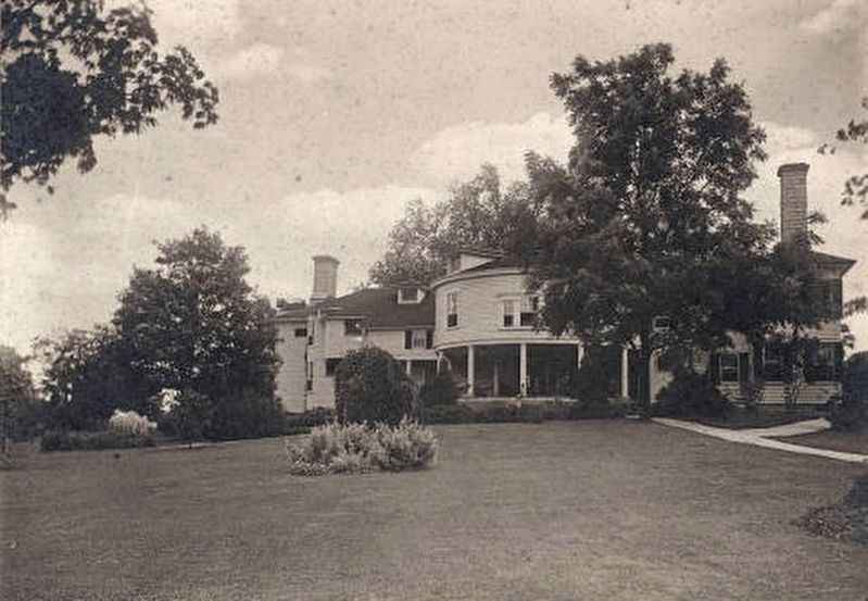
On Cherry Street (State Road 203) at English Drive, on the left when traveling north on Cherry Street.
English (1822-1896), politician, banker, and historian, served as secretary of 1850 Indiana Constitutional Convention, as Speaker of Indiana House, and in U.S. House. Candidate for U.S. Vice President, 1880; President, Indiana Historical Society. . . . — — Map (db m99759) HM
On East Main Street (State Road 356) east of South Cherry Street, on the right when traveling east.
Shea was born at the home of his
parents on this site 1862. Received
A. B. degree from Indiana
University 1889. Admitted to the bar
at Scottsburg 1889; practiced law
there, Seymour, and later
Indianapolis. Shea began public
service as . . . — — Map (db m289233) HM
On East McClain Avenue at South Main Street, on the right when traveling east on East McClain Avenue.
Side A:
County formed by Indiana General Assembly 1820. First county seat located at Lexington; first courthouse built 1821. Several attempts made 1822-1870 to move county seat to more central location, creating animosity among . . . — — Map (db m22063) HM
On North Main Street at NW Railroad Street, on the left when traveling north on North Main Street.
Marker Front:
Built 1872. One of the classic "combination" depots for passengers and freight, with board and batten siding, wide overhanging roof, and agent's bay window. Interior included separate waiting rooms for men and women. Served as . . . — — Map (db m22061) HM
On Bond Street, on the right when traveling north.
Indianapolis and Louisville Traction Company organized to build track between Seymour and Sellersburg as part of the interurban line which extended from Indianapolis to Louisville; track completed in 1907. First railway in the country to operate . . . — — Map (db m99655) HM
On East Main Street (Ohio River Scenic Byway) (Indiana Route 111) just west of East 9th Street, on the right when traveling west.
This stone marks the western line of the Clark (Illinois) Grant containing 150,000 acres given by the State of Virginia, April, 1784, to General George Rogers Clark, his Officers, and Soldiers as a gratuity for the conquest of the Northwest . . . — — Map (db m194189) HM
On South Main Street (Business U.S. 71) at Duncan Street, on the right when traveling south on South Main Street.
While Scott County residents were divided on the issue of secession, once Arkansas left the Union, many supported the Confederacy. The first fighting there was a Sept. 11, 1863, skirmish near Waldron where the 14th Kansas lost 1 dead and 2 wounded . . . — — Map (db m200627) HM
On West Wardell Street at South Main Street, on the left when traveling west on West Wardell Street.
Scott County Board of Commissioners appointed a library board 1917 in response to citizen petitions for a public library. Library board sought Carnegie grant for funding assistance. locally $7,500 was raised; Carnegie grant of $12,500 was added. . . . — — Map (db m99459) HM
On East Canton Road at North Canton Road S, on the right when traveling east on East Canton Road.
On the afternoon of July 10, 1863, General Morgan’s men looted Canton stores and confiscated fresh horses. The raiders continued east from there toward New Philadelphia, crossed the middle fork of the Blue River, and proceeded into Scott County. . . . — — Map (db m126321) HM
On Cherry Street (State Road 203), on the left when traveling north.
Side 1
Scott County formed by Indiana General Assembly 1820; Lexington selected county seat. Attempts made 1823, 1839, 1840 to relocate county seat to more central location. Petition to County Commissioners 1870 was successful; town of . . . — — Map (db m99751) HM
On South Westport Road, on the left when traveling north.
(Side 1)
Kimberlin, a Revolutionary War veteran, was first person to purchase land in what is now Scott County In 1804, he bought Tract 264 of land grant to soldiers of George Rogers Clark. His family settled 1805 in well-built cabin . . . — — Map (db m99663) HM
On South Main Street, on the right when traveling south.
(Side 1)
Indiana law in 1831 authorized counties to establish institutions to support and accommodate the poor, carrying out 1816 Constitution provision. First Scott County home built 1861 north of Lexington; closed 1879. County home moved . . . — — Map (db m99654) HM
Thin black lines indicate changes in relevance. Between each pair of lines entries are ordered geographically but all have the same relevance.
* Inflectional forms of words are their plurals, singulars, and possessives as well as gramatical tenses and similar variations.