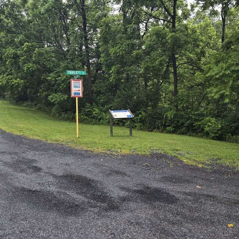
On Battlefield Road (County Route 601) at Triplett Road, on the right when traveling west on Battlefield Road.
On September 22, 1864, Union Gen. James W. McMillan's brigade, roared past where you are standing as his troops assaulted the Confederate line atop the high ground to your left during the Battle of Fisher's Hill.
The fight at Fisher's Hill . . . — — Map (db m275384) HM
Near East Lee Street east of John Sevier Road, on the right when traveling east.
Itinerant pastor to pioneer Lutherans in the Virginia counties of Frederick, Shenandoah, Rockingham, Augusta, Botetourt, Montgomery, Wythe, and Washington; Organizer of numerous congregations in the Shenandoah Valley, in southwest Virginia, in the . . . — — Map (db m173535) HM
On Stony Creek Boulevard (County Route 185) at Piccadilly Street, on the right when traveling north on Stony Creek Boulevard.
Laurel Brigade, Thos. L. Rosser, General
(The 7th Regiment was under Command of Col. Angus McDonald at the beginning of the war. He was succeeded by Col. Turner Ashby, afterwards Brigadier-General killed at Cross Keys. )
Officers: Not . . . — — Map (db m170015) WM
On North Valley Pike (U.S. 11) 0.1 miles south of Shady Lane, on the left when traveling north.
Here ran the Fairfax Line, surveyed in 1746 to mark the southwestern boundary of the Northern Neck Proprietary, a 5.2-million-acre land grant inherited by Thomas, 6th Lord Fairfax. The grant encompassed all the land between the Rappahannock and . . . — — Map (db m165410) HM
Near North Main Street (U.S. 11) at West Court Street, on the left when traveling north.
Shenandoah County's native limestone courthouse was built in 1795 with brick additions in 1871 and 1886. In 1927, portico and columns were added giving the Federal Styled building a Greek revival front. It is the oldest courthouse in continuous use . . . — — Map (db m73774) HM
Original French Version: Lan 1749 du règne de Louis XV Roy de France
nous Céloron commandant d’un détachement
envoie par monsieur le Mis de la Galissoniere
commandant général de la Nouvelle France
pour rétablir la tranquillité dans . . . — — Map (db m42653) HM
Near Frontier Drive north of Barterbrook Road, on the right when traveling north.
Virginia Germans
This log farmhouse was built in Rockingham County, Virginia in 1773 by a German immigrant. Many German farmers in the Valley of Virginia constructed similar homes in the 18th century. Later improvements to the house . . . — — Map (db m298906) HM
On Lee Highway (U.S. 211) just east of Crisman Hollow Road, on the right when traveling east.
Page County. Area 322 square miles. Formed in 1831 from Shenandoah and Rockingham, and named for John Page, Governor of Virginia, 1802–1805. Luray cave is here.
Shenandoah County. Area 510 square miles. . . . — — Map (db m254771) HM
Near George Collin Parkway (Virginia Route 305) at West Old Cross Road (U.S. 211). Reported permanently removed.
In 1875, Confederate veteran Christian Shirley constructed this brick house on the site of his family's former home, which had burned two years earlier. The Shirleys were longtime residents of Shenandoah County who had farmed their 153 ares since . . . — — Map (db m7346) HM
On Nansemond Parkway (Virginia Route 337) at Outlaw Lane on Nansemond Parkway.
James Bowser, a free African American born in Nansemond County about 1763, was one of many black Virginians who served in the army or navy of the United States during the Revolutionary War. He enlisted in the 1st Virginia Regiment of the Continental . . . — — Map (db m41080) HM
On U.S. 340 at Panther Drive, on the right when traveling south on U.S. 340.
On 22 May 1865, after the Civil War ended, Capt. George W. Summers, Sgt. I. Newton Koontz, and two other armed veterans of Co. D, 7th Virginia Cavalry, en route to obtain their paroles, robbed six Federal cavalrymen of their horses near Woodstock. . . . — — Map (db m248566) HM
On East King Street (U.S. 11) just east of South Holliday Street, on the right when traveling east. Reported permanently removed.
The Fire Department building was erected in 1951 in honor of local veterans of all wars. The first firehouse and Town Office stood here from the 1890's in a modest wooden structure known as "the sheep shed." It was the home of Massanutten Hose . . . — — Map (db m158546) HM
On Wardensville Pike / John Marshall Highway (Virginia Route 55) at Star Tannery Road (County Route 604), on the left when traveling west on Wardensville Pike / John Marshall Highway.
Frederick County. Area 485 Square Miles. Formed in 1738 from Orange, and named for Frederick, Prince of Wales, Father of King George III. Several battles were fought in the vicinity of Winchester, 1862–1864.
Shenandoah . . . — — Map (db m9251) HM
On Valley Pike (U.S. 11) south of Shady Lane, on the right when traveling south.
Rockingham County. Area 876 square miles. Formed in 1778 from Augusta, and named for the Marquis of Rockingham, British statesman. John Sevier, of Tennessee, was born in this county. In it took place the battles of Cross Keys . . . — — Map (db m653) HM
On Main Street (U.S. 11) just south of Bridge Street, on the right when traveling north.
This property has been placed on the
National Register
of Historic Places
by the United States
Department of the Interior
c. 1875 — — Map (db m158240) HM
On Main Street / Old Valley Pike (U.S. 11) at Depot Street, on the left when traveling north on Main Street / Old Valley Pike.
This area was a Native American hunting territory
before settlers of European descent arrived early in
the 18th century. Fertile land and powerful streams
supported an agricultural and milling economy. In
1826 the Virginia General Assembly . . . — — Map (db m108888) HM
On Strasburg Road / Front Royal Road (State Highway 55), on the right when traveling west.
Shenandoah County. Area 510 Square Miles. Formed in 1772 from Frederick, and first named Dunmore for Lord Dunmore, Governor of Virginia, 1771-1775. In 1778 the county was renamed for the Shenandoah River.
Warren County. . . . — — Map (db m4297) HM
On Valley Pike (U.S. 11), on the left when traveling south.
Frederick County. Area 485 Square Miles. Formed in 1738 from Orange, and named for Frederick, Prince of Wales, Father of King George III. Several battles were fought in the vicinity of Winchester, 1862-1864.
Shenandoah . . . — — Map (db m3430) HM
Near Main Street Southwest at South Gay Street, on the right when traveling east.
She was the love of his youth, the inspiration of his manhood, a gallant, courageous Colonial and Revolutionary patriot. Her descendants number many notable leaders of men.
Tennessee’s first Five Star Mother
(south side) Sarah Hawkins . . . — — Map (db m134859) HM WM
On Main Street (U.S. 11) at Nelson Street, on the right when traveling north on Main Street. Reported permanently removed.
In September 1861, the Confederate Medical Department built a large general hospital on this site because Mt. Jackson was the western terminus of the Manassas Gap Railroad which provided access to northern Virginia battlefields. Dr. Andrew Russell . . . — — Map (db m156947) HM
On Main Street (U.S. 11) at Nelson Street on Main Street. Reported permanently removed.
In September 1861, the Confederate Medical Department built a large general hospital on this site because Mt. Jackson was the western terminus of the Manassas Gap Railroad, which provided access to northern Virginia battlefields. Dr. Andrew Russell . . . — — Map (db m156946) HM
On Main Street (U.S. 11) at Nelson Street, on the right when traveling north on Main Street.
In September 1861, the Confederate Medical Department built a large general hospital on this site to care for sick and wounded southern soldiers. It was located here because Mt. Jackson was the western terminus of the Manassas Gap Railroad, which . . . — — Map (db m280416) HM
On North Congress Street (U.S. 11) 0.2 miles north of Lee Highway (U.S. 211), on the left when traveling north.
22 enslaved persons were held in bondage on the Rice Farm in the years leading up to the Civil War, making Dr. John W. Rice, the owner of the Rice Farm, one of the largest slaveowners in Shenandoah County. According to the 1850 Slave Schedule . . . — — Map (db m254929) HM
On West King Street (U.S. 11) just east of South Fort Street, on the left when traveling west.
The Strasburg Community Library was organized by the Strasburg Business Women's Club in 1959. The Library occupied several buildings on King Street, moving to its current location when the family of Elien Crawford Hatmaker, a Club member, deeded . . . — — Map (db m280984) HM
On South Church Street north of East South Street, on the left when traveling north.
On July 31, 1839, George Rye wrote that he supported the "elevation of the character of the African race and the final abolition of slavery."
How willing are you to stand up for your beliefs?
In this cemetery lie the remains . . . — — Map (db m280596) HM
On North Main Street (U.S. 11) south of West Locust Street, on the right when traveling south.
The road behind you is US Route 11. Today it looks very ordinary, but in the 19th century it was an engineering marvel. During that time, travelers were often hampered by poor roads that were narrow, difficult to traverse, and plagued by choking . . . — — Map (db m249582) HM
On South Main Street (U.S. 11) just south of West Hughes Street, on the right when traveling south.
Welcome to Woodstock's LOVEwork! This 2018 public art installation is part of our ArtStock program. This installation is made possible through a partnership with Massanutten Academy, Virginia Tourism Corporation, Woodstock . . . — — Map (db m158491) HM
Near Demaris Drive near West Yellowstone Avenue (U.S. 14).
Phillip Henry Vetter was born February 7, 1855 near Woodstock, Shenandoah County, Virginia. He was killed by a grizzly bear on the Greybull River in Wyoming in 1892.
A few years after the Civil War, Phillip's family came West by wagon train and . . . — — Map (db m91072) HM
Thin black lines indicate changes in relevance. Between each pair of lines entries are ordered geographically but all have the same relevance.
* Inflectional forms of words are their plurals, singulars, and possessives as well as gramatical tenses and similar variations.