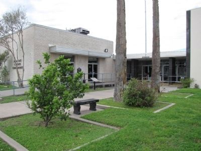
On North Live Oak Street near East Mimosa Street, on the right when traveling south.
For more than 60 years, Rockport’s skyline was dominated by an imposing, three-story Moorish-inspired courthouse. It was the first major building designed by J. Riely Gordon, who would become one of Texas’ most famous architects. Born in Virginia in . . . — — Map (db m297335) HM
On Veterans Memorial Drive 0.1 miles east of Chamber Street, in the median.
In 1866, James Doughty and Richard H. Wood, searching for a safe harbor location to ship cattle, built pens and a livestock-shipping wharf on “Rocky Point,” a prominent limestone protrusion that extended into Aransas Bay near present-day . . . — — Map (db m53787) HM
On Veterans Memorial Drive at North Austin Street (Loop Texas Highway 70), on the right when traveling east on Veterans Memorial Drive.
Rockport’s commercial seafood companies have been operating for more than one hundred years. By 1903, David Rockport Scrivner had opened a fish house. In 1907, he sold to Roy Jackson who named the operation the Jackson Fish Company. A few years . . . — — Map (db m53772) HM
On Water Street at Wharf Street, on the right when traveling north on Water Street.
Since 1866, wharves and piers have been a part of Rockport’s shores. The first wharf, constructed to ship cattle, was at Rocky Point. Other wharves handled commercial shipping and passenger traffic. Sorenson’s Wharf extended into the bay behind the . . . — — Map (db m53770) HM
On Water Street at East Market Street, on the right when traveling north on Water Street.
Shipbuilding was a natural industry for Rockport. The earliest recorded ship built here was the Connie, constructed in 1880 by Bludworth & Company. The Bludworth family specialized in building pleasure craft and scows.
In 1917, World War . . . — — Map (db m58824) HM
On Water Street 0.1 miles south of East Morgan Street, on the left when traveling south.
In early Rockport, many prominent families lived on what was called the Old Beach Road, now Water Street. Paved with white crushed shell, the road was lined with huisache, anacua, wild persimmon, prickly ash trees, dewberry vines, and stately homes. . . . — — Map (db m53767) HM
On Water Street at North Street, on the right when traveling north on Water Street.
After the Civil War, Rockport became an important cattle ranching and shipping center. In 1866, James Doughty, T.H. Mathis, and John M. Mathis constructed cattle pens, with a long wharf that extended out into Aransas Bay from “Rocky . . . — — Map (db m53771) HM
On Broadway Street (State Highway 35) at East Orleans Street, in the median on Broadway Street.
Created September 18, 1871
from Refugio County;
Organized in 1871 with
Rockport as the County Seat.
Named for the River
Nuestra Señora de Aranzazu — — Map (db m53705) HM
On South Austin Street (State Highway 70) at Wharf Street, on the left when traveling south on South Austin Street.
Before the arrival of the railroad in 1888, hotels in Rockport generally served clientele of the several local packeries. The Congdon Hotel was the leading hostelry of early Rockport and once served as a boarding home to the prominent Robert . . . — — Map (db m53769) HM
On North Live Oak Street 0.1 miles north of East Cedar Street, on the left when traveling south.
Aransas County Judge W.H. Baldwin, who promoted Rockport as a deep water port, lived in this house in the 1890s. George A. Brundrett, Jr., was a Confederate veteran and cattle rancher on 15,000 acres on Matagorda Island; his family lived here from . . . — — Map (db m61067) HM
On East First Street at South Chruch Street (Texas Highway 70), on the right when traveling west on East First Street.
This property was the site of the famous Rockport Cottages purchased in 1934 by Connie and Jack Hagar from Corsicana, Texas. Jack managed the cottages while Connie (1886–1973) pursued her passion for nature. Birds were Connie’s major interest, . . . — — Map (db m63659) HM
On Packery Channel Park Road 0.1 miles east of South Padre Island Drive, on the left when traveling east.
Facilities for the rendering of hides and tallow and for meat packing flourished along the Texas Coastal Bend during the last half of the nineteenth century, when hundreds of thousands of wild longhorns roamed South Texas; Packery Channel was named . . . — — Map (db m182899) HM
On North Live Oak Street at East Mimosa Street, on the right when traveling south on North Live Oak Street.
Created out of the coastal portion of Refugio County in 1871, Aransas County is the second smallest county in Texas. Within its boundaries are three bays of the Gulf of Mexico: Copano, St. Charles, and Aransas. The area was the site of early Indian . . . — — Map (db m53582) HM
On Chaparral Street at Fulton Beach Road, on the left when traveling east on Chaparral Street.
The ruins of this rendering vat mark the location of the Marion Packing Co. (spelled “Meriam” in some records), one of the dozen or more meat packing plants built in the Rockport-Fulton area in the 1860s and 1870s to process the huge . . . — — Map (db m53701) HM
On Business State Highway 35 0.1 miles south of Harbor Drive, on the left when traveling north.
Between 1935 and 1939, the Texas Highway Department constructed several roadside parks along Highway 35 in Aransas County. Local residents ~ Mrs. J.L. Bell, Harry Hertzberg, Mrs. Eli Hertzberg, Joe S. Sheldon, Arnold K. Sheldon, Harry Traylor, and . . . — — Map (db m53774) HM
On North Austin Street (Loop State Highway 70) at East Cornwall Street, on the right when traveling north on North Austin Street.
(center panel)
Some gave some • Some gave all
In loving memory
of our fallen heroes
of Aransas County
Erected Nov. 11, 1984
by
the Rockport American G. I. Forum
Chapter 324-F, Texas
Jose “Pepe” Zambrano, . . . — — Map (db m53745) WM
Thin black lines indicate changes in relevance. Between each pair of lines entries are ordered geographically but all have the same relevance.
* Inflectional forms of words are their plurals, singulars, and possessives as well as gramatical tenses and similar variations.