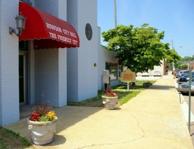
On City Hall Avenue 0 miles east of Wood Alley, on the right when traveling east.
Bowdon is near the geographical center of the last land in Georgia owned by the Creek Nation and ceded to the U.S. This tract, approximately 550 sq. mi. in area, is 80 mi long and 10 mi. wide at its widest point.
When Carroll County was . . . — — Map (db m31329) HM
Near Dillingham Street at Brickyard Road (Route 61).
Coweta was the home of many influential Creek leaders, including three individuals who figured prominently in the history of the Creek people; "Emperor” Brims, Mary Musgrove, Chief William McIntosh.
The Coweta chieftain Brims, who . . . — — Map (db m101336) HM
On Highway 42, on the right when traveling south. Reported missing.
Across the highway stands the inn built about 1823 by William McIntosh, half-breed chief of the Lower Creek Indians. Here on February 12, 1825, McIntosh and other chiefs signed the Second Treaty of Indian Springs, giving up their last Georgia land. . . . — — Map (db m395) HM
On Bankhead Highway (U.S. 78) just west of South Candler Street, on the right when traveling east.
The Bank of Villa Rica was Carroll County’s oldest financial institution, and one of the oldest financial institutions in the State of Georgia. The bank was chartered with $15,000 of capital when it opened in 1899. This was one of the few banks that . . . — — Map (db m107248) HM
On Bankhead Highway (U.S. 78) at South Candler Street, on the left when traveling west on Bankhead Highway.
Around 11:00 a.m. on December 5, 1957, a natural gas leak under Berry’s Pharmacy caused an explosion that destroyed four buildings and damaged several others in Villa Rica’s downtown. The explosion killed twelve and injured twenty. The tragedy . . . — — Map (db m10044) HM
On Rome Street at Alabama Street, on the left when traveling north on Rome Street.
Carrollton was incorporated December 22, 1829, and named in honor of Charles Carroll, last living signer of the Declaration of Independence.
In 1830, the town was surveyed and lots were laid out, with the central feature being the town square, . . . — — Map (db m115249) HM
Near West Main Street (Georgia Route 113) west of South Public Square, on the right when traveling west.
Asa G. Candler, founder of the Coca-Cola Company, moved from Carroll County, Georgia to Cartersville and served as an apprentice to learn the apothecary profession. He studied under Dr. John Best and Dr. William Kirkpatrick between 1870 and 1873 on . . . — — Map (db m190704) HM
On West McIntosh Circle (Georgia Route 5) 2 miles south of Route 5, on the right when traveling east.
It was relocated from near Centre, Alabama by W.O. Kilgore Construction with funds provided by the Department of Natural Resources and private sector funds raised by the Abraham Baldwin Chapter, NSDAR as requested by Carroll County, Georgia. . . . — — Map (db m110846) HM
On South Mount Street at W Bradley St, on the right when traveling south on South Mount Street.
Noted Texas religious leader. Pastor, 1850 to Gen. and Mrs. Sam Houston. Founded first Baptist paper in state, 1855. In difficult Civil War years, served as president of Baylor University, 1861-63, and pastor of the First Baptist Church in . . . — — Map (db m271670) HM
On Newnan Street (Georgia Route 166) at Dixie Street, on the right when traveling east on Newnan Street.
Carroll County, created by an act of the Georgia legislature in December, 1826, proudly bears the name of Charles Carroll, of Carrollton.
Charles Carroll was born in Annapolis, Maryland, in 1737. He attended preparatory schools in this country . . . — — Map (db m12872) HM
On Rebel Drive at Dormitory Row North, on the right when traveling east on Rebel Drive.
In 1920, this building was dedicated in honor of James Zachariah George (1826-1897). Born in Georgia, George moved with his family to Mississippi in 1834, settling two years later in Carroll County.
At the outbreak of war between the United . . . — — Map (db m219881) HM
On Baines Street at Salado Oaks Drive, on the right when traveling north on Baines Street.
Reverend George Washington Baines is buried at this site with his second wife, Cynthia Williams, and one of his sons, Taliaferro. Reverend Baines was born in North Carolina Dec 29, 1809. Educated in Alabama and ordained a minister in 1836. A . . . — — Map (db m203271) HM
On West 18th Street at Baynard Boulevard on West 18th Street.
African American Medal of Honor Recipients Memorial
The Medal of Honor takes its place in our country as the highest award for military valor. The honor, awarded by the President in the name of Congress, may only be accorded an . . . — — Map (db m173924) HM WM
Near East Main Street (Business U.S. 70) at Browning Avenue, on the right when traveling west.
Thomas Park was established in 1906 by the Civic Improvement Club, a women's group whose primary objective was the beautification of their hometown. The Club took on the task of making the area on East Main Street around the train depot more . . . — — Map (db m179631) HM
On North Main Street (Business U.S. 65) at West Rush Avenue, on the right when traveling south on North Main Street.
In memory of those who were killed in the Mountain Meadows Massacre, in September of 1857. Dedicated in 2020.
Modern historical research has yielded information which was not readily available to those who designed the 1955 monument. . . . — — Map (db m225251) HM
Thin black lines indicate changes in relevance. Between each pair of lines entries are ordered geographically but all have the same relevance.
* Inflectional forms of words are their plurals, singulars, and possessives as well as gramatical tenses and similar variations.