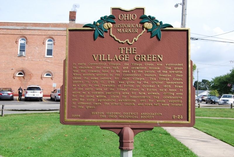
Side A
In 1796, surveyors for the Connecticut Land Company designated an area five miles square surrounding this place as Range 7, Township 7 of the Connecticut Western Reserve. A landowner's expedition on June 15, 1798, arrived at the . . . — — Map (db m122760) HM
On Main Street at Center Road, on the right when traveling west on Main Street.
Hugh Mosher was the fifer portrayed in Archibald Willard's "Spirit of '76", one of America"s most famous patriotic paintings. Mosher was born on January 29, 1819 in Perry, Lake County (then part of Geauga County), Ohio. He served as Fifer Major in . . . — — Map (db m122810) HM
On South High Street at Church Street, on the right when traveling north on South High Street.
On December 30, 1847, six educators met at the Summit County Courthouse to organize the first convention of the Ohio State Teachers' Association, now known as the Ohio Education Association (OEA). The organizers Josiah Hurty (Richland County), . . . — — Map (db m299758) HM
On Ravenna Road (Ohio Route 44) at Pond Road on Ravenna Road.
Centennial Oak. The Newbury Woman Suffrage Political Club, headquartered at Union Chapel, planted the Centennial Oak on July 4, 1876. The White Oak (Quercus alba) was chosen for its endurance, longevity, and beauty. The picnic and planting . . . — — Map (db m309439) HM
On Carlton Street at South Cheshire Street, on the right when traveling east on Carlton Street.
Burton Township, Geauga County, ODNR/DMRM Permit #2013 Producer: David R. Hill, Inc.
In 1860, the Macksburg/Dexter well, in south eastern Ohio, Noble County, became the first commercial oil well drilled in Ohio, and followed the Drake well by . . . — — Map (db m300030) HM
On Carlton Street at South Cheshire Street, on the right when traveling east on Carlton Street.
Saving the Whales
Up until the mid 1800's, clean-burning whale oil was still the "burning fluid of choice." Around 1850, Samuel Kier of Pittsburgh, Pennsylvania, began distilling for crude oil in very small quantities to get "Carbon Oil," . . . — — Map (db m300028) HM
On Main Street (Route 6) near Short Court Street, on the left when traveling south.
In recognition of the Patriotism of the People of Geauga County who so generously purchased War Savings Stamps in 1918 this tablet is gratefully erected by the Ohio War Savings Committee — — Map (db m202402) WM
Near Dean Street at Brown Street, on the right when traveling north.
This sculpture “Place of Origins” is dedicated to Elmer and Ellen Jagow Mr. Jagow served as President of Hiram College from 1966 — 1985 The sculpture was made possible through gifts to the Jagow Art Fund It was created by John Spofforth . . . — — Map (db m310396) HM
Near Cook Street at North Cheshire Street, on the right when traveling west.
The Directors of the Geauga County Agricultural Society place this marker in recognition of Paul Harris' and Pam Krotzer's lifelong dedication to the fair industry.
If you knew Paul, you knew his two greatest passions: dairy farming and The . . . — — Map (db m299776) HM
Near Maple Highlands Trail 0.2 miles north of South Street ( Route 44), on the right when traveling west.
Near this location on May 15, 1823, the first murder trial in Geauga County concluded with the public execution of Benjamin Wright, Jr. On February 1, 1823, Wright stabbed Zophar Warner over a financial dispute, wounding him mortally. The following . . . — — Map (db m291293) HM
On South Professor Street 0.1 miles south of West College Street, on the left when traveling south.
Aluminum pioneer Charles Martin Hall was born in 1863 in Thompson, Ohio (Geauga County), and moved with his family to Oberlin in 1873. Hall graduated from Oberlin College in 1885, studying chemistry under Professor Frank Fanning Jewett . . . — — Map (db m224994) HM
On State Road South (County Road 25) north of Plymouth Ridge Road, on the right when traveling west.
Indian Trails Park - Master Plan
Indian Trails Park Timeline ~1908-2010
November 7, 1908 First land purchased of Main Avenue in the river gulf (beginning of Indian Trails Park)
• Former riverside paths of Indians . . . — — Map (db m213953) HM
Near Cook Street at North Cheshire Street, on the right when traveling west.
The directors of the Geauga County Agricultural Society, place this marker in honor of Audre and Evelyn Blair for their tireless contributions to The Great Geauga County Fair.
Audre and Evelyn's involvement spans ninety of the last one . . . — — Map (db m299779) HM
On Cook Street at North Cheshire Street, on the right when traveling west on Cook Street.
The Directors of the Geauga County Agricultural Society place this marker in recognition of Vernon and Marion Howard's endless contributions to The Great Geauga County Fair.
Vernon and Marion served as directors and officers of the fair . . . — — Map (db m299778) HM
On Cook Street at North Cheshire Street, on the right when traveling west on Cook Street.
The Directors of the Geauga County Agricultural Society place this marker in recognition of Dan McClelland's endless contributions to the Great Geauga County Fair.
As a peace officer in Geauga County for 41 years, he provided outstanding . . . — — Map (db m299774) HM
On West Park Avenue at Cheshire Street, on the left when traveling east on West Park Avenue.
Side A
In recognition of its noteworthy representation of the history, culture, and architecture of the Western Reserve, Burton Village's Historic District was placed on the National Register of Historic Places in 1974. The Historic . . . — — Map (db m122778) HM
Near North Cheshire Street (County Route 3) at Berkshire Lane, on the left when traveling south.
The Great Geauga county Fair is the longest continuously operating
county fair in Ohio. The fair is a major county gathering event
each year, pulling together people from the whole county. Geauga’s
settlers imported the idea of the county fair . . . — — Map (db m134516) HM
On Richmond Street at Mentor Avenue, on the right when traveling south on Richmond Street.
Erected by popular subscription, this building was the first courthouse built after the county of Lake was established on March 6, 1840.
Purchased for Painesville City Hall 1909
Jonathan Goldsmith
Architect
Harvey . . . — — Map (db m198231) HM
Thin black lines indicate changes in relevance. Between each pair of lines entries are ordered geographically but all have the same relevance.
* Inflectional forms of words are their plurals, singulars, and possessives as well as gramatical tenses and similar variations.