13 entries match your criteria.
Historical Markers in Labrador Region
By Jimmy Emerson, July 1, 2024
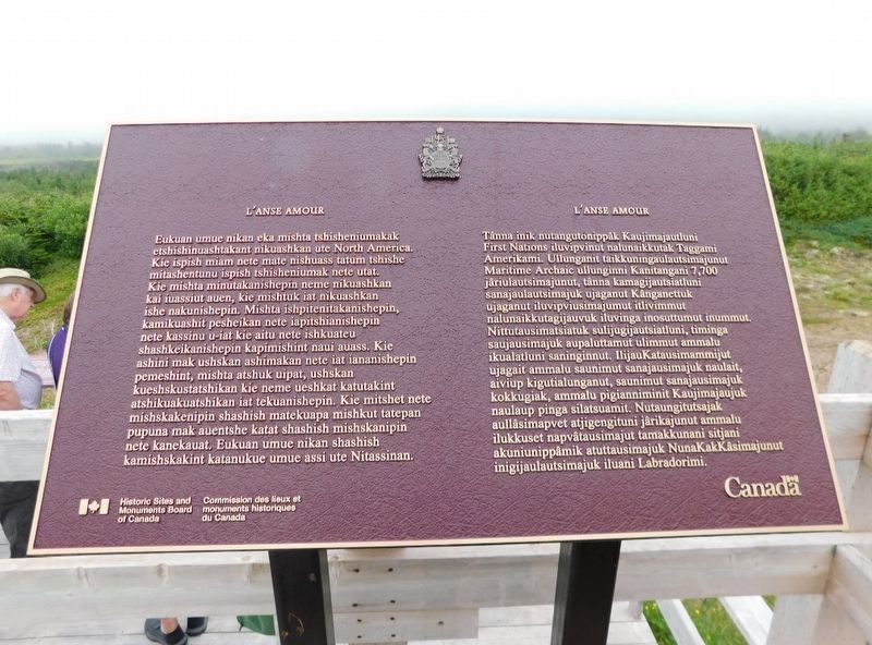
L'anse Amour Marker
1 ► Newfoundland and Labrador, CensusDiv 10 - Labrador-Happy Valley-Goose Bay, Davis House — L'anse Amour —  |
| On L'Anse Amour Branch Road, on the right when traveling south. | |||
| 2 ► Newfoundland and Labrador, CensusDiv 10 - Labrador-Happy Valley-Goose Bay, L'Anse-au-Loup — L’Anse Amour Burial — Site funéraire de l’anse Amour — |
| On L'Anse Amour Branch Road close to Trans-Labrador Highway (Newfoundland and Labrador Route 510), on the right when traveling south. | |||
| 3 ► Newfoundland and Labrador, CensusDiv 10 - Labrador-Happy Valley-Goose Bay, L'Anse-au-Loup — The Diaphone — Lighthouse Trail — |
| Near L'Anse Amour Branch Road close to Trans-Labrador Highway (Newfoundland and Labrador Route 510), on the right when traveling east. | |||
| 4 ► Newfoundland and Labrador, CensusDiv 10 - Labrador-Happy Valley-Goose Bay, L'Anse-au-Loup — The Marconi Station — Lighthouse Trail — |
| On L'Anse Amour Branch Road close to Trans-Labrador Highway (Newfoundland and Labrador Route 510). | |||
| 5 ► Newfoundland and Labrador, CensusDiv 10 - Labrador-Happy Valley-Goose Bay, Red Bay — (The Moores Family Home) — |
| Near Trans-Labrador Highway (Newfoundland and Labrador Route 510), on the right when traveling north. | |||
| 6 ► Newfoundland and Labrador, CensusDiv 10 - Labrador-Happy Valley-Goose Bay, Red Bay — Basque Whalers in the Strait of Belle Isle — Les baleiners Basques dans la détroit de Belle Isle — |
| Near unnamed road. | |||
| 7 ► Newfoundland and Labrador, CensusDiv 9 - Northern Peninsula-St. Anthony, Flower's Cove — Thrombolites or Living Rocks — |
| Near Newfoundland and Labrador Route 430, on the left when traveling north. | |||
| 8 ► Newfoundland and Labrador, CensusDiv 9 - Northern Peninsula-St. Anthony, Sally's Cove — Green Point — Cambrian-Ordovician Boundary / La limite Cambrien-Ordovicien — |
| Near unnamed road close to Route 430. | |||
| 9 ► Newfoundland and Labrador, CensusDiv 9 - Northern Peninsula-St. Anthony, St Lunaire-Griquet — L’Anse aux Meadows — |
| Near Newfoundland and Labrador Route 436 close to Route 430. | |||
| 10 ► Newfoundland and Labrador, CensusDiv 9 - Northern Peninsula-St. Anthony, St Lunaire-Griquet — The End of a Quest: L’aboutissement d’une quête — Fishing for the Past: À la recherche du passé — |
| Near unnamed road close to Route 43. | |||
| 11 ► Newfoundland and Labrador, CensusDiv 9 - Northern Peninsula-St. Anthony, St. Anthony — Fox Point Lightouse — (Fishing Point) — |
| On West Street, on the left when traveling east. | |||
| 12 ► Newfoundland and Labrador, CensusDiv 9 - Northern Peninsula-St. Anthony, St. Anthony — Sir Wilfred Thomason Grenfell — 1865-1940 — |
| On West Street close to Hospital Road, on the right when traveling east. | |||
| 13 ► Newfoundland and Labrador, CensusDiv 9 - Northern Peninsula-St. Anthony, St. Anthony — St. Anthony — Population 2,996 (1996) — |
| On West Street, in the median. | |||