By Tim Fillmon, September 12, 2014
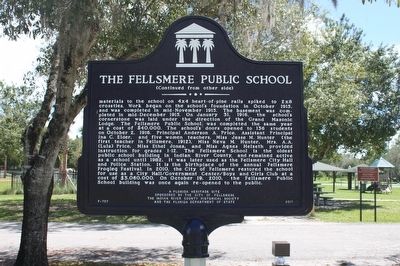
The Fellsmere Public School Marker-Side 2
RANKED BY RELEVANCE
| On South Orange Street 0.1 miles south of Pennslvania Avenue (County Road 512), on the right when traveling south. |
| On Fellsmere Grade Road at Babcock Street SE (County Road 507), on the left when traveling west on Fellsmere Grade Road. |
| On 82nd Avenue (County Route 619) 0.1 miles north of 37th Street, on the left when traveling south. |
| Near Dahlia Lane west of Riverside Park Drive when traveling west. |
| Near 14th Avenue 0.1 miles south of 22nd Street, on the left when traveling south. |
| On Old Winter Beach Road 0.5 miles west of Florida Route A1A. |
| On North Hickory Street at Pennsylvania Avenue (County Road 512), on the left when traveling north on North Hickory Street. |
| On North Central Avenue 0.1 miles north of Jackson Street, on the left when traveling north. |
| On 14th Avenue at 21st Street, on the right when traveling north on 14th Avenue. |
| Near U.S. 1 at Vista Garden Trails, on the right when traveling north. |
| On 44th Court (Cemetery Road) 0.1 miles south of 71st Street, on the left when traveling north. |
| On 39th Street 0.1 miles east of U.S. 1, on the right when traveling west. |
| On North Cypress Street 0.1 miles south of West New York Avenue, on the right when traveling north. |
| On U.S. 1 at Old Dixie Highway (State Road 605), on the right when traveling north on U.S. 1. |
| On 14th Avenue just north of 23rd Street, on the right when traveling north. |
| On Florida Route 510 0.1 miles Shore Lane, on the left when traveling east. |
| On 45th Street just east of 28th Court, on the right when traveling west. |
| On 138th Avenue just south of 111th Street, on the left when traveling north. |
| On 21st Street at 16th Avenue, on the right when traveling east on 21st Street. |
| On 83rd Avenue at Baird Street, on the right when traveling south on 83rd Avenue. |
| On Flight Safety Drive south of 26th Street (Road 0.1), on the right when traveling south. |
| On Southwest Old Dixie Highway 0.4 miles north of Highland Drive Southwest, on the left when traveling north. |
| On 19th Street at 20th Avenue, on the right when traveling west on 19th Street. |
| Near Royal Palm Boulevard 0.5 miles east of Indian River Boulevard (State Road 60), on the right when traveling east. |
| Near Cherokee Drive 0.2 miles east of Flight Safety Drive. |
| Near Thomas Barbour Drive 0.5 miles north of U.S. 1. |
| Near North Palmetto Avenue. |
Thin black lines indicate changes in relevance. Between each pair of lines entries are ordered geographically but all have the same relevance.* Inflectional forms of words are their plurals, singulars, and possessives as well as gramatical tenses and similar variations.
Nov. 13, 2026
