THE HISTORICAL
MARKER DATABASE
“Bite-Size Bits of Local, National, and Global History”


25 entries match your criteria.  


Entries Containing All of the Phrases «raleigh county» AND «west virginia»

This list will also include matches for inflectional* forms of the words.
 
By Merle T. Cole, October 12, 2019
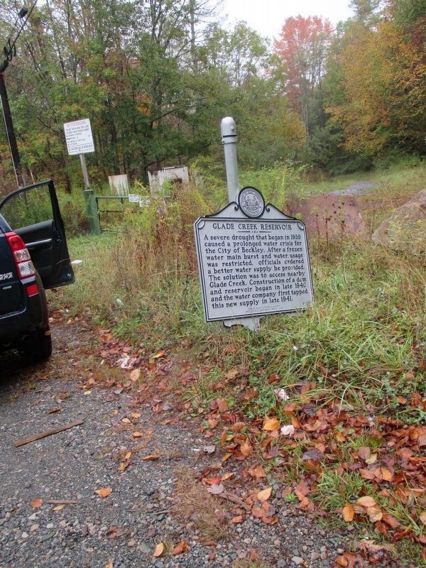
Rescue of Dismounted Glade Creek Reservoir Marker
RANKED BY RELEVANCE
1 ► West Virginia, Raleigh County, White Oak — Glade Creek Reservoir —
On Hinton Road (West Virginia Route 3) at Joes Ridge Road (County Road 3/25), on the right when traveling east on Hinton Road.

2 ► West Virginia, Raleigh County, Beaver — Big Beaver Creek Ancient Fortification —
On Ritter Drive (West Virginia Route 19) at Blue Jay Drive, on the right when traveling south on Ritter Drive.
3 ► West Virginia, Raleigh County, Beaver — Grandview Monitor —
On Grandview Road (County Road 9) north of Heron Lane, on the left when traveling north.
4 ► West Virginia, Raleigh County, Beckley — Beckley Mill —
On Joel L. Smith Drive at Jersey Avenue, on the right when traveling north on Joel L. Smith Drive.
5 ► West Virginia, Raleigh County, Beckley — Bill Withers —
On South Fayette (West Virginia Route 3) near Mool Avenue, on the right when traveling south.
6 ► West Virginia, Raleigh County, Beckley — Casa Loma —
On South Prince Street.
7 ► West Virginia, Raleigh County, Beckley — Clarence W. Meadows —
On East Beckley Bypass (Bypass U.S. 19) 0.3 miles north of Pinecrest Industrial Road, on the right when traveling west.
8 ► West Virginia, Raleigh County, Beckley — Eccles Mine Explosions —
On Main Street, on the left when traveling east.
9 ► West Virginia, Raleigh County, Beckley — Old Bluestone Road —
On I Street.
10 ► West Virginia, Raleigh County, Beckley — Raleigh County Coal Mines —
Near Ewart Avenue, on the left.
11 ► West Virginia, Raleigh County, Fairdale — Logan, Raleigh and Monroe Turnpike —
On Bolt Road (West Virginia Route 99) 0.1 miles Rockhouse Fork (County Road 15/8), on the left when traveling west.
12 ► West Virginia, Raleigh County, Terry — Camp Prince Army Station —
On Stanaford Road (West Virginia Route 41) 0.1 miles east of Terry Road (County Road 41/8) when traveling east.
13 ► West Virginia, Summers County, Sandstone — William Richmond Homeplace / Sandstone Falls —
On Temple Street (West Virginia Route 20) south of Faith Lane (County Road 7), on the right when traveling south.

14 ► West Virginia, Raleigh County, Beckley — The Schoolhouse —
Near Ewart Avenue 0.5 miles west of Robert C. Byrd Drive ( Route 16), on the left when traveling west.

15 ► West Virginia, Raleigh County, Beckley — From Agriculture to Mining —
Near Tamarack Place.
Paid Advertisement

16 ► West Virginia, Raleigh County, Beckley — Alfred Beckley — 1802-1888 —
On Neville Street west of Woodlawn Avenue, on the right when traveling west.
17 ► West Virginia, Raleigh County, Beckley — The Attar Center — Dedicated to Economic Development of — Beckley and Southern West Virginia —
On Main Street at S Fayette Street on Main Street.
18 ► West Virginia, Raleigh County, Helen — Baseball —
Near Foreman Bottom Road west of Tams Highway ( Route 16).
19 ► West Virginia, Raleigh County, Lester — The Big Tunnel Fight —
On Lester Highway (West Virginia Route 54/97) 0.1 miles west of 4th Avenue (County Road 54/4), on the right when traveling west.

20 ► West Virginia, Raleigh County, Beckley — Stratton High School — African American Heritage Tour —
On South Fayette Street (West Virginia Route 3) at G Street, on the right when traveling west on South Fayette Street.

21 ► West Virginia, Raleigh County, Beckley — Dinky Locomotive —
On Ewart Avenue.

22 ► West Virginia, Raleigh County, Beckley — Aerial Gateway to Beckley —
On Industrial Drive just west of Lewis Ritchie Drive, on the right when traveling west.

23 ► West Virginia, Fayette County, Ansted — Did You Know? —
Near East Main Street (U.S. 60) at Holley Street.

24 ► West Virginia, Boone County, Whitesville — Big Coal River — An Important and Historical Water Trail Serving Man and Industry — Coal Heritage Trail —
On Coal River Road (West Virginia Route 3) at Bridge Avenue, on the left when traveling east on Coal River Road.

25 ► West Virginia, Fayette County, Ansted — History Around the Cupola —
Near East Main Street (U.S. 60) at Holley Street.
 
    Thin black lines indicate changes in relevance. Between each pair of lines entries are ordered geographically but all have the same relevance.
* Inflectional forms of words are their plurals, singulars, and possessives as well as gramatical tenses and similar variations.
 
CeraNet Cloud Computing sponsors the Historical Marker Database.
This website earns income from purchases you make after using our links to Amazon.com. We appreciate your support.
Paid Advertisement
Nov. 13, 2026
