20 entries match your criteria.
Related Historical Markers
Battle of Beaver Dam Creek or Mechanicsville by markers.
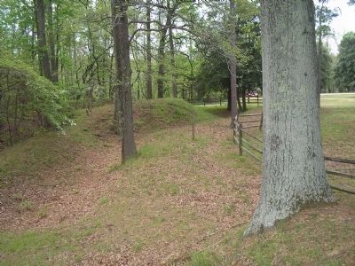
By Bill Coughlin, April 24, 2007
Confederate Fortifications at Chickahominy Bluff
SHOWN IN SOURCE-SPECIFIED ORDER
| Near Mechanicsville Turnpike (U.S. 360), on the right when traveling north. Reported permanently removed. |
| Near Mechanicsville Turnpike (U.S. 360) at Springdale Road, on the right when traveling east. |
| Near Mechanicsville Turnpike (U.S. 360), on the right when traveling north. Reported permanently removed. |
| On Mechanicsville Turnpike (U.S. 360) at Springdale Road, on the right when traveling north on Mechanicsville Turnpike. |
| On Mechanicsville Turnpike (U.S. 360) 0.2 miles north of East Laburnum Avenue, on the left when traveling east. Reported missing. |
| On Mechanicsville Turnpike (U.S. 360) 0.6 miles east of Springdale Road, on the right when traveling east. |
| On Mechanicsville Turnpike (Business U.S. 360) 0.1 miles east of Edgeworth Road, on the right when traveling east. |
| On Mechanicsville Bypass 0.1 miles west of Atlee Road, on the left when traveling east. |
| On Cold Harbor Road (Virginia Route 156) at Fast Lane, on the right when traveling east on Cold Harbor Road. |
| On Cold Harbor Road (Route 156), on the right when traveling east. |
| On Old Cold Harbor Road trace 0.1 miles south of Cold Harbor Road, on the left when traveling south. |
| Near Cold Harbor Road (Virginia Route 156), on the right when traveling east. Reported missing. |
| Near Cold Harbor Road (Virginia Route 156), on the right when traveling east. Reported missing. |
| Near Cold Harbor Road (Virginia Route 156), on the right when traveling east. Reported permanently removed. |
| Near Cold Harbor Road (Virginia Route 156), on the right when traveling east. Reported missing. |
| Near Cold Harbor Road (Virginia Route 156), on the right when traveling east. Reported missing. |
| Near Cold Harbor Road (Virginia Route 156), on the right when traveling east. |
| Near Cold Harbor Road (Virginia Route 156), on the right when traveling east. |
| On Old Cold Harbor Road 0.1 miles west of Harbor Hill Drive, on the right when traveling west. |
| On Cold Harbor Road (Virginia Route 156) at Bell Creek Road ( Route 1597), on the right when traveling east on Cold Harbor Road. |
Nov. 11, 2026
