By James Hulse, June 6, 2022
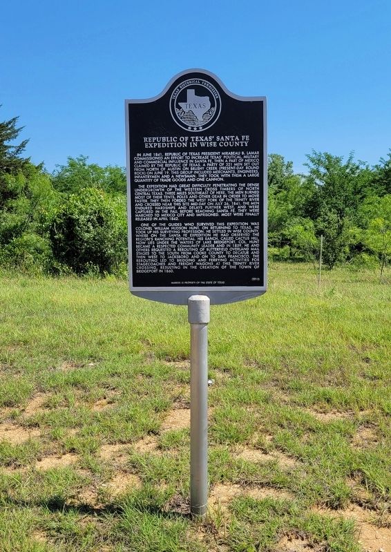
Republic of Texas' Santa Fe Expedition in Wise County Marker
RANKED BY RELEVANCE
| On U.S. 380 0.1 miles east of 16th Street (State Highway 373), on the right when traveling west. |
| On North Trinity Street (Farm to Market Road 730), on the right when traveling south. |
| On County Road 4681 0.6 miles north of Farm to Market Road 2048, on the left when traveling north. |
| On Cemetery Road north of Brammer Road, on the right when traveling north. |
| On Farm to Market Road 2210 at County Road 3706, on the left when traveling west on Road 2210. |
| On West 7th Street at Taylor Street, on the left when traveling east on West 7th Street. |
| On West Main Street at North State Street, on the right when traveling west on West Main Street. |
| On U.S. 380 at Renshaw-Beal Road (County Highway 2311), on the right when traveling east on U.S. 380. |
| On Dolorosa east of South Main Avenue, on the right when traveling east. |
| On South Main Street (U.S. 81) near East 2nd Avenue, on the left when traveling south. |
| On 17th Street 0.1 miles south of Elementary Drive, on the left when traveling south. |
| On West Walnut Street at North State Street, on the right when traveling east on West Walnut Street. |
| Near South Deep Creek Road (County Road 4227) 2.2 miles south of County Road 4360, on the right when traveling south. Reported missing. |
| On County Road 4226 east of County Highway 4127, on the left when traveling east. |
| On County Road 2360 0.8 miles north of Farm to Market Road 730, on the left when traveling north. |
| On County Road 3555 at Chapman Ranch Road, on the right when traveling north on County Road 3555. |
| Near West Main Street at South Lane Street, on the right when traveling west. |
| Near Cemetery Road 0.8 miles north of Old Greenwood Road, on the right when traveling north. |
| On Van Vleet Oval 0.1 miles north of West Lindsey Street, on the left when traveling north. |
| On North Bonnie Brae Street north of North Lake Trail, on the right when traveling north. Reported missing. |
| On County Road 1550 north of Pleasant Grove Road (County Road 1560), on the left when traveling north. |
| On North Trinity Street (Farm to Market Road 730) south of East Walnut Street, on the right when traveling south. |
| On East Shoemaker Street at South Hill Street, on the left when traveling east on East Shoemaker Street. |
| Near Pecan Street 0.1 miles south of Honeysuckle, on the right when traveling south. |
| On East Pecan Street at South Market Street, on the left when traveling east on East Pecan Street. |
| On U.S. 66, on the left when traveling east. |
| On Irvin Street 0.2 miles east of 16th Street (State Highway 373), on the left when traveling east. |
| On County Highway 1638 west of Highway 2952, on the right when traveling west. |
| On East 5th Street at North Main Street, on the right when traveling west on East 5th Street. |
Thin black lines indicate changes in relevance. Between each pair of lines entries are ordered geographically but all have the same relevance.* Inflectional forms of words are their plurals, singulars, and possessives as well as gramatical tenses and similar variations.
Nov. 12, 2026
